<?xml version="1.0" encoding="UTF-8"?>
<?xml-model href="../schemas/london_all.rng" type="application/xml" schematypens="http://relaxng.org/ns/structure/1.0"?>
<?xml-model href="../schemas/london_all.rng" type="application/xml" schematypens="http://purl.oclc.org/dsdl/schematron"?>

<TEI xmlns="http://www.tei-c.org/ns/1.0" xml:id="MAPS1" version="5.0">
      <teiHeader>
            <fileDesc>
                  <titleStmt>
                        <title>Mapography of Early Modern London</title>
                        <respStmt>
                              <resp ref="PERS1.xml#ccp">Conceptor<date when="2014"/></resp>
                              <name ref="PERS1.xml#JENS1">Janelle Jenstad</name>
                        </respStmt>
                        <respStmt>
                              <resp ref="PERS1.xml#ccp">Conceptor<date notBefore="2015"/></resp>
                              <name ref="PERS1.xml#MCFI1">Kim McLean-Fiander</name>
                        </respStmt>
                        <respStmt>
                              <resp ref="PERS1.xml#aut">Author (Preface)</resp>
                              <name ref="PERS1.xml#JENS1">Janelle Jenstad</name>
                        </respStmt>
                        <respStmt>
                              <resp ref="PERS1.xml#res">Researcher</resp>
                              <name ref="PERS1.xml#WRIG7">Brianna Wright</name>
                        </respStmt>
                        <respStmt>
                              <resp ref="PERS1.xml#res">Researcher</resp>
                              <name ref="PERS1.xml#LAND2">Tye Landels</name>
                        </respStmt>
                        <respStmt>
                              <resp ref="PERS1.xml#res">Researcher<date when="2019"/></resp>
                              <name ref="PERS1.xml#HORN6">Chris Horne</name>
                        </respStmt>
                        <respStmt>
                              <resp ref="PERS1.xml#edt">Editor<date notBefore="2021-06"/></resp>
                              <name ref="PERS1.xml#ZABE1">Jamie Zabel</name>
                        </respStmt>
                        <respStmt>
                              <resp ref="PERS1.xml#edt">Editor<date notBefore="2021-07"/></resp>
                              <name ref="PERS1.xml#ROTH4">Molly Rothwell</name>
                        </respStmt>
                        <respStmt>
                              <resp ref="PERS1.xml#edt">Editor</resp>
                              <name ref="PERS1.xml#LAND2">Tye Landels</name>
                        </respStmt>
                        <respStmt>
                              <resp ref="PERS1.xml#edt">Editor<date when="2019"/></resp>
                              <name ref="PERS1.xml#HORN6">Chris Horne</name>
                        </respStmt>
                        <respStmt>
                              <resp ref="PERS1.xml#mrk">Encoder<date when="2016"/></resp>
                              <name ref="PERS1.xml#LAND2">Tye Landels</name>
                        </respStmt>
                        <respStmt>
                              <resp ref="PERS1.xml#mrk">Encoder<date when="2015"/></resp>
                              <name ref="PERS1.xml#TAKE1">Joey Takeda</name>
                        </respStmt>

                        <respStmt>
                              <resp ref="PERS1.xml#prg">Programmer<date notBefore="2011"/></resp>
                              <name ref="PERS1.xml#HOLM3">Martin Holmes</name>
                        </respStmt>

                        <respStmt>
                              <resp ref="PERS1.xml#pdr">Project Director<date notBefore="1999"/></resp>
                              <name ref="PERS1.xml#JENS1">Janelle Jenstad</name>
                        </respStmt>
                  </titleStmt>
                  <publicationStmt>
                        <publisher><title level="m">The Map of Early Modern London</title></publisher><idno type="URL">http://mapoflondon.uvic.ca/includes.xml</idno><pubPlace>Victoria, BC, Canada</pubPlace><address>
        <addrLine>Department of English</addrLine>
        <addrLine>P.O.Box 3070 STNC CSC</addrLine>
        <addrLine>University of Victoria</addrLine>
        <addrLine>Victoria, BC</addrLine>
        <addrLine>Canada</addrLine>
        <addrLine>V8W 3W1</addrLine>
    </address><date when="2016">2016</date><distributor>University of Victoria</distributor><idno type="ISBN">978-1-55058-519-3</idno><authority>
          <name ref="PERS1.xml#JENS1">Janelle Jenstad</name>
          <email>london@uvic.ca</email>
        </authority><availability>
            <p>Copyright held by <title level="m">The Map of Early Modern London</title> on behalf of the contributors.</p>
            <licence target="http://creativecommons.org/licenses/by-sa/4.0/">
              <p>This work is licensed under a Creative Commons Attribution-ShareAlike 4.0 International License. </p>
            </licence>
            <p>Further details of licences are available from our
              <ref target="licence.xml">Licences</ref> page. For more
              information, contact the project director, <name ref="PERS1.xml#JENS1">Janelle Jenstad</name>, for
              specific information on the availability and licensing of content
              found in files on this site.</p>
        </availability>
                  </publicationStmt>
                  <sourceDesc>
                        <p>Database from spreadsheet created by Brianna Wright.</p>
                  </sourceDesc>
            </fileDesc>
            <profileDesc>
                  <textClass>
                        <catRef scheme="includes.xml#molDocumentTypes" target="includes.xml#mdtDatabase"/>
                        <catRef scheme="includes.xml#molDocumentTypes" target="includes.xml#mdtEncyclopediaBibliographyFinding"/>
                  </textClass>
            </profileDesc>
            <encodingDesc>
                  <p>Our editorial and encoding practices are documented in detail in the <ref target="praxis.xml">Praxis</ref> section of our website.</p>
                  <charDecl>
                        <char xml:id="MAPS1_ye">
                              <localProp name="name" value="LATIN SMALL LETTER Y WITH REVERSED HOOK ABOVE"/>
                              <desc>An abbreviated form of <mentioned>the</mentioned>. This
                                    character takes the form of a small latin letter y with a
                                    reversed hook above. The closest Unicode character we have to
                                    represent this is a small latin letter y with a combining left
                                    half ring above. This character appears only twice in the text,
                                    which is in black letter gothic.</desc>
                              <localProp name="entity" value="yesup"/>
                              <mapping type="standard">y͑</mapping>
                              <mapping type="simplified">ye</mapping>
                              <mapping type="medieval">þe</mapping>
                              <mapping type="modern">the</mapping>
                        </char>
                  </charDecl>
            </encodingDesc>
            <revisionDesc status="published">
                  <change who="PERS1.xml#JENS1" when="2022-04-27" status="published">Added and encoded
                        preface. Published file.</change>
                  <change who="PERS1.xml#HOLM3" when="2022-04-20">Replaced obsolete charProp with
                        localProp.</change>

                  <change who="PERS1.xml#ROTH4" when="2022-01-26">ROTH4 worked on editing file.</change>
                  <change who="PERS1.xml#JENS1" when="2021-06-17">JENS1 and ZABE1 worked on editing
                        file.</change>
                  <change who="PERS1.xml#JENS1" when="2020-08-26">JENS1 and HORN6 did a knowledge
                        transfer.</change>
                  <change who="PERS1.xml#ELHA1" when="2020-08-03">Changed mol:ANON5 to mol:BOWL4 on line
                        4184 and mol:ANON12 to mol:SMIT58 on line 4118 -- Diagnostic fix.</change>
                  <change who="PERS1.xml#HORN6" when="2019-06-01">Began restructuring document hierarchy
                        and markup editing.</change>
                  <change who="PERS1.xml#TAKE1" when="2018-04-28">Changed calendar value from "julian" to
                        "julianSic" using XSLT.</change>
                  <change who="PERS1.xml#LAND2" when="2016-11-27">Created document based on earlier
                        document compiled by WRIG7 and TAKE1 (now MAPS1_db.xm_).</change>
            </revisionDesc>
      </teiHeader>
      <text>
            <front>
                  <docTitle>
                        <titlePart type="main">Mapography of Early Modern London</titlePart>
                  </docTitle>
            </front>
            <body>
                  <div xml:id="MAPS1_preface">
                        <head>Preface</head>
                        <div xml:id="MAPS1_preface_purpose">
                              <head>Purpose</head>
                              <p>This bibliography of maps (our <soCalled>Mapography</soCalled>) aims
                                    to help MoEML contributors and team members find information
                                    about <ref target="LOND5.xml">London</ref> locations on the many maps of <ref target="LOND5.xml">London</ref> now available
                                    in print and digital surrogates. Maps are generally excluded
                                    from traditional bibliographies or hard to find therein. Cartographic materials present cataloguing challenges that are variously resolved by different institutions (see Yale’s <ref target="https://web.library.yale.edu/cataloging/cartographic"><title level="a">Cartographic Cataloging</title></ref>, for example), which in turn presents challenges to researchers searching for maps across many library catalogues. The single
                                    richest digital resource for the study of early modern London is
                                    the <ref target="http://www.bl.uk/onlinegallery/onlineex/crace/">Crace Collection</ref> at the British Library. Containing
                                    approximately 1200 maps (from ground plans to long views, and
                                    spanning the period <date when-custom="1570" calendar="includes.xml#julianSic" datingMethod="includes.xml#julianSic">1570</date> to <date when="1860">1860</date>), this online exhibition lacks an advanced
                                    search interface. Our objectives, therefore, have been:

                              <list rend="numbered">
                                    <item>to find the most useful maps both in Crace and in other
                                          resources (print and digital), and</item>
                                    <item>to organize our own list in a way meaningful to
                                          researchers writing about places in <ref target="LOND5.xml">London</ref> and researching
                                          the toponyms, locations, physical structures, and
                                          historical significance of those places.</item>
                              </list>
                              </p>
                        </div>
                        <div xml:id="MAPS1_preface_emMaps">
                              <head>Early Modern Urban Maps</head>
                              <p>The first accurate map of <ref target="LOND5.xml">London</ref> is the <name ref="PERS1.xml#OGIL6">Ogilby</name> and <name ref="PERS1.xml#MORG2">Morgan</name> <title level="m"><ref target="BIBL1.xml#OGIL7" type="bibl">Large Map</ref></title> (<date when-custom="1676" datingMethod="includes.xml#julianSic" calendar="includes.xml#julianSic">1676</date>), drawn after the <ref target="FIRE1.xml">Great
                                    Fire</ref>. Earlier maps were not accurate plans of the city, but
                                    rather <quote>noisily rhetorical art</quote> (<ref type="bibl" target="BIBL1.xml#EDWA9">Edwards para. 4</ref> that served a
                                    variety of purposes.</p>
                              <p>Early maps survive in three forms:
                              <list rend="numbered"><item>Sheet maps like the <soCalled><ref target="map.xml">Agas map</ref></soCalled> (<title level="m"><ref target="BIBL1.xml#AGAS3" type="bibl">Civitas Londinum</ref></title>), large maps printed on two or more sheets of paper. These are rare, fragile, and often incomplete.</item>
                                    <item>Atlases (books of maps) like <name ref="PERS1.xml#BRAU1">George Braun</name> and <name ref="PERS1.xml#HOGE2">Frans Hogenberg</name>’s <title level="m">Civitates Orbis Terrarum</title> (6 vols; Cologne, <date from-custom="1572" to-custom="1617" calendar="includes.xml#julianSic" datingMethod="includes.xml#julianSic">1572-1617</date>), which gives us the famous <soCalled><ref target="BIBL1.xml#HOGE1" type="bibl">Braun and Hogenberg Map</ref></soCalled> of <ref target="LOND5.xml">London</ref>. These books have been ransacked for wall decoration and are rarely pristine.</item>
                                    <item>Maps as illustrations in books. These rarely survive <foreign>in situ</foreign>, having been cut out of the books and sold separately by unscrupulous book dealers.</item></list></p>
                              <p>Before <name ref="PERS1.xml#OGIL6">Ogilby</name> and <name ref="PERS1.xml#MORG2">Morgan</name>’s <title level="m"><ref type="bibl" target="BIBL1.xml#OGIL7">Large Map</ref></title>, maps took one or more of the following perspectives:
                              <list rend="bulleted">
                                    <item>Stereographic view offering a prospect or profile, often a prospect of the city as a traveller would see it from the road;</item>
                              <item>Perspective or bird’s eye view offering a view of the city as a bird might have seen it or a person from the top of a nearby hill or vantage point (see <ref type="bibl" target="BIBL1.xml#STEV1">Stevenson</ref>);</item>
                                    
                              <item>Linear ground-plan or <soCalled>plat</soCalled>; and/or</item>
                              <item>Map view, a hybrid genre offering a ground plan and one or more insets offering a bird’s eye or stereographic view.</item></list>
                              <title level="m"><ref target="BIBL1.xml#AGAS3" type="bibl">Civitas Londinum</ref></title> offers a hybrid of these perspectives. The foreground offers a bird’s eye view of <ref target="SOUT2.xml">Southwark</ref>. The central part of the map is a plat of the City and areas just outside the wall. The background offers a stereographic landscape view with a vanishing point north of the city.</p>
                              <p>Maps also include people, architectural detail, cartouches, coats of arms, labels, poems, and other texts. In general, it is worth asking what an early modern map depicts. Maps that contain buildings show us the <foreign xml:lang="la">urbs</foreign> or built environment. Maps that contain people in their traditional habit or carrying out their regular activities show us the <foreign xml:lang="la">civitas</foreign>. Maps that emphasize fortifications, walls, gates, armed ships, soldiers, civic coats of arms, or governors show us the <foreign xml:lang="la">res publica</foreign> or well governed city. (See <ref type="bibl" target="BIBL1.xml#KAGA1">Kagan</ref> for an elaboration of these terms.) <title level="m"><ref target="BIBL1.xml#AGAS3" type="bibl">Civitas Londinum</ref></title> depicts the <foreign xml:lang="la">urbs</foreign> in its central plat-like map; the <foreign xml:lang="la">communitas</foreign> is in evidence only on the river and in the surrounding recreational and agricultural areas. Being attentive to what a map depicts will alert you to its rhetorical and political purposes, which in turn will help you situate the evidence offered by the map.</p>
                        </div>

                        <div xml:id="MAPS1_preface_scope">
                              <head>Scope of Contents</head>
                              <p>The MoEML Mapography follows these selection principles:</p>
                              <list rend="numbered">
                                    <item>We include selected manuscript and print maps available in
                                          the <ref target="http://www.bl.uk/onlinegallery/onlineex/crace/">Crace Collection</ref> when they show a part of London
                                          addressed in MoEML’s geographic scope and when we think they will help MoEML
                                          contributors to: <list rend="bulleted">
                                                <item>establish precise and accurate geocoordinates
                                                  and Agas locations, and/or</item>
                                                <item>capture toponyms, and/or</item>
                                                <item>see the location in context.</item>
                                          </list>
                                          <p>Note that the maps in the <ref target="http://www.bl.uk/onlinegallery/onlineex/crace/">Crace Collection</ref> are often a
                                                second or subsequent printing of a map. Our metadata
                                                includes the date of the <ref target="LOND5.xml">London</ref> depicted so that
                                                users know how to deploy the evidence of the map in
                                                the service of a historical argument. Users may
                                                assume that maps do not change in subsequent
                                                printings unless we have made a note describing
                                                changes.</p>
                                    </item>
                                    <item>We include all the maps listed in Darlington and Howgego’s
                                                <ref type="bibl" target="BIBL1.xml#DARL2"><title level="a">Printed Maps of London circa
                                                1553–1850</title></ref> up to <date when-custom="1666" datingMethod="includes.xml#julianSic" calendar="includes.xml#julianSic">1666</date>, except as
                                          follows: <list rend="bulleted">
                                                <item>We exclude inaccurate maps printed in Europe
                                                  for the European market. Despite their visual
                                                  appeal and the fact that they bear witness to the
                                                  popularity of images of <ref target="LOND5.xml">London</ref>, they contain
                                                  inaccuracies that make them inappropriate for use
                                                  by MoEML place researchers</item>
                                                <item>We exclude pictorial images of <ref target="LOND5.xml">London</ref> inset
                                                  into small-scale maps of larger areas. These are
                                                  usually based on earlier, more detailed long
                                                  views.</item>
                                          </list>
                                    </item>
                                    <item>We include a selection of post-Fire maps because the
                                          footprint and streetscape of the City is clearer on the
                                          post-Fire maps and because most contributors will want to
                                          indicate the impact of the Fire on the place about which
                                          they are writing. Depictions of the Fire and the
                                          sensational scale of destruction sold well across Europe,
                                          with the result that we have many images of dubious
                                          authority. We have included only post-Fire maps with some
                                          claim to authority and which are not obviously copies of
                                          copies.</item>
                                    <item>We include selected eighteenth-century maps that have been
                                          particularly helpful to the MoEML Team in making a
                                          connection between modern georeferenced surfaces and early
                                          map-like surfaces. One such map is the <date when-custom="1746" datingMethod="includes.xml#julianSic" calendar="includes.xml#julianSic">1746</date> <ref target="BIBL1.xml#ROCQ1" type="bibl">Rocque Map</ref>
                                          (conveniently digitized and georeferenced by the <ref target="https://www.layersoflondon.org/">Layers of
                                          London</ref> project).</item>
                                    <item>We include one important eighteenth-century map that is
                                          the earliest surviving witness to a now-lost much earlier
                                          map, namely <name ref="PERS1.xml#VERT7">George Vertue</name>’s <date when-custom="1737" datingMethod="includes.xml#julianSic" calendar="includes.xml#julianSic">1737</date> map, which is the only
                                          witness to the lost <date when-custom="1561" datingMethod="includes.xml#julianSic" calendar="includes.xml#julianSic">1561</date> version of <title level="m"><ref target="BIBL1.xml#AGAS3" type="bibl">Civitas Londinum</ref></title>. The Agas
                                          map survives otherwise only in three copies of the <date when-custom="1633" datingMethod="includes.xml#julianSic" calendar="includes.xml#julianSic">1633</date>
                                          printing.</item>
                                    <item>We include all of the <name ref="PERS1.xml#BLOM42">Blome</name> ward maps (first printed in
                                          <date when-custom="1720" datingMethod="includes.xml#julianSic" calendar="includes.xml#julianSic">1720</date> but drawn some years earlier) because they are the
                                          earliest ward maps we have.</item>
                                    <item>Finally, we include selected scholarly reconstructions,
                                          most notably <title level="m"><ref target="BIBL1.xml#HIST2" type="bibl">The Map of Tudor
                                                London</ref></title>, a carefully researched footprint of
                                          <date from-custom="1520" to-custom="1529" calendar="includes.xml#julianSic" datingMethod="includes.xml#julianSic">1520s</date> <ref target="LOND5.xml">London</ref> by Historic Towns Trust.</item>
                              </list>
                        </div>

                       <div xml:id="MAPS1_preface_dataModel">
                             <head>Data Model</head>
                             <p>The MoEML Mapography (MAPS1) functions coordinately with the MoEML Bibliography. The Bibliography (BIBL1) contains full bibliographic details for each map, listed by cartographer. These BIBL1 entries, each of which has a unique xml:id (e.g., NEEL1), describe the cartographic work rather than particular copies, variant states, or issues. Each entry in MAPS1 has an xml:id beginning with MAPS1_ and concluding with the xml:id from BIBL1 (e.g., MAPS1_NEEL1). The BIBL1 entry has a link to the MAPS1 entry and vice versa. Additionally, whenever the data in MAPS1 mentions a print surrogate (e.g., John Schofield’s edition of <name ref="PERS1.xml#TRES1">Treswell</name>’s manuscript surveys), we include a link to the particular BIBL1 entry for that source.</p>
                       
                             <p>For each map, we capture ten data points:</p>
                             
                            <list rend="numbered">
                                  <item>Title: We give a short, recognizable title for the map. Clicking on the title will produce a pop-up window containing the entry for the map in BIBL1.</item>
                             <item><ref type="bibl" target="BIBL1.xml#DARL2">Darlington and
                                   Howgego</ref> Number: If the map is not in listed, the field will read <quote>n/a</quote>.</item>
                             <item>Cartographer[s]: If the cartographer is not known, the field will read <quote>Anonymous</quote>.</item>
                             <item>Engraver[s]: If the engraver is not known to us, we leave the field empty. Further information is welcome.</item>
                             <item>Date Depicted.</item>
                             <item>Date Drawn.</item>
                             <item>Location[s] Depicted: Terms are general (e.g., <ref target="LOND5.xml">London</ref>, <ref target="WEST6.xml">Westminster</ref>, <ref target="SOUT2.xml">Southwark</ref>).</item>
                             <item>Digital Surrogate[s]: We give links to digital surrogates (facsimiles) hosted by institutions and in a few cases antique map dealers.</item>
                             <item>Print Surrogate[s]: We list reproductions of the map, including those in books.</item>
                             <item>Note: We include comments on the conventional name by which the map is known and any other information likely to help our contributors make effective use of the map.</item>
                            
                            </list>


                       </div>


                  <div xml:id="MAPS1_preface_credits">
                        <head>Credits</head>
                        <p>The Mapography began life as two independent handlists of maps, one prepared by <name ref="PERS1.xml#MCFI1">Kim McLean-Fiander</name> and one prepared by <name ref="PERS1.xml#JENS1">Janelle Jenstad</name>, the latter augmented by a finding aid kindly provided by <ref target="https://www.folger.edu/staff/dr-erin-blake">Erin Blake</ref> at the Folger Shakespeare Library. In <date from="2014" to="2015">2014-2015</date>, <ref target="https://www.uvic.ca/learningandteaching/students/student-awards/jcura/index.php">JCURA</ref> student <name ref="PERS1.xml#WRIG7">Brianna Wright</name> worked with UVic Maps Librarian <ref target="https://www.uvic.ca/library/help/librarians/danielbm/index.php">Daniel Brendle-Moczuk</ref> to develop the first iteration of our metadata model and track down digital surrogates. Since then, numerous members of the MoEML team have added to MAPS1, principally <name ref="PERS1.xml#LAND2">Tye Landels</name>, <name ref="PERS1.xml#TAKE1">Joey Takeda</name>, <name ref="PERS1.xml#HORN6">Chris Horne</name>, <name ref="PERS1.xml#ROTH4">Jamie Zabel</name>, and <name ref="PERS1.xml#ZABE1">Molly Rothwell</name>. We would like to thank the British Library for allowing us to include the Blome ward maps from the <ref target="http://www.bl.uk/onlinegallery/onlineex/crace/">Crace Collection</ref> in our ward pages, thus making MoEML one place to view digital surrogates of these maps.</p></div>
                      

                        <div xml:id="MAPS1_preface_additions">
                              <head>Additions</head>
                              <p>Libraries are making available new digital surrogates of their
                                    cartographic material at a rapid rate in the 2020s. The MoEML
                                    team welcomes suggestions for additions of new links. Please
                                    write to the <ref target="mailto:londonpm@uvic.ca">Project
                                          Manager</ref>.</p>
                        </div>
                  </div>


                  <div xml:id="MAPS1_index">
                        <head>Index of Maps and Long Views (excluding Wards and Parishes)</head>
                        <table cols="10">
                              <row role="label">
                                    <cell>Title</cell>
                                    <cell><ref type="bibl" target="BIBL1.xml#DARL2">Darlington and
                                                Howgego</ref> Number</cell>
                                    <cell>Cartographer[s]</cell>
                                    <cell>Engraver[s]</cell>
                                    <cell>Date Depicted</cell>
                                    <cell>Date Drawn</cell>
                                    <cell>Location[s] Depicted</cell>
                                    <cell>Digital Surrogate[s]</cell>
                                    <cell>Print Surrogate[s]</cell>
                                    <cell>Note</cell>
                              </row>

                              <row role="data" xml:id="MAPS1_WYNG1">
                                    <!-- Checked by JENS1 and ZABE1. -->
                                    <cell>
                                          <ref type="bibl" target="BIBL1.xml#WYNG1"><title level="m">Panorama of London as seen from Southwark:
                                                  Westminster</title></ref>
                                    </cell>
                                    <cell>n/a</cell>
                                    <cell><name ref="PERS1.xml#WYNG2">van den Wyngaerde,
                                          Antony</name></cell>
                                    <cell/>
                                    <cell><date when-custom="1554" datingMethod="includes.xml#julianSic" calendar="includes.xml#julianSic">1554</date></cell>
                                    <cell><date when-custom="1554" datingMethod="includes.xml#julianSic" calendar="includes.xml#julianSic">1554</date></cell>
                                    <cell>
                                          <ref target="LOND5.xml">London</ref>, <ref target="WEST6.xml">Westminster</ref>, and <ref target="SOUT2.xml">Southwark</ref></cell>
                                    <cell>
                                          <list>
                                                <item>Ashmolean Museum. <ref target="http://collections.ashmolean.org/object/94120">Metadata and image</ref>. [Digital surrogate of
                                                  original.]</item>
                                          </list></cell>
                                    <cell/>
                                    <cell/>
                              </row>
                              <row role="data" xml:id="MAPS1_ANON24">
                                    <!-- Checked. -->
                                    <cell/>
                                    <cell><idno type="howgego">1</idno></cell>
                                    <cell>Anonymous</cell>
                                    <cell/>
                                    <cell><date from-custom="1553" to-custom="1559" datingMethod="includes.xml#julianSic" calendar="includes.xml#julianSic">1553–1559</date></cell>
                                    <cell><date from-custom="1553" to-custom="1559" datingMethod="includes.xml#julianSic" calendar="includes.xml#julianSic">1553–1559</date></cell>
                                    <cell><ref target="LOND5.xml">London</ref>, <ref target="WEST6.xml">Westminster</ref>, and <ref target="SOUT2.xml">Southwark</ref></cell>
                                    <cell>
                                          <list>
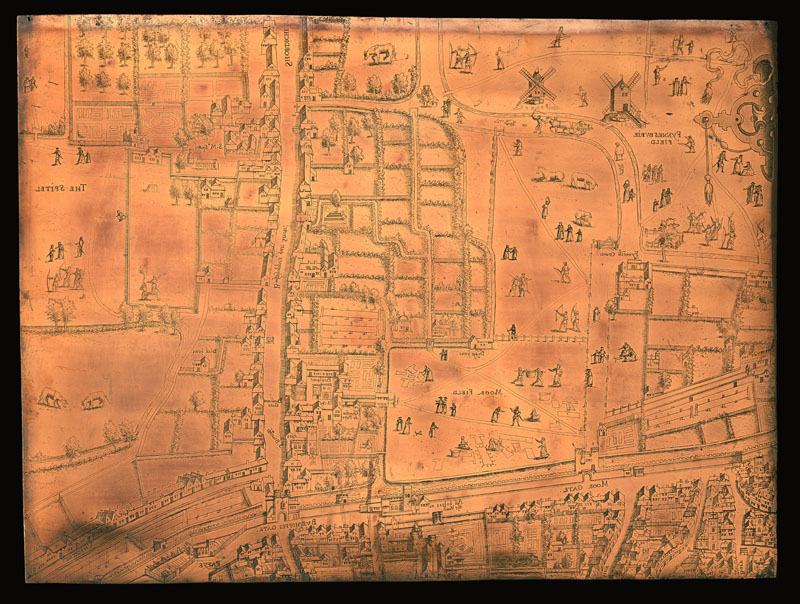
                                                <item>Museum of London. <ref target="https://collections.museumoflondon.org.uk/online/object/104948.html#">Metadata for Moorfields Plate (Item ID:
                                                  62.75)</ref>. </item>
                                                <item><ref target="https://collections.museumoflondon.org.uk/mol/mediaLib/327/24/62_75.jpg">Digital surrogate of original Moorfields copper
                                                  plate</ref>.</item>
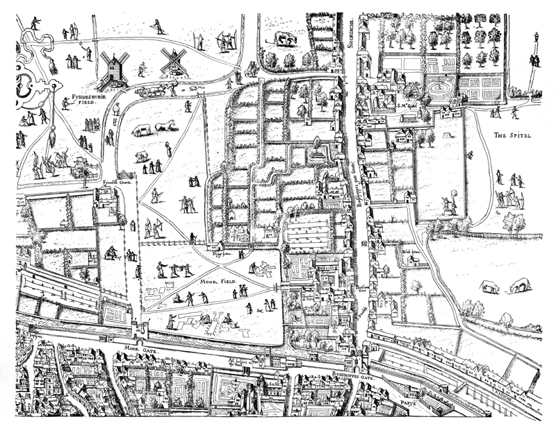
                                                <item><ref target="https://collections.museumoflondon.org.uk/mol/mediaLib/385/572/62_75_vb.jpg">Digital surrogate of impression from Moorfields
                                                  copper plate.</ref></item>
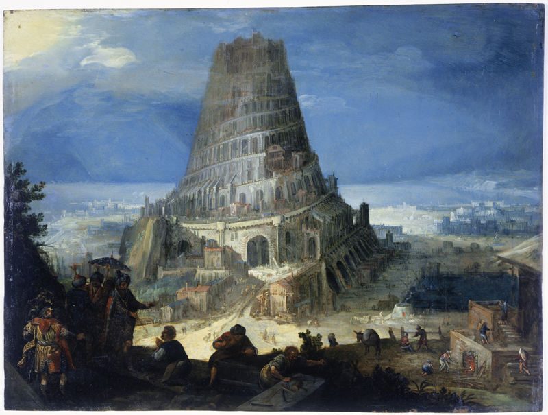
                                                <item><ref target="https://collections.museumoflondon.org.uk/mol/mediaLib/385/749/62_75_vc.jpg">Digital surrogate of painting of Tower of Babel
                                                  on the verso of the copper plate</ref></item>
                                                <item>Museum of London. <ref target="https://collections.museumoflondon.org.uk/online/object/104949.html">Metadata for East City Plate (Item ID:
                                                  85.471)</ref>.</item>
                                                <item>Museum of London. <ref target="https://collections.museumoflondon.org.uk/mol/mediaLib/327/22/85__471.jpg">Digital surrogate of original East City copper
                                                  plate</ref>.</item>
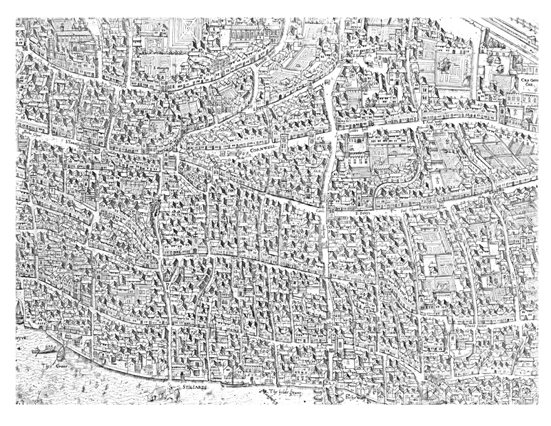
                                                <item>Museum of London. <ref target="https://collections.museumoflondon.org.uk/mol/mediaLib/385/748/85_471_vb.jpg">Digital surrogate of impression from East City
                                                  copper plate</ref>.</item>
                                                <item>Wikimedia. <ref target="https://en.wikipedia.org/wiki/Copperplate_map_of_London#/media/File:Copperplate_map_W_City.jpg">The Dessau Sheet</ref>, showing St. Pauls.</item>
                                          </list>
                                    </cell>
                                    <cell><list>
                                                <item><ref type="bibl" target="BIBL1.xml#BARB10">Barber
                                                  29</ref>. [Print surrogates of impressions drawn
                                                  from original Moorfields, East City, and Dessau
                                                  copper plates.]</item>
                                                <item><ref type="bibl" target="BIBL1.xml#DARL2">Darlington
                                                  and Howgego Plate 2</ref>. [Print surrogate of
                                                  impression drawn from original East City copper
                                                  plate.]</item>
                                                <item><ref type="bibl" target="BIBL1.xml#MARK10">Marks
                                                  Plate 1</ref>. [Print surrogate of impression
                                                  drawn from original Moorfields copper
                                                  plate.]</item>
                                                <item><ref type="bibl" target="BIBL1.xml#PROC1">Prockter
                                                  and Taylor 30-31</ref>. [Print surrogates of
                                                  impressions drawn from original Moorfields and
                                                  East City copper plates.]</item>
                                                <item><ref type="bibl" target="BIBL1.xml#WHIT54">Whitfield
                                                  32–33</ref>. [Print surrogate of original
                                                  Moorfields copper plate.]</item>
                                          </list></cell>
                                    <cell>Popularly known as the <soCalled>Copperplate map of
                                                London</soCalled>. Originally comprised of sheets
                                          printed from fifteen copper plates, only three of which
                                          survive (two in the Museum of London and one in the
                                          Anthaltische Gemäldegalerie Dessau, in Dessau, Germany).
                                          The Agas map is based on the Copperplate map. For more
                                          information about the three surviving plates, the
                                          information they offer about London, and their
                                          relationship to the Agas map, see Saunders and Schofield,
                                                <title level="m"><ref target="BIBL1.xml#SAUN7" type="bibl">Tudor London: A Map and a
                                          View</ref></title>.</cell>
                              </row>

                              <row role="data" xml:id="MAPS1_AGAS3">
                                    <cell>
                                          <ref type="bibl" target="BIBL1.xml#AGAS3"><title level="m">Civitas Londinum</title></ref>
                                    </cell>
                                    <cell><idno type="howgego">8</idno></cell>
                                    <cell>Anonymous (attributed to <name ref="PERS1.xml#AGAS1">Ralph
                                                Agas</name>).</cell>
                                    <cell/>
                                    <cell><date when-custom="1561" datingMethod="includes.xml#julianSic" calendar="includes.xml#julianSic">1561</date></cell>
                                    <cell><date when-custom="1633" datingMethod="includes.xml#julianSic" calendar="includes.xml#julianSic">1633</date></cell>
                                    <cell>
                                          <ref target="LOND5.xml">London</ref>, <ref target="WEST6.xml">Westminster</ref>, and <ref target="SOUT2.xml">Southwark</ref></cell>
                                    <cell><list>
                                                <item>The Map of Early Modern London (MoEML). <ref type="metadata" target="map.xml">Metadata</ref>.
                                                  [<ref target="agas.htm">Digital surrogate of
                                                  modified original</ref>.]</item>
                                                <item>British History Online (BHO). <ref type="metadata" target="https://www.british-history.ac.uk/no-series/london-map-agas/1561">Metadata</ref>. [Digital surrogate of
                                                  original.]</item>
                                          </list></cell>
                                    <cell><list>
                                                <item><ref type="bibl" target="BIBL1.xml#PROC1">Prockter
                                                  and Taylor 2-29</ref>. [Print surrogate of
                                                  original.]</item>
                                          </list></cell>
                                    <cell>Popularly known as <soCalled>The Agas
                                          Map</soCalled>.</cell>
                              </row>


                              <row role="data" xml:id="MAPS1_VERT9">
                                    <cell><ref type="bibl" target="BIBL1.xml#VERT9"><title level="m">Civitas
                                          Londinum</title></ref></cell><!-- Checked -M.R.-->
                                  
                                    <cell>n/a</cell>
                                    <cell/>
                                    <cell><name ref="PERS1.xml#VERT7">George Vertue</name></cell>
                                    <cell><date when-custom="1561" datingMethod="includes.xml#julianSic" calendar="includes.xml#julianSic">1561</date></cell>
                                    <cell>1737</cell>
                                    <cell><ref target="LOND5.xml">London</ref>, <ref target="WEST6.xml">Westminster</ref>, and <ref target="SOUT2.xml">Southwark</ref></cell>
                                    <cell>
                                          <list>
                                                <item>Raremaps. <ref type="metadata" target="https://www.raremaps.com/gallery/detail/45471/civitas-londinum-ano-dni-m-d-l-x-vertue">High resolution image and Metadata</ref>.
                                                  [Digital surrogate of original.]</item>
                                                <item>British Museum. <ref target="https://www.britishmuseum.org/collection/object/P_1880-1113-1117-1118">Metadata and images.</ref>[Digital surrogate of 1880 reprint.]</item>

                                          </list>
                                    </cell>
                                    <cell/>
                                    <cell>Popularly known as the <soCalled>Pewterplate
                                                Map</soCalled>. Discussed in <ref target="BIBL1.xml#DARL2" type="bibl">Darlington and Howgego</ref> 8. <name ref="PERS1.xml#VERT7">Vertue</name> was commissioned by the Society of Antiquaries
                                          to engrave the Agas map. <name ref="PERS1.xml#VERT7">Vertue</name> seems to have had access
                                          to a now-lost copy of the <date when-custom="1561" calendar="includes.xml#julianSic" datingMethod="includes.xml#julianSic">1561</date> map. The three surviving
                                          copies of the Agas map are from the <date when-custom="1633" calendar="includes.xml#julianSic" datingMethod="includes.xml#julianSic">1633</date> printing, which
                                          has been altered to include the <ref target="ROYA1.xml">Royal Exchange</ref> and the
                                          Stuart Coat of Arms. Thus, <name ref="PERS1.xml#VERT7">Vertue</name>’s engraving is the only
                                          extant witness to the earlier version of the Agas
                                          map.</cell>

                              </row>

                              <row role="data" xml:id="MAPS1_NEEL1">
                                    <!-- Checked. -->
                                    <cell>
                                          <ref type="bibl" target="BIBL1.xml#NEEL1">London and Westminster
                                                in the Reign of Queen Elizabeth Anno Dom. 1563</ref>
                                    </cell>
                                    <cell>n/a</cell>
                                    <cell/>
                                    <cell><name ref="PERS1.xml#NEEL3">Neele, Samuel John</name></cell>
                                    <cell><date when-custom="1563" datingMethod="includes.xml#julianSic" calendar="includes.xml#julianSic">1563</date></cell>
                                    <cell>c. <date when="1800" cert="low">1800</date></cell>
                                    <cell>
                                          <ref target="LOND5.xml">London</ref> and <ref target="WEST6.xml">Westminster</ref>.</cell>
                                    <cell><list>
                                                <item>British Library Crace Collection. <ref type="metadata" target="http://www.bl.uk/onlinegallery/onlineex/crace/l/007000000000001u00027000.html">Metadata</ref>. <ref target="http://www.bl.uk/onlinegallery/onlineex/crace/l/largeimage87864.html">Image</ref>. [Digital surrogate of
                                                  original.]</item>
                                                <item>British Library Crace Collection. <ref type="metadata" target="http://www.bl.uk/onlinegallery/onlineex/crace/l/007000000000001u00025000.html">Metadata</ref>. <ref target="http://www.bl.uk/onlinegallery/onlineex/crace/l/largeimage87860.html">Image</ref>. [Digital surrogate of c. <date cert="low" when="1820">1820</date>
                                                  reproduction.]</item>
                                          </list></cell>
                                    <cell/>
                                    <cell>Nineteenth-century retrospective of <ref target="LOND5.xml">London</ref> in <date when-custom="1563" datingMethod="includes.xml#julianSic" calendar="includes.xml#julianSic">1563</date>. Use caution in
                                          drawing conclusions from this map.</cell>
                              </row>


                              <row role="data" xml:id="MAPS1_HOGE1">
                                    <!-- Checked -M.R. -->
                                    <cell><ref type="bibl" target="BIBL1.xml#HOGE1"><title level="m">Londinum Feracissimi Angliæ Regni
                                                  Metropolis</title></ref></cell>
                                    <cell><idno type="howgego">2</idno></cell>
                                    <cell><name ref="PERS1.xml#HOGE2">Hogenberg, Frans</name></cell>
                                    <cell><name ref="PERS1.xml#HOGE2">Hogenberg, Frans</name></cell>
                                    <cell><date when-custom="1572" datingMethod="includes.xml#julianSic" calendar="includes.xml#julianSic">1572</date></cell>
                                    <cell><date when-custom="1572" datingMethod="includes.xml#julianSic" calendar="includes.xml#julianSic">1572</date></cell>
                                    <cell><ref target="LOND5.xml">London</ref>, <ref target="WEST6.xml">Westminster</ref>, and <ref target="SOUT2.xml">Southwark</ref></cell>
                                    <cell><list>
                                                <item>British Library Crace Collection. <ref target="http://www.bl.uk/onlinegallery/onlineex/crace/l/007zzz000000001u00012000.html">Metadata</ref>. <ref target="http://www.bl.uk/onlinegallery/onlineex/crace/l/largeimage88416.html">Image</ref>. [Digital surrogate of
                                                  original.]</item>
                                                <item>British Museum. <ref type="metadata" target="https://www.britishmuseum.org/collection/object/P_Heal-Topography-181">Metadata and image.</ref> [Digital surrogate of
                                                  original.]</item>
                                          </list></cell>
                                    <cell><list>
                                                <item><ref type="bibl" target="BIBL1.xml#BARB10">Barber
                                                  29</ref>. [Print surrogate of the
                                                  original.]</item>
                                                <item><ref type="bibl" target="BIBL1.xml#DARL2">Darlington
                                                  and Howgego Plate 3</ref>. [Print surrogate of the
                                                  original.]</item>
                                                <item><ref type="bibl" target="BIBL1.xml#MARK10">Marks
                                                  Plate 2</ref>. [Print surrogate of the
                                                  original.]</item>
                                                <item><ref type="bibl" target="BIBL1.xml#PROC1">Prockter
                                                  and Taylor 32</ref>. [Print surrogate of the
                                                  original.]</item>
                                                <item><ref type="bibl" target="BIBL1.xml#WHIT54">Whitfield
                                                  34–35</ref>. [Print surrogate of the
                                                  original.]</item>
                                          </list></cell>
                                    <cell>Popularly known as <soCalled>The Braun and Hogenberg
                                                Map</soCalled>. Published in <name ref="PERS1.xml#HOGE2">Hogenberg</name> and <name ref="PERS1.xml#BRAU1">Braun</name>’s <title level="m">Civitates Orbis
                                                Terrarum</title>. 1st ed.</cell>
                              </row>


                              <row role="data" xml:id="MAPS1_BELL20">
                                    <!-- Checked -M.R.-->
                                    <cell>
                                          <ref type="bibl" target="BIBL1.xml#BELL20"><title level="m">Londinum Feracissimi Angliæ Regni
                                                  Metropolis</title></ref>
                                    </cell>
                                    <cell><idno type="howgego">3</idno></cell>
                                    <cell><name ref="PERS1.xml#BELL25">de Belleforest,
                                          François</name></cell>
                                    <cell/>
                                    <cell><date when-custom="1575" datingMethod="includes.xml#julianSic" calendar="includes.xml#julianSic">1575</date></cell>
                                    <cell><date when-custom="1575" datingMethod="includes.xml#julianSic" calendar="includes.xml#julianSic">1575</date></cell>
                                    <cell><ref target="LOND5.xml">London</ref>, <ref target="WEST6.xml">Westminster</ref>, and <ref target="SOUT2.xml">Southwark</ref></cell>
                                    <cell><list>
                                                <item>British Library Crace Collection. <ref type="metadata" target="http://www.bl.uk/onlinegallery/onlineex/crace/l/007zzz000000001u00013000.html">Metadata</ref>. <ref target="http://www.bl.uk/onlinegallery/onlineex/crace/l/largeimage88417.html">Image</ref>. [Digital surrogate of
                                                  original.]</item>
                                                <item>Raremaps. <ref type="metadata" target="https://www.raremaps.com/gallery/detail/37871/La_Ville_De_Londres_Londinum_Feracissimi_Angliae_Regni_Metropolis/De%20Belleforest.html">High resolution image and Metadata</ref>.
                                                  [Digital surrogate of original.]</item>
                                                <item>Princeton U Library. <ref type="metadata" target="https://maps.princeton.edu/catalog/princeton-gh93h1582">High resolution image and Metadata</ref>.
                                                  [Digital surrogate of original.]</item>
                                          </list></cell>
                                    <cell/>
                                    <cell><p>Popularly known as <soCalled>Belleforest’s
                                                  Map</soCalled>. Published in <name ref="PERS1.xml#BELL25">Belleforest</name> and <name ref="PERS1.xml#MUNS2">Sebastian Münster</name>’s <title level="m">La Cosmographie Universelle de Tout la
                                                        Monde</title>. Derivative of the <soCalled>Braun and Hogenberg map</soCalled></p></cell>
                              </row>


                              <row role="data" xml:id="MAPS1_TRES3">
                                    <!-- Checked -M.R.-->

                                    <cell><ref type="bibl" target="BIBL1.xml#SCHO3"><title level="m">Ralph
                                                  Treswell’s Holograph Surveys for the Clothworkers’
                                                  Company</title></ref></cell>
                                    <cell>n/a</cell>
                                    <cell><name ref="PERS1.xml#TRES1">Treswell, Ralph</name></cell>
                                    <cell/>
                                    <cell><date from-custom="1585" to-custom="1614" datingMethod="includes.xml#julianSic" calendar="includes.xml#julianSic">1585–1614</date></cell>
                                    <cell><date from-custom="1585" to-custom="1614" datingMethod="includes.xml#julianSic" calendar="includes.xml#julianSic">1585–1614</date></cell>
                                    <cell><ref target="LOND5.xml">London</ref></cell>
                                    <cell>The Clothworkers’ Company Archive. <ref target="https://www2.calmview.co.uk/clothworkers/calmview/Record.aspx?src=CalmView.Catalog&amp;id=CL%2fG%2f7%2f1&amp;pos=1">Metadata and high resolution image</ref>. [Digital
                                          surrogate of original.]</cell>

                                    <cell><list>
                                                <item><bibl><title level="m">The London Surveys of
                                                  Ralph Treswell</title>. Ed. <editor>John
                                                  Schofield</editor>. <pubPlace>London</pubPlace>:
                                                  <publisher>London Topographical
                                                  Society</publisher>, <date when="1987">1987</date>. Print.</bibl> [Print surrogate of
                                                  original.]</item>
                                          </list>
                                    </cell>

                                    <cell>Popularly known as <soCalled>Treswell’s Maps</soCalled>.
                                          These manuscript surveys belong to the <name type="org" ref="ORGS1.xml#CLOT2">Clothworkers’ Company</name>. The
                                          print volume offers surrogates of these valuable original
                                          manuscript items.</cell>
                              </row>


                              <row role="data" xml:id="MAPS1_SMIT20">
                                    <!-- Checked. -M.R. -->
                                    <cell>
                                          <ref type="bibl" target="BIBL1.xml#SMIT20"><title level="m">London</title></ref>
                                    </cell>
                                    <cell>n/a</cell>
                                    <cell><name ref="PERS1.xml#SMIT28">Smith, William</name></cell>
                                    <cell/>
                                    <cell><date when-custom="1588" datingMethod="includes.xml#julianSic" calendar="includes.xml#julianSic">1588</date></cell>
                                    <cell><date when-custom="1588" datingMethod="includes.xml#julianSic" calendar="includes.xml#julianSic">1588</date></cell>
                                    <cell><ref target="LOND5.xml">London</ref>, <ref target="WEST6.xml">Westminster</ref>, and <ref target="SOUT2.xml">Southwark</ref></cell>
                                    <cell><list>
                                                <item>British Library. <ref target="https://www.bl.uk/collection-items/panorama-of-london-by-william-smith-1588">Metadata and high resolution image</ref>.
                                                  [Digital surrogate of original.]</item>
                                          </list></cell>
                                    <cell/>
                                    <cell>Includes two coats of arms.</cell>
                              </row>


                              <row role="data" xml:id="MAPS1_NORD3">
                                    <!-- Checked. -M.R. -->
                                    <cell><ref type="bibl" target="BIBL1.xml#NORD3"><title level="m">London</title></ref></cell>
                                    <cell><idno type="howgego">5</idno></cell>
                                    <cell><name ref="PERS1.xml#NORD2">Norden, John</name></cell>
                                    <cell><name ref="PERS1.xml#KEER1">Pieter Van den Keere</name></cell>
                                    <cell><date when-custom="1593" datingMethod="includes.xml#julianSic" calendar="includes.xml#julianSic">1593</date></cell>
                                    <cell><date when-custom="1593" datingMethod="includes.xml#julianSic" calendar="includes.xml#julianSic">1593</date></cell>
                                    <cell><ref target="LOND5.xml">London</ref> and <ref target="SOUT2.xml">Southwark</ref></cell>
                                    <cell><list>
                                                <item>British Library Crace Collection. <ref type="metadata" target="http://www.bl.uk/onlinegallery/onlineex/crace/l/007zzz000000001u00021000.html">Metadata</ref>. <ref target="http://www.bl.uk/onlinegallery/onlineex/crace/l/largeimage88425.html">Image</ref>. [Digital surrogate of
                                                  original.]</item>
                                                <item>Folger Shakespeare Library. <ref target="https://luna.folger.edu/luna/servlet/s/d18tf3">Metadata and high resolution image</ref>.
                                                  [Digital surrogate of original.]</item>
                                          </list></cell>
                                    <cell/>
                                    <cell>Popularly known as <soCalled>Norden’s Map</soCalled>.
                                          Surrounded by shields of 12 great livery companies, and
                                          accompanied by an alphanumerical key to 45 streets and
                                          sites. Published in <title level="m">Speculum Britanniae.
                                                The first parte an historicall,
                                                &amp; chorographicall discription of
                                                Middlesex. Wherin are also
                                                alphabeticallie sett downe, the names of
                                                the cyties, townes,parishes hamletes, howses of name
                                                &amp;c. W.th direction spedelie
                                                to finde anie place desired in the mappe &amp; the
                                                distance betwene place and place
                                                without compasses</title>. [Insert between sig. E1v
                                          and sig. E2r.]</cell>
                              </row>


                              <row role="data" xml:id="MAPS1_VALE4">
                                    <!-- Checked. -M.R. -->
                                    <cell>
                                          <ref type="bibl" target="BIBL1.xml#VALE4"><title level="m">Londra</title></ref>
                                    </cell>
                                    <cell><idno type="howgego">4</idno></cell>
                                    <cell><name ref="PERS1.xml#VALE8">Valegio, Francesco</name></cell>
                                    <cell/>
                                    <cell><date when-custom="1595" datingMethod="includes.xml#julianSic" calendar="includes.xml#julianSic">1595</date></cell>
                                    <cell><date when-custom="1595" datingMethod="includes.xml#julianSic" calendar="includes.xml#julianSic">1595</date></cell>
                                    <cell>
                                          <ref target="LOND5.xml">London</ref> and <ref target="WEST6.xml">Westminster</ref>
                                    </cell>
                                    <cell><list>
                                                <item>British Library Crace Collection. <ref type="metadata" target="http://www.bl.uk/onlinegallery/onlineex/crace/l/007zzz000000001u00016000.html">Metadata</ref>. <ref target="http://www.bl.uk/onlinegallery/onlineex/crace/l/largeimage88420.html">Image</ref>. [Digital surrogate of
                                                  original.]</item>
                                          </list></cell>
                                    <cell/>
                                    <cell>Popularly known as <soCalled>Valegio’s Map</soCalled>.
                                          Published in <name ref="PERS1.xml#VALE8">Valegio</name>’s <title level="m">Raccolta di le piu illustre et famose
                                                citta di tuttoil mondo</title>.</cell>
                              </row>


                              <row role="data" xml:id="MAPS1_MUNS1">
                                    <!-- Checked -M.R. -->
                                    <cell>
                                          <ref type="bibl" target="BIBL1.xml#MUNS1"><title level="m">Londinum Feracis: Ang. Met.</title></ref>
                                    </cell>
                                    <cell><idno type="howgego">6</idno></cell>
                                    <cell><name ref="PERS1.xml#MUNS2">Münster, Sebastian</name></cell>
                                    <cell/>
                                    <cell>c.<date notBefore-custom="1544" notAfter-custom="1552" datingMethod="includes.xml#julianSic" calendar="includes.xml#julianSic">1544-1552</date></cell>
                                    <cell>c.<date notBefore-custom="1544" notAfter-custom="1552" calendar="includes.xml#julianSic" datingMethod="includes.xml#julianSic">1544-1552</date></cell>
                                    <cell><ref target="LOND5.xml">London</ref>, <ref target="WEST6.xml">Westminster</ref>, and <ref target="SOUT2.xml">Southwark</ref></cell>
                                    <cell><list>
                                                <item>Bibliothèque Nationale de France. <ref target="https://gallica.bnf.fr/ark:/12148/btv1b55007164r/f168.item">Metadata and high resolution image</ref>.
                                                  [Digital surrogate of original.]</item>
                                          </list></cell>
                                    <cell/>
                                    <cell>Popularly known as <soCalled>Münster’s Map</soCalled>.
                                          Features the City and the Tudor arms. Published in <name ref="PERS1.xml#MUNS2">Münster</name>’s <title level="m">Cosmographey, das ist Beschreibung aller
                                                Länder</title> although it is unclear which edition
                                          it first appeared in.</cell>
                              </row>


                              <row role="data" xml:id="MAPS1_SPEE1">
                                    <!-- Checked -M.R. -->
                                    <cell>
                                          <ref type="bibl" target="BIBL1.xml#SPEE1"><title level="m">Middle-sex Described with the Most Famous Cities
                                                  of London and Westminster</title></ref>
                                    </cell>
                                    <cell><idno type="howgego">7</idno>(Darlington and Howgego are
                                          only referencing the London inset in this entry.)</cell>
                                    <cell><name ref="PERS1.xml#SPEE3">John Speed</name></cell>
                                    <cell><name ref="PERS1.xml#HONI3">Jodocus Hondius</name></cell>
                                    <cell><date when-custom="1611" datingMethod="includes.xml#julianSic" calendar="includes.xml#julianSic">1611</date></cell>
                                    <cell><date when-custom="1611" datingMethod="includes.xml#julianSic" calendar="includes.xml#julianSic">1611</date></cell>
                                    <cell><ref target="MIDD30.xml">Middlesex</ref></cell>
                                    <cell><list>
                                                <item>British Library Crace Collection. <ref type="metadata" target="http://www.bl.uk/onlinegallery/onlineex/crace/m/007000000000001u00028000.html">Metadata</ref>. <ref target="http://www.bl.uk/onlinegallery/onlineex/crace/m/largeimage87865.html">Image</ref>. [Digital surrogate of
                                                  original.]</item>
                                                <item>Rijks Museum. <ref type="metadata" target="https://www.rijksmuseum.nl/en/collection/RP-P-1892-A-17232">High resolution image</ref>. [Digital surrogate
                                                  of original.]</item>
                                          </list></cell>
                                    <cell/>
                                    <cell>Includes inset images of <ref target="STPE3.xml">St. Peter
                                                upon Cornhill</ref>, <ref target="STPA2.xml">St.
                                                Paul’s Cathedral</ref>, <ref target="WEST6.xml">Westminster</ref>, and <ref target="WEST6.xml">London</ref>. Published in <title level="m">The
                                                Theatre of the Empire of Great Britaine</title>.
                                          [Inserted after sig. H2r.] The <ref target="http://www.bl.uk/onlinegallery/onlineex/crace/m/007000000000001u00028000.html">Crace Collection metadata page</ref> notes that
                                                <quote>Speed, the cartographer, owed much of his
                                                success to the mapwork of Christopher Saxton and
                                                  <name ref="PERS1.xml#NORD2">John Norden</name> during
                                                the <date when-custom="r_ELIZ1" datingMethod="includes.xml#regnal" calendar="includes.xml#regnal">reign of <name ref="PERS1.xml#ELIZ1">Elizabeth
                                                  I</name></date>.</quote>
                                    </cell>
                              </row>


                              <row role="data" xml:id="MAPS1_VISS1">
                                    <!-- Checked -M.R. -->
                                    <cell>
                                          <ref type="bibl" target="BIBL1.xml#VISS1"><title level="m">Londinum Florentissima Britanniæ Urbs; Toto Orbe
                                                  Celeberriumum Emporiumque</title></ref>
                                    </cell>
                                    <cell>n/a</cell>
                                    <cell><name ref="PERS1.xml#VANV1">Visscher, Claes Jansz.</name></cell>
                                    <cell><name ref="PERS1.xml#VANV1">Visscher, Claes Jansz.</name></cell>
                                    <cell><date when-custom="1600" datingMethod="includes.xml#julianSic" calendar="includes.xml#julianSic">1600</date></cell>
                                    <cell><date when-custom="1616" datingMethod="includes.xml#julianSic" calendar="includes.xml#julianSic">1616</date></cell>
                                    <cell><ref target="LOND5.xml">London</ref>, <ref target="THAM2.xml">Thames</ref>, and <ref target="SOUT2.xml">Southwark</ref></cell>
                                    <cell><list>
                                                <item>British Library. <ref type="metadata" target="http://explore.bl.uk/primo_library/libweb/action/dlDisplay.do?vid=BLVU1&amp;afterPDS=true&amp;institution=BL&amp;docId=BLL01004880204&amp;_ga=2.145324532.1531156774.1568748560-1827610599.1568222913">Metadata</ref>. <ref target="https://www.bl.uk/collection-items/engraved-view-of-london-by-c-j-visscher-showing-the-globe-1616">High resolution image</ref> [Digital surrogate of
                                                  original.]</item>
                                          </list></cell>
                                    <cell/>
                                    <cell>Popularly known as <soCalled>Visscher’s
                                          Map</soCalled>.</cell>
                              </row>


                              <row role="data" xml:id="MAPS1_MERI2">
                                    <!-- Checked -M.R.-->
                                    <cell>
                                          <ref type="bibl" target="BIBL1.xml#MERI2"><title level="m">View
                                                  of London</title></ref>
                                    </cell>
                                    <cell>n/a</cell>
                                    <cell><name ref="PERS1.xml#MERI1">Merian, Matthäus</name></cell>
                                    <cell/>
                                    <cell><date when-custom="1600" datingMethod="includes.xml#julianSic" calendar="includes.xml#julianSic">1600</date></cell>
                                    <cell><date when-custom="1638" datingMethod="includes.xml#julianSic" calendar="includes.xml#julianSic">1638</date></cell>
                                    <cell><ref target="LOND5.xml">London</ref>, <ref target="THAM2.xml">Thames</ref>, and <ref target="SOUT2.xml">Southwark</ref></cell>
                                    <cell><list>
                                                <item>Victoria and Albert Museum. <ref target="http://collections.vam.ac.uk/item/O1111455/view-of-london-looking-over-print-merian-matthaus-the/">Metadata and image</ref>. [Digital surrogate of
                                                  original.]</item>
                                          </list></cell>
                                    <cell/>
                                    <cell>Based on <name ref="PERS1.xml#NORD2">John Norden</name>’s <date when-custom="1600" datingMethod="includes.xml#julianSic" calendar="includes.xml#julianSic">1600</date> engraving and
                                                <name ref="PERS1.xml#VANV1">Visscher</name>’s <date when-custom="1616" datingMethod="includes.xml#julianSic" calendar="includes.xml#julianSic">1616</date> view. Published
                                          in <title level="m">Neuwe Archonto-logica Cosmica</title>.
                                          By Johann Ludwig Gottfried and <name ref="PERS1.xml#MERI1">Matthäus Merian</name>. [Insert between sig. 2B1v
                                          and sig. 2B1r.]</cell>
                              </row>


                              <row role="data" xml:id="MAPS1_VERT4">
                                    <!-- Checked. -M.R. -->
                                    <cell>
                                          <ref type="bibl" target="BIBL1.xml#VERT4"><title level="m">A
                                                  Plan of the City and Environs of London as
                                                  Fortified by Order of Parliament in the Years 1642
                                                  &amp; 1643</title></ref>
                                    </cell>
                                    <cell>n/a</cell>
                                    <cell/>
                                    <cell><name ref="PERS1.xml#VERT7">Vertue, George</name></cell>
                                    <cell><date from-custom="1643" datingMethod="includes.xml#julianSic" calendar="includes.xml#julianSic">1643</date></cell>
                                    <cell><date when-custom="1738" datingMethod="includes.xml#julianSic" calendar="includes.xml#julianSic">1738</date></cell>
                                    <cell><ref target="LOND5.xml">London</ref> and <ref target="SOUT2.xml">Southwark</ref></cell>
                                    <cell><list>
                                                <item>British Library Crace Collection. <ref type="metadata" target="http://www.bl.uk/onlinegallery/onlineex/crace/a/007000000000001u00039000.html">Metadata</ref>. <ref target="http://www.bl.uk/onlinegallery/onlineex/crace/a/largeimage87880.html">Image</ref>. [ Digital surrogate of
                                                  original.]</item>
                                                <item>Digital Archive @ McMaster University Library.
                                                  <ref type="metadata" target="http://digitalarchive.mcmaster.ca/islandora/object/macrepo%3A31439">Metadata and image</ref>. [Digital surrogate of a
                                                  possible 1808 reproduction.]</item>
                                          </list></cell>
                                    <cell/>
                                    <cell>Eighteenth-century retrospective of <ref target="LOND5.xml">London</ref> and <ref target="SOUT2.xml">Southwark</ref> after <date when-custom="1643" calendar="includes.xml#julianSic" datingMethod="includes.xml#julianSic">1643</date>. Published
                                          in William Maitland’s <title level="m">The History of
                                                London, from its Foundation by the Romans, to the
                                                Present Time</title>. [Insert between sig. 3P1v and
                                          sig. 3P2r.]</cell>
                              </row>


                              <row role="data" xml:id="MAPS1_PICA3">
                                    <!-- Checked -M.R.-->
                                    <cell>
                                          <ref type="bibl" target="BIBL1.xml#PICA3"><title level="m">Profil de la Ville de Londre Cappitalle du
                                                  Royaume D’Angleterre</title></ref>
                                    </cell>
                                    <cell>n/a</cell>
                                    <cell><name ref="PERS1.xml#PICA5">Picart, Nicolas</name></cell>
                                    <cell/>
                                    <cell><date when-custom="1600" datingMethod="includes.xml#julianSic" calendar="includes.xml#julianSic">1600</date></cell>
                                    <cell><date when-custom="1643" datingMethod="includes.xml#julianSic" calendar="includes.xml#julianSic">1643</date></cell>
                                    <cell>
                                          <ref target="LOND5.xml">London</ref>, <ref target="THAM2.xml">Thames</ref>, and <ref target="SOUT2.xml">Southwark</ref>
                                    </cell>
                                    <cell><list>
                                                <item>British Museum. <ref type="metadata" target="https://www.britishmuseum.org/collection/object/P_1880-0911-605">Metadata and image</ref>.[Digital surrogate of
                                                  original.]</item>
                                          </list></cell>
                                    <cell/>
                                    <cell/>
                              </row>


                              <row role="data" xml:id="MAPS1_SPEE2">
                                    <!-- Checked. -M.R. -->
                                    <cell>
                                          <ref type="bibl" target="BIBL1.xml#SPEE2"><title level="m">London</title></ref>
                                    </cell>
                                    <cell>n/a</cell>
                                    <cell><name ref="PERS1.xml#SPEE3">Speed, John</name></cell>
                                    <cell/>
                                    <cell><date when-custom="1646" datingMethod="includes.xml#julianSic" calendar="includes.xml#julianSic">1646</date></cell>
                                    <cell><date when-custom="1646" datingMethod="includes.xml#julianSic" calendar="includes.xml#julianSic">1646</date></cell>
                                    <cell><ref target="LOND5.xml">London</ref> and <ref target="SOUT2.xml">Southwark</ref></cell>
                                    <cell><list>
                                                <item>British Library Crace Collection. <ref type="metadata" target="http://www.bl.uk/onlinegallery/onlineex/crace/l/007zzz000000001u00019000.html">Metadata</ref>. <ref target="http://www.bl.uk/onlinegallery/onlineex/crace/l/largeimage88423.html">Image</ref>. [Digital surrogate of
                                                  original.]</item>
                                          </list></cell>
                                    <cell/>
                                    <cell>A miniature map of <ref target="LOND5.xml">London</ref>.</cell>
                              </row>


                              <row role="data" xml:id="MAPS1_HOLL12">
                                    <!-- Checked -M.R. -->
                                    <cell>
                                          <ref type="bibl" target="BIBL1.xml#HOLL12"><title level="m">London</title></ref>
                                    </cell>

                                    <cell>n/a</cell>
                                    <cell/>
                                    <cell><name ref="PERS1.xml#HOLL3">Hollar, Wenceslaus</name></cell>
                                    <cell><date when-custom="1647" datingMethod="includes.xml#julianSic" calendar="includes.xml#julianSic">1647</date></cell>
                                    <cell><date when-custom="1647" datingMethod="includes.xml#julianSic" calendar="includes.xml#julianSic">1647</date></cell>
                                    <cell><ref target="LOND5.xml">London</ref>, <ref target="WEST6.xml">Westminster</ref>, and <ref target="SOUT2.xml">Southwark</ref></cell>
                                    <cell><list>
                                                <item>The British Museum. <ref type="metadata" target="https://www.britishmuseum.org/collection/object/P_1864-0813-331">Metadata and image</ref>. [Digital surrogate for
                                                  sheet 1 and 7 of the original.]</item>
                                                <item>The British Museum. <ref type="metadata" target="https://www.britishmuseum.org/collection/object/P_1864-0611-434">Metadata and image</ref>. [Digital surrogate for
                                                  sheet 2 of the original.]</item>
                                                <item>The British Museum. <ref type="metadata" target="https://www.britishmuseum.org/collection/object/P_1864-0611-435">Metadata and image</ref>. [Digital surrogate for
                                                  sheet 3 of the original.]</item>
                                                <item>The British Museum. <ref type="metadata" target="https://www.britishmuseum.org/collection/object/P_1864-0611-436">Metadata and image</ref>. [Digital surrogate for
                                                  sheet 4 of the original.]</item>
                                                <item>The British Museum. <ref type="metadata" target="https://www.britishmuseum.org/collection/object/P_1864-0611-437">Metadata and image</ref>. [Digital surrogate for
                                                  sheet 5 of the original.]</item>
                                                <item>The British Museum. <ref type="metadata" target="https://www.britishmuseum.org/collection/object/P_1864-0611-438">Metadata and image</ref>. [Digital surrogate for
                                                  sheet 6 of the original.]</item>

                                          </list></cell>
                                    <cell/>
                                    <cell>Popularly known as the <soCalled>Long View of
                                                London</soCalled>. Drawn from the top tower of <ref target="STSA1.xml">St. Saviour (Southwark)</ref>.
                                          Some labels were copied from <name ref="PERS1.xml#VANV1">Visscher</name>’s <date when-custom="1616" datingMethod="includes.xml#julianSic" calendar="includes.xml#julianSic">1616</date> view. <name ref="PERS1.xml#HOLL3">Hollar</name> mistakenly labels the
                                                <ref target="HOPE2.xml">Hope Theatre</ref>
                                          <soCalled>The Globe</soCalled>. The building labelled
                                                <soCalled>Beere bayting</soCalled> was the actual
                                          site of the second <ref target="GLOB1.xml">Globe
                                                Theatre</ref>, which replaced <name ref="PERS1.xml#SHAK1">Shakespeare</name>’s original building that burned
                                          down in <date when-custom="1613" datingMethod="includes.xml#julianSic" calendar="includes.xml#julianSic">1613</date>. For more
                                          information, see the <ref target="https://www.britishmuseum.org/collection/object/P_1864-0611-434">British Museum’s data page</ref>.</cell>
                              </row>


                              <row role="data" xml:id="MAPS1_HOLL13">
                                    <!-- Checked -M.R. -->
                                    <cell>
                                          <ref type="bibl" target="BIBL1.xml#HOLL13"><title level="m">The
                                                  Prospect of London and Westminster taken from
                                                  Lambeth</title></ref>
                                    </cell>
                                    <cell>n/a</cell>
                                    <cell><name ref="PERS1.xml#HOLL3">Hollar, Wenceslaus</name></cell>
                                    <cell/>
                                    <cell><date when-custom="1647" datingMethod="includes.xml#julianSic" calendar="includes.xml#julianSic">1647</date></cell>
                                    <cell><date when-custom="1647" datingMethod="includes.xml#julianSic" calendar="includes.xml#julianSic">1647</date></cell>
                                    <cell><ref target="LOND5.xml">London</ref>, <ref target="WEST6.xml">Westminster</ref>, and <ref target="LAMB1.xml">Lambeth</ref>.</cell>
                                    <cell><list>
                                                <item>British Museum. <ref type="metadata" target="https://www.britishmuseum.org/collection/object/P_1926-0617-10-1-4">Metadata and image.</ref> [Digital surrogate of
                                                  original.]</item>
                                          </list></cell>
                                    <cell><list>
                                                <item><title level="m">Hollar’s Prospect of London
                                                  and Westminster taken from Lambeth, c. 1665 and c.
                                                  1707</title>. London: London Topographical
                                                  Society, <date when="1988">1988</date>. [Print
                                                  surrogate of original.]</item>
                                          </list></cell>
                                    <cell>Includes a key identifying more than 40 buildings.</cell>
                              </row>


                              <row role="data" xml:id="MAPS1_PORT9">
                                    <!-- Checked -M.R.-->

                                    <cell>
                                          <ref type="bibl" target="BIBL1.xml#PORT9"><title level="m">The
                                                  Newest &amp; Exactest Map of the Most Famous
                                                  Citties London and Westminster with their Suburbs;
                                                  and the Manner of their Streets</title></ref>
                                    </cell>
                                    <cell><idno type="howgego">11</idno></cell>
                                    <cell><name ref="PERS1.xml#PORT12">Porter, Thomas</name> (credited
                                          as surveyor).</cell>
                                    <cell/>
                                    <cell>c. <date when-custom="1655" datingMethod="includes.xml#julianSic" calendar="includes.xml#julianSic">1655</date></cell>
                                    <cell>c. <date when-custom="1655" datingMethod="includes.xml#julianSic" calendar="includes.xml#julianSic">1655</date></cell>
                                    <cell><ref target="LOND5.xml">London</ref> and <ref target="WEST6.xml">Westminster</ref>.</cell>
                                    <cell><list>
                                                <item>British Library Crace Collection. <ref type="metadata" target="http://www.bl.uk/onlinegallery/onlineex/crace/t/007000000000001u00034000.html">Metadata</ref>. <ref target="http://www.bl.uk/onlinegallery/onlineex/crace/t/largeimage87873.html">Image</ref>. [Digital surrogate of
                                                  original.]</item>
                                          </list></cell>
                                    <cell><list>
                                                <item><title level="m">Map of London and
                                                  Westminster, ab. A.D. 1660</title>. London: London
                                                  Topographical Society, <date when="1898">1898</date>. [Print surrogate of
                                                  original.]</item>
                                          </list></cell>
                                    <cell>Features an explanation for the two alphanumerical tables,
                                          which list sites within and without the walls. For a full
                                          title of the map, see <ref target="BIBL1.xml#DARL2" type="bibl">Darlington and Howgego</ref>.</cell>
                              </row>


                              <row role="data" xml:id="MAPS1_HOLL25">
                                    <!-- Checked -M.R. -->
                                    <cell>
                                          <ref type="bibl" target="BIBL1.xml#HOLL25"><title level="m">London</title></ref>
                                    </cell>
                                    <cell>n/a</cell>
                                    <cell><name ref="PERS1.xml#HOLL3">Hollar, Wenceslaus</name></cell>
                                    <cell/>
                                    <cell><date when-custom="1657" datingMethod="includes.xml#julianSic" calendar="includes.xml#julianSic">1657</date></cell>
                                    <cell><date when-custom="1657" datingMethod="includes.xml#julianSic" calendar="includes.xml#julianSic">1657</date></cell>
                                    <cell><ref target="LOND5.xml">London</ref>, <ref target="THAM2.xml">Thames</ref>, and <ref target="SOUT2.xml">Southwark</ref></cell>
                                    <cell><list>
                                                <item>Folger Shakespeare Library. <ref target="https://luna.folger.edu/luna/servlet/s/j1dm7q">Metadata and high resolution image</ref>.
                                                  [Digital surrogate of original.]</item>
                                                <item>University of Toronto Digital Hollar
                                                  Collection. <ref target="https://hollar.library.utoronto.ca/islandora/object/hollar%3AHollar_k_0970">High resolution image</ref>. [Digital surrogate
                                                  of original.]</item>
                                          </list></cell>
                                    <cell/>
                                    <cell>Includes a listing of 46 sites. Published in <title level="m">Londinopolis; An Historicall Discourse or
                                                Perlustration of the City of London, the Imperial
                                                Chamber, and Chief Emporium of Great Britain:
                                                Whereunto is added another of the City of
                                                Westminster</title>. By <name ref="PERS1.xml#HOWE5">James
                                                Howell</name>. [Insert between sig. A4v and sig.
                                          B1r.]</cell>
                              </row>


                              <row role="data" xml:id="MAPS1_HOLL14">
                                    <!-- Checked M.R. -->
                                    <cell>
                                          <ref type="bibl" target="BIBL1.xml#HOLL14"><title level="m"><supplied reason="unclear" evidence="external" source="https://luna.folger.edu/luna/servlet/s/d98w50">Bird’s-eye Plan of the West Central District of
                                                  London</supplied></title></ref>
                                    </cell>
                                    <cell>n/a</cell>
                                    <cell><name ref="PERS1.xml#HOLL3">Hollar, Wenceslaus</name></cell>
                                    <cell/>
                                    <cell>c. <date when-custom="1660" datingMethod="includes.xml#julianSic" calendar="includes.xml#julianSic">1660</date></cell>
                                    <cell>c. <date when-custom="1660" datingMethod="includes.xml#julianSic" calendar="includes.xml#julianSic">1660</date></cell>
                                    <cell>
                                          <ref target="LOND5.xml">London</ref>
                                    </cell>
                                    <cell><list>
                                                <item>Folger Shakespeare Library. <ref target="https://luna.folger.edu/luna/servlet/s/d98w50">Metadata and high resolution image</ref>.
                                                  [Digital surrogate of original.]</item>
                                                <item>British Museum. <ref type="metadata" target="https://www.britishmuseum.org/collection/object/P_Q-6-136">Metadata and image.</ref> [Digital surrogate of
                                                  original.]</item>
                                          </list></cell>
                                    <cell/>
                                    <cell/>
                              </row>


                              <row role="data" xml:id="MAPS1_NEWC5">
                                    <!-- Checked -M.R. -->
                                    <cell><ref type="bibl" target="BIBL1.xml#NEWC5"><title level="m">London</title></ref></cell>
                                    <cell><idno type="howgego">12</idno></cell>
                                    <cell><name ref="PERS1.xml#NEWC4">Newcourt, Richard</name></cell>
                                    <cell><name ref="PERS1.xml#FAIT2">William Faithorne</name></cell>
                                    <cell><date when-custom="1658" datingMethod="includes.xml#julianSic" calendar="includes.xml#julianSic">1658</date></cell>
                                    <cell><date when-custom="1658" datingMethod="includes.xml#julianSic" calendar="includes.xml#julianSic">1658</date></cell>
                                    <cell><ref target="LOND5.xml">London</ref>, <ref target="WEST6.xml">Westminster</ref>, and <ref target="SOUT2.xml">Southwark</ref></cell>
                                    <cell><list>
                                                <item>London Topographical Society. <ref target="https://londontopsoc.org/wp-content/uploads/2018/06/header1_orig_G70079-41.jpg">High resolution image</ref>. [Digital surrogate
                                                  of 1661 edition.]</item>
                                                <item>British Museum. <ref type="metadata" target="https://www.britishmuseum.org/collection/object/P_1881-0611-254-1-6">Metadata and image.</ref> [Digital surrogate of
                                                  1661 edition.]</item>
                                          </list></cell>
                                    <cell/>
                                    <cell/>
                              </row>

                              <row role="data" xml:id="MAPS1_HERM4">
                                    <!-- Checked M.R. -->
                                    <cell>
                                          <ref type="bibl" target="BIBL1.xml#HERM4"><title level="m">Londinum London</title></ref>
                                    </cell>
                                    <cell><idno type="howgego">13</idno></cell>
                                    <cell><name ref="PERS1.xml#HERM6">Hermannides, Rutgerus</name> (credited
                                          as publisher).</cell>
                                    <cell/>
                                    <cell><date when-custom="1661" datingMethod="includes.xml#julianSic" calendar="includes.xml#julianSic">1661</date></cell>
                                    <cell><date when-custom="1661" datingMethod="includes.xml#julianSic" calendar="includes.xml#julianSic">1661</date></cell>
                                    <cell><ref target="LOND5.xml">London</ref>, <ref target="WEST6.xml">Westminster</ref>, and <ref target="SOUT2.xml">Southwark</ref></cell>
                                    <cell><list>
                                                <item>British Library Crace Collection. <ref type="metadata" target="http://www.bl.uk/onlinegallery/onlineex/crace/l/007000000000001u00042000.html">Metadata</ref>. <ref target="http://www.bl.uk/onlinegallery/onlineex/crace/l/largeimage87885.html">Image</ref>. [Digital surrogate of
                                                  original.]</item>
                                          </list></cell>
                                    <cell/>
                                    <cell>Published in <title level="m">Britannia Magna: sive
                                                Angliae, Scotiae, Hiberniæ &amp; Adjacentium
                                                Insularum, Geographico-historica
                                          Description</title>. [Insert between sig. M12v and sig.
                                          N1r.]</cell>
                              </row>


                              <row role="data" xml:id="MAPS1_ANON4">
                                    <!-- Checked -M.R. -->
                                    <cell>
                                          <ref type="bibl" target="BIBL1.xml#ANON4"><title level="m"><supplied reason="unclear" evidence="external" source="http://www.bl.uk/onlinegallery/onlineex/crace/l/007000000000001u00044000.html">London. Part of the County of
                                                  Midlesex</supplied></title></ref>
                                    </cell>
                                    <cell>n/a</cell>
                                    <cell>Anonymous</cell>
                                    <cell/>
                                    <cell><date when-custom="1662" datingMethod="includes.xml#julianSic" calendar="includes.xml#julianSic">1662</date></cell>
                                    <cell><date when-custom="1662" datingMethod="includes.xml#julianSic" calendar="includes.xml#julianSic">1662</date></cell>
                                    <cell><ref target="LOND5.xml">London</ref>, <ref target="WEST6.xml">Westminster</ref>, and <ref target="SOUT2.xml">Southwark</ref></cell>
                                    <cell><list>
                                                <item>British Library Crace Collection. <ref type="metadata" target="http://www.bl.uk/onlinegallery/onlineex/crace/l/007000000000001u00044000.html">Metadata</ref>. <ref target="http://www.bl.uk/onlinegallery/onlineex/crace/l/largeimage87887.html">Image</ref>. [Digital surrogate of
                                                  original.]</item>
                                          </list></cell>
                                    <cell/>
                                    <cell>Includes a panorama of <ref target="LOND5.xml">London</ref> with views of towns along the <ref target="THAM2.xml">Thames</ref>.</cell>
                              </row>


                              <row role="data" xml:id="MAPS1_HOLL34">
                                    <!-- Checked M.R. -->
                                    <cell><ref type="bibl" target="BIBL1.xml#HOLL34"><title level="m">A Map of Both Cities London and Westminster, Before the Fire</title></ref></cell>
                                    <cell><idno type="howgego">14</idno></cell>
                                    <cell><name ref="PERS1.xml#HOLL3">Hollar, Wenceslaus</name></cell>
                                    <cell/>
                                    <cell>c. <date when-custom="1667" datingMethod="includes.xml#julianSic" calendar="includes.xml#julianSic">1667</date></cell>
                                    <cell>c. <date when-custom="1664" datingMethod="includes.xml#julianSic" calendar="includes.xml#julianSic">1664</date></cell>
                                    <cell><ref target="LOND5.xml">London</ref>, <ref target="THAM2.xml">Thames</ref>, and <ref target="SOUT2.xml">Southwark</ref></cell>
                                    <cell><list>
                                                <item>British Museum. <ref target="https://www.britishmuseum.org/collection/object/P_Q-6-113">Metadata</ref>. <ref target="https://www.britishmuseum.org/collectionimages/AN00922/AN00922498_001_l.jpg">Image</ref>. [Digital surrogate of
                                                  original.]</item>
                                                <item/>
                                          </list></cell>
                                    <cell/>
                                    <cell>Inset on <title level="m">A New and Exact Map of Great
                                                Britannie</title>.</cell>
                              </row>


                              <row role="data" xml:id="MAPS1_JONG1">
                                    <!-- Checked -M.R. -->
                                    <cell>
                                          <ref type="bibl" target="BIBL1.xml#JONG1"><title level="m">Londinum Celeberrimum Angliæ
                                                Emporium</title></ref>
                                    </cell>
                                    <cell>n/a</cell>
                                    <cell><name ref="PERS1.xml#JONG2">de Jonghe, Clement</name> (credited
                                          as publisher).</cell>
                                    <cell/>
                                    <cell><date when-custom="1666" datingMethod="includes.xml#julianSic" calendar="includes.xml#julianSic">1666</date></cell>
                                    <cell><date when-custom="1666" datingMethod="includes.xml#julianSic" calendar="includes.xml#julianSic">1666</date></cell>
                                    <cell><ref target="LOND5.xml">London</ref>, <ref target="THAM2.xml">Thames</ref>, and <ref target="SOUT2.xml">Southwark</ref></cell>
                                    <cell><list>
                                                <item>British Museum. <ref target="http://www.bmimages.com/preview.asp?image=00579270001&amp;imagex=1&amp;searchnum=0001">Metadata and image</ref>. [Digital surrogate of
                                                  original.]</item>
                                          </list></cell>
                                    <cell/>
                                    <cell>Includes a description and a table of references.</cell>
                              </row>


                              <row role="data" xml:id="MAPS1_DEWI1">
                                    <!--Checked -M.R.-->
                                    <cell>
                                          <ref type="bibl" target="BIBL1.xml#DEWI2"><title level="m">Platte Grondt der Stadt London met de Aenwysinghe
                                                  hoe die Afgebrandt is</title></ref>
                                    </cell>
                                    <cell><idno type="howgego">16</idno></cell>
                                    <cell><name ref="PERS1.xml#FWIT1">de Wit, Frederick</name></cell>
                                    <cell/>
                                    <cell><date when-custom="1666" datingMethod="includes.xml#julianSic" calendar="includes.xml#julianSic">1666</date></cell>
                                    <cell><date when-custom="1666" datingMethod="includes.xml#julianSic" calendar="includes.xml#julianSic">1666</date></cell>
                                    <cell><ref target="LOND5.xml">London</ref>, <ref target="WEST6.xml">Westminster</ref>, and <ref target="SOUT2.xml">Southwark</ref></cell>
                                    <cell><list>
                                                <item>British Library Crace Collection. <ref type="metadata" target="http://www.bl.uk/onlinegallery/onlineex/crace/p/007000000000001u00048000.html">Metadata</ref>. <ref target="http://www.bl.uk/onlinegallery/onlineex/crace/p/largeimage87891.html">Image</ref>. [Digital surrogate of
                                                  original.]</item>
                                                <item>British Library Crace Collection. <ref type="metadata" target="http://www.bl.uk/onlinegallery/onlineex/crace/p/007000000000001u00049000.html">Metadata</ref>. <ref target="http://www.bl.uk/onlinegallery/onlineex/crace/p/largeimage87892.html">Image</ref>. [Digital surrogate of later
                                                  version.]</item>
                                          </list></cell>
                                    <cell/>
                                    <cell>Includes a list of 130 sites and a panorama view of <ref target="LOND5.xml">London</ref> along the <ref target="THAM2.xml">Thames</ref>.</cell>
                              </row>


                              <row role="data" xml:id="MAPS1_DOOR1">
                                    <!-- Checked. -M.R. -->
                                    <cell>
                                          <ref type="bibl" target="BIBL1.xml#DOOR1"><title level="m">Platte Grondt der Verbrande Stadt
                                                London</title></ref>
                                    </cell>
                                    <cell><idno type="howgego">17</idno></cell>
                                    <cell><name ref="PERS1.xml#DOOR2">Doornik, Marcus
                                          Willemsz</name></cell>
                                    <cell/>
                                    <cell><date when-custom="1666" datingMethod="includes.xml#julianSic" calendar="includes.xml#julianSic">1666</date></cell>
                                    <cell><date when-custom="1666" datingMethod="includes.xml#julianSic" calendar="includes.xml#julianSic">1666</date></cell>
                                    <cell><ref target="LOND5.xml">London</ref> and <ref target="SOUT2.xml">Southwark</ref></cell>
                                    <cell><list>
                                                <item>British Library Crace Collection. <ref type="metadata" target="http://www.bl.uk/onlinegallery/onlineex/crace/p/007000000000001u00047000.html">Metadata</ref>. <ref target="http://www.bl.uk/onlinegallery/onlineex/crace/p/largeimage87890.html">Image</ref>. [Digital surrogate of second
                                                  edition.]</item>
                                          </list></cell>
                                    <cell/>
                                    <cell>Includes a detail of a rebuilding plan, a profile view of
                                                <ref target="LOND5.xml">London</ref> as it burned,
                                          and a legend with Dutch and English references.</cell>
                              </row>


                              <row role="data" xml:id="MAPS1_EVEL3">
                                    <!-- Checked -M.R.-->
                                    <cell>
                                          <ref type="bibl" target="BIBL1.xml#EVEL3"><title level="m">Londinum Rediviuum. Presented by Me to his
                                                  Majesty, a Week after the Conflagration, together
                                                  with a Discourse now in the Paper
                                                Office.</title></ref>
                                    </cell>
                                    <cell>n/a</cell>
                                    <cell><name ref="PERS1.xml#EVEL1">Evelyn, John</name> (credited
                                          as architect).</cell>
                                    <cell/>
                                    <cell><date when-custom="1666" datingMethod="includes.xml#julianSic" calendar="includes.xml#julianSic">1666</date></cell>
                                    <cell><date when-custom="1666" datingMethod="includes.xml#julianSic" calendar="includes.xml#julianSic">1666</date></cell>
                                    <cell>
                                          <ref target="LOND5.xml">London</ref>
                                    </cell>
                                    <cell><list>
                                                <item>British Library Crace Collection. <ref type="metadata" target="http://www.bl.uk/onlinegallery/onlineex/crace/l/007000000000017u00008000.html">Metadata</ref>. <ref target="http://www.bl.uk/onlinegallery/onlineex/crace/l/largeimage88332.html">High resolution image</ref>. [Digital surrogate
                                                  of original. Published 1748.]</item>
                                                <item>McMaster University. <ref type="metadata" target="http://digitalarchive.mcmaster.ca/islandora/object/macrepo%3A31438/">Metadata and image</ref>. [Digital surrogate of
                                                  original. Estimated publishing date: 1808.]</item>
                                                <item>British Museum. <ref type="metadata" target="https://www.britishmuseum.org/collection/object/P_1874-0110-254">Metadata</ref>. <ref target="https://media.britishmuseum.org/media/Repository/Documents/2014_10/2_20/8822431d_0b5c_47ec_9b25_a3b801581ee3/mid_00332545_001.jpg">High resolution image</ref>. [Digital surrogate
                                                  of original. Estimated publishing date:
                                                  1808.]</item>
                                          </list></cell>
                                    <cell/>
                                    <cell>Popularly known as <soCalled>Evelyn’s Post-Fire
                                                Map</soCalled>. Includes a listing of 38 sites and a
                                          second proposed plan.</cell>
                              </row>

                              <row role="data" xml:id="MAPS1_HOLL15">
                                    <!-- Checked -M.R.-->
                                    <cell>
                                          <ref type="bibl" target="BIBL1.xml#HOLL15"><title level="m">A Plan of the City
                                                and Liberties of London; Shewing the Extent of the
                                                Dreadful Conflagration in the Year 1666</title></ref>
                                    </cell>
                                    <cell>n/a</cell>
                                    <cell><name ref="PERS1.xml#HOLL3">Hollar, Wenceslaus</name></cell>
                                    <cell/>
                                    <cell><date when-custom="1666" datingMethod="includes.xml#julianSic" calendar="includes.xml#julianSic">1666</date></cell>
                                    <cell><date when="1756">1756</date></cell>
                                    <cell>
                                          <ref target="LOND5.xml">London</ref>
                                    </cell>
                                    <cell><list>
                                                <item>Museum of London. <ref type="metadata" target="https://collections.museumoflondon.org.uk/online/object/435893.html">Metadata and image</ref>. [Digital surrogate of
                                                  eighteenth century engraver’s depiction of London
                                                  in 1666. Published 1756.]</item>
                                          </list></cell>
                                    <cell/>
                                    <cell>Popularly known as <soCalled>Hollar’s Post-Fire
                                                Map</soCalled>. Includes a reference table.
                                          Derivative of <ref type="bibl" target="BIBL1.xml#HOLL29"><title level="m">A Map or Groundplot of the Citty of
                                                  London and the Suburbes
                                          thereof</title></ref>.</cell>
                              </row>


                              <row role="data" xml:id="MAPS1_HOLL28">
                                    <!-- Checked -M.R.-->
                                    <cell>
                                          <ref type="bibl" target="BIBL1.xml#HOLL28"><title level="m">A
                                                  Generall Map of the Whole Citty of London with
                                                  Westminster &amp; All the Suburbs, by Which May
                                                  Bee Computed the Proportion of That Which Is
                                                  Burnt, with the Other Parts Standing</title></ref>
                                    </cell>
                                    <cell><idno type="howgego">18</idno></cell>
                                    <cell><name ref="PERS1.xml#HOLL3">Hollar, Wenceslaus</name></cell>
                                    <cell><name ref="PERS1.xml#HOLL3">Hollar, Wenceslaus</name></cell>
                                    <cell><date when-custom="1666" datingMethod="includes.xml#julianSic" calendar="includes.xml#julianSic">1666</date></cell>
                                    <cell><date when-custom="1666" datingMethod="includes.xml#julianSic" calendar="includes.xml#julianSic">1666</date></cell>
                                    <cell>
                                          <ref target="LOND5.xml">London</ref>
                                    </cell>
                                    <cell><list>
                                                <item>Folger Shakespeare Library. <ref type="metadata" target="https://luna.folger.edu/luna/servlet/s/0ahj25">Metadata and high resolution image</ref>.
                                                  [Digital surrogate of original.]</item>
                                          </list></cell>
                                    <cell/>
                                    <cell>Inset on <ref type="bibl" target="BIBL1.xml#HOLL29"><title level="m">A Map or Groundplot of the Citty of
                                                  London and the Suburbes
                                          thereof</title></ref>.</cell>
                              </row>


                              <row role="data" xml:id="MAPS1_HOLL29">
                                    <!-- Checked -M.R.-->
                                    <cell>
                                          <ref type="bibl" target="BIBL1.xml#HOLL29"><title level="m">A
                                                  Map or Groundplot of the Citty of London and the
                                                  Suburbes Thereof, That Is to Say, All Which Is
                                                  within the Iurisdiction of the Lord Mayor or
                                                  Properlie Calld’t London by Which Is Exactly
                                                  Demonstrated the Present Condition Thereof, since
                                                  the Last Sad Accident of Fire. The Blanke Space
                                                  Signifeing the Burnt Part &amp; Where the Houses
                                                  are Exprest, Those Places Yet
                                                Standing</title></ref>
                                    </cell>
                                    <cell><idno type="howgego">19</idno></cell>
                                    <cell><name ref="PERS1.xml#HOLL3">Hollar, Wenceslaus</name></cell>
                                    <cell><name ref="PERS1.xml#HOLL3">Hollar, Wenceslaus</name></cell>
                                    <cell><date when-custom="1666" datingMethod="includes.xml#julianSic" calendar="includes.xml#julianSic">1666</date></cell>
                                    <cell><date when-custom="1666" datingMethod="includes.xml#julianSic" calendar="includes.xml#julianSic">1666</date></cell>
                                    <cell>
                                          <ref target="LOND5.xml">London</ref>
                                    </cell>
                                    <cell><list>
                                                <item>Folger Shakespeare Library. <ref type="metadata" target="https://luna.folger.edu/luna/servlet/s/0ahj25">Metadata and high resolution image</ref>.
                                                  [Digital surrogate of original.]</item>
                                          </list></cell>
                                    <cell><list>
                                                <item><ref type="bibl" target="BIBL1.xml#DARL2">Darlington
                                                  and Howgego Plate 5</ref> [Print surrogate of
                                                  original.]</item>
                                          </list></cell>
                                    <cell>Contains a reference table of 138 sites.</cell>
                              </row>

                              <row role="data" xml:id="MAPS1_HOLL16">
                                    <!--Checked -M.R.-->
                                    <cell>
                                          <ref type="bibl" target="BIBL1.xml#HOLL16"><title level="m">A
                                                  Map or Groundplott of the Citty of London, with
                                                  the Suburbes Thereof So Farr as the Lord Mayors
                                                  Jurisdiction Doeth Extend, by Which Is Exactly
                                                  Demonstrated the Present Condition of it, since
                                                  the Last Sad Accident of Fire, the Blanke Space
                                                  Signifyng the Burnt Part, &amp; Where the House Be
                                                  Those Places Yet Standing. Å 1666</title></ref>
                                    </cell>
                                    <cell><idno type="howgego">20</idno></cell>
                                    <cell><name ref="PERS1.xml#HOLL3">Hollar, Wenceslaus</name></cell>
                                    <cell/>
                                    <cell><date when-custom="1666" datingMethod="includes.xml#julianSic" calendar="includes.xml#julianSic">1666</date></cell>
                                    <cell><date when-custom="1666" datingMethod="includes.xml#julianSic" calendar="includes.xml#julianSic">1666</date></cell>
                                    <cell>
                                          <ref target="LOND5.xml">London</ref>
                                    </cell>
                                    <cell><list>
                                                <item>British Library Crace Collection. <ref type="metadata" target="http://www.bl.uk/onlinegallery/onlineex/crace/a/007000000000002u00053000.html">Metadata</ref>. <ref target="http://www.bl.uk/onlinegallery/onlineex/crace/a/largeimage87896.html">Image</ref>. [Digital surrogate of
                                                  original.]</item>
                                          </list></cell>
                                    <cell/>
                                    <cell>Contains a reference table of 138 sites.</cell>
                              </row>


                              <row role="data" xml:id="MAPS1_HOLL17">
                                    <!-- Checked -M.R. -->
                                    <cell>
                                          <ref type="bibl" target="BIBL1.xml#HOLL17"><title level="m">London</title></ref>
                                    </cell>
                                    <cell>n/a</cell>

                                    <cell><name ref="PERS1.xml#HOLL3">Hollar, Wenceslaus</name></cell>
                                    <cell/>
                                    <cell><date when-custom="1640" datingMethod="includes.xml#julianSic" calendar="includes.xml#julianSic">1640</date> and <date when-custom="1666" datingMethod="includes.xml#julianSic" calendar="includes.xml#julianSic">1666</date></cell>
                                    <cell><date when-custom="1666" datingMethod="includes.xml#julianSic" calendar="includes.xml#julianSic">1666</date></cell>
                                    <cell><ref target="LOND5.xml">London</ref> and <ref target="THAM2.xml">Thames</ref>.</cell>
                                    <cell><list>
                                                <item>British Library. <ref target="https://www.bl.uk/collection-items/great-fire-of-london-map">Metadata and high resolution image</ref>.
                                                  [Digital surrogate of original.]</item>
                                          </list></cell>
                                    <cell/>
                                    <cell>Features two prospects of the city with an accompanying
                                          key listing 58 sites.</cell>
                              </row>


                              <row role="data" xml:id="MAPS1_HOLL18">
                                    <!--Checked -M.R.-->
                                    <cell>
                                          <ref type="bibl" target="BIBL1.xml#HOLL18"><title level="m">London</title></ref>
                                    </cell>
                                    <cell><idno type="howgego">15</idno></cell>
                                    <cell><name ref="PERS1.xml#BLOM42">Blome, Richard</name></cell>
                                    <cell><name ref="PERS1.xml#HOLL3">Wenceslaus Hollar</name></cell>
                                    <cell><date when-custom="1666" datingMethod="includes.xml#julianSic" calendar="includes.xml#julianSic">1666</date></cell>
                                    <cell><date when-custom="1666" datingMethod="includes.xml#julianSic" calendar="includes.xml#julianSic">1666</date></cell>
                                    <cell><ref target="LOND5.xml">London</ref>, <ref target="WEST6.xml">Westminster</ref>, and <ref target="SOUT2.xml">Southwark</ref></cell>
                                    <cell><list>
                                                <item>British Library Crace Collection. <ref type="metadata" target="http://www.bl.uk/onlinegallery/onlineex/crace/l/007000000000001u00045000.html">Metadata</ref>. <ref target="http://www.bl.uk/onlinegallery/onlineex/crace/l/largeimage87888.html">Image</ref>. [Digital surrogate 1673
                                                  edition.]</item>
                                                <item>British Library Crace Collection. <ref type="metadata" target="http://www.bl.uk/onlinegallery/onlineex/crace/p/007000000000001u00046000.html">Metadata</ref>. <ref target="http://www.bl.uk/onlinegallery/onlineex/crace/p/largeimage87889.html">Image</ref>. [Digital surrogate of later
                                                  edition.]</item>
                                          </list></cell>
                                    <cell/>
                                    <cell>Popularly known as <soCalled>The Blome and Hollar
                                                Map</soCalled>. Features the arms of livery
                                          companies and of <ref target="LOND5.xml">London</ref>, and
                                          an alphanumeric list of 45 sites.</cell>
                              </row>
                              <row role="data" xml:id="MAPS1_LEAK1">
                                    <!--Checked -M.R.-->
                                    <cell>
                                          <ref type="bibl" target="BIBL1.xml#LEAK1"><title level="m">An
                                                  Exact Surveigh of the Streets Lanes, and Churches
                                                  contained within the Ruines of the City of London,
                                                  First Described in Six Plats by John Leake, John
                                                  Jennings, William Marr, Willm Leybourn, Thomas
                                                  Streete &amp; Richard Shortgrave in Decber Ao 1666
                                                  by the Order of the Lord Mayor Aldermen, and
                                                  Common Councell of the Said City Reduced here into
                                                  one intire plat by John Leake, the Citty Wall
                                                  being added also. The places where the Halls stood
                                                  are exprest by Coats of Armes &amp; all the Wards
                                                  divided by Pricks &amp; Alphabet
                                                etc.</title></ref>
                                    </cell>
                                    <cell><idno type="howgego">21</idno></cell>
                                    <cell><name ref="PERS1.xml#LEAK2">Leake, John</name></cell>
                                    <cell><name ref="PERS1.xml#HOLL3">Wenceslaus Hollar</name></cell>
                                    <cell><date when-custom="1666" datingMethod="includes.xml#julianSic" calendar="includes.xml#julianSic">1666</date></cell>
                                    <cell><date when-custom="1667" datingMethod="includes.xml#julianSic" calendar="includes.xml#julianSic">1667</date></cell>
                                    <cell>
                                          <ref target="LOND5.xml">London</ref>
                                    </cell>
                                    <cell><list>
                                                <item>British Library Crace Collection. <ref type="metadata" target="http://www.bl.uk/onlinegallery/onlineex/crace/a/007000000000001u00050000.html">Metadata</ref>. <ref target="http://www.bl.uk/onlinegallery/onlineex/crace/a/largeimage87893.html">Image</ref>. [Digital surrogate of 1669
                                                  edition.]</item>
                                          </list></cell>
                                    <cell><list>
                                                <item>Hollar’s <title level="m">Exact
                                                  Surveigh</title>. London: London Topographical
                                                  Society, <date when="1966"><date when-custom="1966" datingMethod="includes.xml#julianSic" calendar="includes.xml#julianSic">1966</date></date>.
                                                  [Print surrogate of original.]</item>
                                          </list></cell>
                                    <cell>Popularly known as <soCalled>Leake’s Map</soCalled>.
                                          Includes an inset panorama and a table of more than 170
                                          references.</cell>
                              </row>
                              <row role="data" xml:id="MAPS1_PRIC7">
                                    <!-- Checked -M.R.-->
                                    <cell>
                                          <ref type="bibl" target="BIBL1.xml#PRIC7"><title level="m">An
                                                  exact Map representing the condition of the late
                                                  famous and flourishing City of London as it lyeth
                                                  in its ruins whearin you may see what Churches,
                                                  Halls and places of note with a multitude of
                                                  houses y<supplied reason="unclear" evidence="internal">t</supplied> weare burnt and
                                                  ruinated in four dayes time by that dreadfull
                                                  &amp; lamentable fire which begun in Pudding lane
                                                  the 2d of September 1666</title></ref>
                                    </cell>
                                    <cell><idno type="howgego">22</idno></cell>
                                    <cell><name ref="PERS1.xml#PRIC2">Pricke, Robert</name></cell>
                                    <cell><name ref="PERS1.xml#PRIC2">Pricke, Robert</name></cell>
                                    <cell><date when-custom="1667" datingMethod="includes.xml#julianSic" calendar="includes.xml#julianSic">1667</date></cell>
                                    <cell><date when-custom="1667" datingMethod="includes.xml#julianSic" calendar="includes.xml#julianSic">1667</date></cell>
                                    <cell>
                                          <ref target="LOND5.xml">London</ref>
                                    </cell>
                                    <cell><list>
                                                <item>British Library Crace Collection. <ref type="metadata" target="http://www.bl.uk/onlinegallery/onlineex/crace/a/007000000000002u00052000.html">Metadata</ref>. <ref target="http://www.bl.uk/onlinegallery/onlineex/crace/a/largeimage87895.html">Image</ref>. [Digital surrogate of
                                                  original.]</item>
                                          </list></cell>
                                    <cell/>
                                    <cell>Includes an inset map (<ref target="BIBL1.xml#DARL2" type="bibl">Darlington and Howgego</ref> no. 23) and
                                          a table of more than 170 references.</cell>
                              </row>


                              <row role="data" xml:id="MAPS1_PRIC8">
                                    <!--Checked -M.R.-->
                                    <cell>
                                          <ref type="bibl" target="BIBL1.xml#PRIC8">A Map of the Whole
                                                City of London and Westminster with the Suburbs,
                                                Whearein May be Judged what proportion is burnt and
                                                what remains standing</ref>
                                    </cell>
                                    <cell><idno type="howgego">23</idno></cell>
                                    <cell><name ref="PERS1.xml#PRIC2">Pricke, Robert</name></cell>
                                    <cell><name ref="PERS1.xml#PRIC2">Pricke, Robert</name></cell>
                                    <cell><date when-custom="1667" datingMethod="includes.xml#julianSic" calendar="includes.xml#julianSic">1667</date></cell>
                                    <cell><date when-custom="1667" datingMethod="includes.xml#julianSic" calendar="includes.xml#julianSic">1667</date></cell>
                                    <cell>
                                          <ref target="LOND5.xml">London</ref>
                                    </cell>
                                    <cell><list>
                                                <item>British Library Crace Collection. <ref type="metadata" target="http://www.bl.uk/onlinegallery/onlineex/crace/a/007000000000002u00052000.html">Metadata</ref>. <ref target="http://www.bl.uk/onlinegallery/onlineex/crace/a/largeimage87895.html">Image</ref>. [Digital surrogate of
                                                  original.]</item>
                                          </list></cell>
                                    <cell/>
                                    <cell>Inset at bottom of <ref target="BIBL1.xml#DARL2" type="bibl">Darlington and Howgego</ref> no. 22.</cell>
                              </row>


                              <row role="data" xml:id="MAPS1_ANON22">
                                    <!-- Checked -M.R.-->
                                    <cell>
                                          <ref type="bibl" target="BIBL1.xml#ANON22"><title level="m">Grundtriss der Statt London wie solche vor und
                                                  nach dem Brand anzusehen, sampt dem Newen Model,
                                                  wie selbige widrum Auffgebauwet werden
                                                  solle</title></ref>
                                    </cell>
                                    <cell><idno type="howgego">25</idno></cell>
                                    <cell>Anonymous</cell>
                                    <cell/>
                                    <cell>c. <date when-custom="1670" datingMethod="includes.xml#julianSic" calendar="includes.xml#julianSic">1670</date></cell>
                                    <cell>c. <date when-custom="1677" datingMethod="includes.xml#julianSic" calendar="includes.xml#julianSic">1677</date></cell>
                                    <cell><ref target="LOND5.xml">London</ref>, <ref target="WEST6.xml">Westminster</ref>, and <ref target="SOUT2.xml">Southwark</ref></cell>
                                    <cell><list>
                                                <item>British Library Crace Collection. <ref type="metadata" target="http://www.bl.uk/onlinegallery/onlineex/crace/g/007000000000002u00066000.html">Metadata</ref>. <ref target="http://www.bl.uk/onlinegallery/onlineex/crace/g/largeimage87906.html">Image</ref>. [Digital surrogate of
                                                  original.]</item>
                                                <item>Universitätsbibliothek Augsburg. <ref target="http://digital.bib-bvb.de/webclient/DeliveryManager?custom_att_2=simple_viewer&amp;pid=272616&amp;childpid=274696">High resolution image</ref>. [Digital surrogate
                                                  of original.]</item>
                                          </list></cell>
                                    <cell/>
                                    <cell>Published in <title level="m">Theatri Europaei Continuatio
                                                X</title>. By Johann Philipp Abelinus, Matthaeus
                                          Merian der Ältere, and Heinrich Oraeus. [Insert between
                                          sig. 2B4v and sig. 2B5r.]</cell>
                              </row>


                              <row role="data" xml:id="MAPS1_HOLL19">
                                    <!-- Checked -M.R. -->
                                    <cell>
                                          <ref type="bibl" target="BIBL1.xml#HOLL19"><title level="m">A
                                                  New Map of the Citties of London Westminster &amp;
                                                  ye Borough of Southwarke with their Suburbs,
                                                  Shewing ye Strets, Lanes, Allies, Courts etc. with
                                                  Other Remarks, as they are now, Truly &amp;
                                                  Carefully Delineated</title></ref>
                                    </cell>
                                    <cell><idno type="howgego">26</idno></cell>
                                    <cell><name ref="PERS1.xml#HOLL3">Hollar, Wenceslaus</name></cell>
                                    <cell><name ref="PERS1.xml#HOLL3">Hollar, Wenceslaus</name></cell>
                                    <cell><date when-custom="1675" datingMethod="includes.xml#julianSic" calendar="includes.xml#julianSic">1675</date></cell>
                                    <cell><date when-custom="1675" datingMethod="includes.xml#julianSic" calendar="includes.xml#julianSic">1675</date></cell>
                                    <cell><ref target="LOND5.xml">London</ref>, <ref target="SOUT2.xml">Southwark</ref> and <ref target="WEST6.xml">Westminster</ref>.</cell>
                                    <cell><list>
                                                <item>British Library Crace Collection. <ref type="metadata" target="http://www.bl.uk/onlinegallery/onlineex/crace/a/007000000000002u00055000.html">Metadata</ref>. <ref target="http://www.bl.uk/onlinegallery/onlineex/crace/a/largeimage87899.html">Image</ref>. [Digital surrogate of
                                                  original.]</item>
                                                <item>British Library Crace Collection. <ref type="metadata" target="http://www.bl.uk/onlinegallery/onlineex/crace/a/007000000000002u00056000.html">Metadata</ref>. <ref target="http://www.bl.uk/onlinegallery/onlineex/crace/a/largeimage87899.html">Image</ref>. [Digital surrogate of later
                                                  edition.]</item>
                                          </list></cell>
                                    <cell/>
                                    <cell>Includes a list containing about 93 references. For a full
                                          title of the map, see <ref target="BIBL1.xml#DARL2" type="bibl">Darlington and Howgego</ref>.</cell>
                              </row>


                              <row role="data" xml:id="MAPS1_HOLL20">
                                    <!-- Checked -M.R.-->
                                    <cell>
                                          <ref type="bibl" target="BIBL1.xml#HOLL20"><title level="m">London</title></ref>
                                    </cell>
                                    <cell><idno type="howgego">27</idno></cell>
                                    <cell><name ref="PERS1.xml#HOLL3">Hollar, Wenceslaus</name></cell>
                                    <cell><name ref="PERS1.xml#HOLL3">Hollar, Wenceslaus</name></cell>
                                    <cell>c. <date when-custom="1675" datingMethod="includes.xml#julianSic" calendar="includes.xml#julianSic">1675</date></cell>
                                    <cell>c. <date when-custom="1675" datingMethod="includes.xml#julianSic" calendar="includes.xml#julianSic">1675</date></cell>
                                    <cell><ref target="LOND5.xml">London</ref>, <ref target="SOUT2.xml">Southwark</ref>, <ref target="WEST6.xml">Westminster</ref> and <ref target="LAMB1.xml">Lambeth</ref>.</cell>
                                    <cell><list>
                                                <item>Early English Books Online. <ref target="http://gateway.proquest.com/openurl?ctx_ver=Z39.88-2003&amp;res_id=xri:eebo&amp;rft_id=xri:eebo:image:96402">High resolution image</ref>. [Digital surrogate
                                                  of 1677 edition.]</item>
                                          </list></cell>
                                    <cell/>
                                    <cell>Second edition published in <date when-custom="1677" datingMethod="includes.xml#julianSic" calendar="includes.xml#julianSic">1677</date> as frontispiece
                                          to <title level="m"><ref type="bibl" target="BIBL1.xml#OGIL3">London Survey’d: or, an explanation of the large
                                                  Map of London</ref></title>.</cell>
                              </row>


                              <row role="data" xml:id="MAPS1_OGIL7">
                                    <!--Checked -M.R.-->
                                    <cell>
                                          <ref type="bibl" target="BIBL1.xml#OGIL7"><title level="m">A
                                                  Large and Accurate Map of the City of London.
                                                  Ichnographically Describing all the Streets,
                                                  Lanes, Alleys, Courts, Yards, Churches, Halls and
                                                  Houses, &amp;c. Actually Surveyed and
                                                  Delinated.</title></ref>
                                    </cell>
                                    <cell><idno type="howgego">28</idno></cell>
                                    <cell><name ref="PERS1.xml#OGIL6">Ogilby, John</name> and <name ref="PERS1.xml#MORG2">William Morgan</name></cell>
                                    <cell/>
                                    <cell><date when-custom="1676" datingMethod="includes.xml#julianSic" calendar="includes.xml#julianSic">1676</date></cell>
                                    <cell><date when-custom="1676" datingMethod="includes.xml#julianSic" calendar="includes.xml#julianSic">1676</date></cell>
                                    <cell>
                                          <ref target="LOND5.xml">London</ref>
                                    </cell>
                                    <cell><list>
                                                <item>British Library Crace Collection. <ref type="metadata" target="http://www.bl.uk/onlinegallery/onlineex/crace/l/007000000000002u00061000.html">Metadata</ref>. <ref target="http://www.bl.uk/onlinegallery/onlineex/crace/l/largeimage87902.html">Image</ref>. [Digital surrogate of 1677
                                                  issue.]</item>
                                                <item>British Museum. <ref type="metadata" target="https://www.britishmuseum.org/collection/object/P_1857-0613-297">Metadata</ref>. <ref target="https://media.britishmuseum.org/media/Repository/Documents/2014_10/11_15/298a0932_af06_46d2_b14a_a3c100fad342/mid_00665838_001.jpg">High resolution images</ref>. [Digital surrogate
                                                  of 1677 issue.]</item>
                                          </list></cell>
                                    <cell><list>
                                                <item><ref type="bibl" target="BIBL1.xml#FISH13">Fisher
                                                  and Cline 2–80</ref>. [Print surrogate of
                                                  original.]</item>
                                          </list></cell>
                                    <cell>Popularly known as <soCalled>The Large Map</soCalled>.
                                          Features a dedication to the Lord Mayor, aldermen, and
                                          sheriffs of <ref target="LOND5.xml">London</ref>.</cell>
                              </row>


                              <row role="data" xml:id="MAPS1_OVER7">
                                    <!-- Checked -M.R.-->
                                    <cell>
                                          <ref type="bibl" target="BIBL1.xml#OVER7"><title level="m">A New
                                                  and Plaine Mapp of the Citty of London shewing the
                                                  Streets, Lanes, Allies, Courts, Churches Walls and
                                                  other remarkable places as they are now rebuilt
                                                  1676</title></ref>
                                    </cell>
                                    <cell><idno type="howgego">29</idno></cell>
                                    <cell><name ref="PERS1.xml#OVER6">Overton, John</name></cell>
                                    <cell/>
                                    <cell><date when-custom="1676" datingMethod="includes.xml#julianSic" calendar="includes.xml#julianSic">1676</date></cell>
                                    <cell><date when-custom="1676" datingMethod="includes.xml#julianSic" calendar="includes.xml#julianSic">1676</date></cell>
                                    <cell>
                                          <ref target="LOND5.xml">London</ref>
                                    </cell>
                                    <cell><list>
                                                <item>British Library Crace Collection. <ref target="http://www.bl.uk/onlinegallery/onlineex/crace/a/007000000000002u00069000.html">Metadata</ref>. <ref target="http://www.bl.uk/onlinegallery/onlineex/crace/a/largeimage87913.html">Image</ref>. [Digital surrogate of second
                                                  edition.]</item>
                                                <item>British Museum. <ref target="https://www.britishmuseum.org/collection/object/P_Heal-Topography-186">Metadata</ref>. <ref target="https://media.britishmuseum.org/media/Repository/Documents/2014_11/4_14/34003256_075f_4112_bd1e_a3d900ec5d2b/mid_01161913_001.jpg">Image</ref>. [Digital surrogate of second
                                                  edition.]</item>
                                          </list></cell>
                                    <cell/>
                                    <cell>Includes a list containing about 126 references.</cell>
                              </row>
                              <row role="data" xml:id="MAPS1_WALT10">
                                    <!-- Checked -M.R.-->
                                    <cell>
                                          <ref type="bibl" target="BIBL1.xml#WALT10"><title level="m">Englands Glory or the Glory of England Being a
                                                  New Mapp of the Citty of London Shewing the
                                                  remarkable streets Lanes Alleyes Chruches Halls
                                                  Courts and other places as they are now rebuilt
                                                  the which will therefore be a guide to Strangers
                                                  and such as are not well acquainted herein to
                                                  direct them from place to place. Divers faults
                                                  y<supplied reason="unclear" evidence="internal">t</supplied> are in y<supplied reason="unclear" evidence="internal">e</supplied> former are in
                                                  this amended. Allsoe the severall figures
                                                  y<supplied reason="unclear" evidence="internal">t</supplied> stand up and downe in ye Mapp are
                                                  explained in y<supplied reason="unclear" evidence="internal">e</supplied> 2 tables at
                                                  y<supplied reason="unclear" evidence="internal">e</supplied> upper corners hereof</title></ref>
                                    </cell>
                                    <cell><idno type="howgego">30</idno></cell>
                                    <cell><name ref="PERS1.xml#WALT9">Walton, Robert</name></cell>
                                    <cell/>
                                    <cell><date when-custom="1676" datingMethod="includes.xml#julianSic" calendar="includes.xml#julianSic">1676</date></cell>
                                    <cell><date when-custom="1676" datingMethod="includes.xml#julianSic" calendar="includes.xml#julianSic">1676</date></cell>
                                    <cell>
                                          <ref target="LOND5.xml">London</ref> and <ref target="SOUT2.xml">Southwark</ref>
                                    </cell>
                                    <cell><list>
                                                <item>Harvard Library Map Collection. <ref target="http://id.lib.harvard.edu/alma/990102052680203941/catalog">Metadata</ref>. <ref target="http://ids.lib.harvard.edu/ids/view/7157771?buttons=yes">High resolution image</ref>. [Digital surrogate
                                                  of original.]</item>
                                          </list></cell>
                                    <cell/>
                                    <cell>Includes a list containing about 126 references. <ref target="BIBL1.xml#DARL2" type="bibl">Darlington and
                                                Howgego</ref> note that changes were made to the
                                          map’s title for the second edition.</cell>
                              </row>


                              <row role="data" xml:id="MAPS1_OLIV2">
                                    <!--Checked -M.R.-->
                                    <cell>
                                          <ref type="bibl" target="BIBL1.xml#OLIV2"><title level="m">A
                                                  Mapp of the Cityes of London &amp; Westminster
                                                  &amp; Burrough of Southwark with their Suburbs as
                                                  it is now Rebuilt since the Late Dreadfull
                                                  Fire</title></ref>
                                    </cell>
                                    <cell><idno type="howgego">31</idno></cell>
                                    <cell><name ref="PERS1.xml#OLIV3">Oliver, John</name></cell>
                                    <cell><name ref="PERS1.xml#OLIV3">Oliver, John</name></cell>
                                    <cell><date when-custom="1680" datingMethod="includes.xml#julianSic" calendar="includes.xml#julianSic">1680</date></cell>
                                    <cell><date when-custom="1680" datingMethod="includes.xml#julianSic" calendar="includes.xml#julianSic">1680</date></cell>
                                    <cell><ref target="LOND5.xml">London</ref>, <ref target="WEST6.xml">Westminster</ref>, and <ref target="SOUT2.xml">Southwark</ref></cell>
                                    <cell><list>
                                                <item>British Library Crace Collection. <ref target="http://www.bl.uk/onlinegallery/onlineex/crace/a/007000000000002u00087000.html">Metadata</ref>. <ref target="http://www.bl.uk/onlinegallery/onlineex/crace/a/largeimage87930.html">Image</ref>. [Digital surrogate of a later
                                                  edition.]</item>
                                          </list></cell>
                                    <cell/>
                                    <cell>Features personified figures and lists 80 sites.</cell>
                              </row>


                              <row role="data" xml:id="MAPS1_OLIV4">
                                    <!-- Checked -M.R. -->
                                    <cell>
                                          <ref type="bibl" target="BIBL1.xml#OLIV4"><title level="m">Westminster and London</title></ref>
                                    </cell>
                                    <cell><idno type="howgego">32</idno></cell>
                                    <cell><name ref="PERS1.xml#OLIV3">Oliver, John</name></cell>
                                    <cell><name ref="PERS1.xml#OLIV3">Oliver, John</name></cell>
                                    <cell>c. <date when-custom="1680" datingMethod="includes.xml#julianSic" calendar="includes.xml#julianSic">1680</date></cell>
                                    <cell>c. <date when-custom="1680" datingMethod="includes.xml#julianSic" calendar="includes.xml#julianSic">1680</date></cell>
                                    <cell>
                                          <ref target="LOND5.xml">London</ref> and <ref target="SOUT2.xml">Southwark</ref>
                                    </cell>
                                    <cell/>
                                    <cell/>
                                    <cell/>
                              </row>
<!-- Check databases regularly to see if digiital copy is made available. -M.R.-->
                              <row role="data" xml:id="MAPS1_MORG3">
                                    <!--Checked -M.R.-->
                                    <cell>
                                          <ref type="bibl" target="BIBL1.xml#MORG3"><title level="m">London &amp;.c. Actually Survey’d</title></ref>
                                    </cell>
                                    <cell><idno type="howgego">33</idno></cell>
                                    <cell><name ref="PERS1.xml#MORG2">Morgan, William</name></cell>
                                    <cell/>
                                    <cell><date from-custom="1681" to-custom="1682" datingMethod="includes.xml#julianSic" calendar="includes.xml#julianSic">1681–1682</date></cell>
                                    <cell><date when-custom="1682" datingMethod="includes.xml#julianSic" calendar="includes.xml#julianSic">1682</date></cell>
                                    <cell><ref target="LOND5.xml">London</ref>, <ref target="WEST6.xml">Westminster</ref>, and <ref target="SOUT2.xml">Southwark</ref></cell>
                                    <cell><list>
                                                <item>British History Online. <ref type="metadata" target="https://www.british-history.ac.uk/no-series/london-map-morgan/1682">High resolution image</ref>. [Digital surrogate
                                                  of original.]</item>
                                                <item>Library of Congress. <ref type="metadata" target="https://www.loc.gov/item/76697117/">Metadata</ref>. <ref target="https://www.loc.gov/resource/g5754l.ct002386/">High resolution image</ref>. [Digital surrogate
                                                  of original.]</item>
                                          </list></cell>
                                    <cell><list>
                                                <item><title level="m">Ogilby and Morgan’s
                                                  Plan</title>. London: London Topographical
                                                  Society, <date when="1904">1904</date>. [Print
                                                  surrogate of original.]</item>
                                          </list></cell>
                                    <cell>Popularly known as <soCalled>Morgan’s Map</soCalled>.
                                          Contains written explanations and illustrations including
                                          a geneological tree and an impression of <ref type="bibl" target="BIBL1.xml#MORD8"><title level="m">A Prospect of London and
                                                Westminster</title></ref> as an inset.</cell>
                              </row>


                              <row role="data" xml:id="MAPS1_OGIL8">
                                    <!-- Checked -M.R.-->
                                    <cell>
                                          <ref type="bibl" target="BIBL1.xml#OGIL8"><title level="m">The
                                                  Country About 15 Miles any Way from
                                                London</title></ref>
                                    </cell>
                                    <cell><idno type="howgego">34</idno></cell>
                                    <cell><name ref="PERS1.xml#OGIL6">Ogilby, John</name>, and <name ref="PERS1.xml#MORG2">William Morgan</name></cell>
                                    <cell><name ref="PERS1.xml#HOLL3">Hollar, Wenceslaus</name></cell>
                                    <cell><date when-custom="1683" datingMethod="includes.xml#julianSic" calendar="includes.xml#julianSic">1683</date></cell>
                                    <cell><date when-custom="1683" datingMethod="includes.xml#julianSic" calendar="includes.xml#julianSic">1683</date></cell>
                                    <cell><ref target="LOND5.xml">London</ref> and
                                          surroundings</cell>
                                    <cell/>
                                    <cell><ref type="bibl" target="BIBL1.xml#DARL2">Darlington and Howgego
                                                Plate 7</ref>. [Print surrogate of original.]</cell>
                                    <cell/>
                              </row>
                              <row role="data" xml:id="MAPS1_HOLL30">
                                    <cell>
                                          <ref type="bibl" target="BIBL1.xml#HOLL30"><title level="m">A
                                                  New Mapp of the Cittyes of London and Westminster
                                                  with the Borough of Southwark &amp; all the
                                                  Suburbs, Shewing the severall Streets, Lanes,
                                                  Alleys and most of the Throwgh-faires Being a
                                                  ready guide for all Strangers to find any place
                                                  therein</title></ref>
                                    </cell>
                                    <cell><idno type="howgego">35</idno></cell>
                                    <cell><name ref="PERS1.xml#HOLL3">Hollar, Wenceslaus</name>
                                                (attributed)</cell>
                                    <cell/>
                                    <cell><date when-custom="1685" datingMethod="includes.xml#julianSic" calendar="includes.xml#julianSic">1685</date></cell>
                                    <cell><date when-custom="1685" datingMethod="includes.xml#julianSic" calendar="includes.xml#julianSic">1685</date></cell>
                                    <cell><ref target="LOND5.xml">London</ref> and <ref target="SOUT2.xml">Southwark</ref></cell>
                                    <cell/>
                                    <!-- Find surrogates. -->
                                    <cell/>
                                    <cell>Based on <name ref="PERS1.xml#HOLL3">Hollar</name>’s <date when-custom="1675" datingMethod="includes.xml#julianSic"><date when-custom="1675" datingMethod="includes.xml#julianSic" calendar="includes.xml#julianSic">1675</date></date>
                                          <ref type="bibl" target="BIBL1.xml#HOLL19"><title level="m">New
                                                Map</title></ref>. As explained in <ref type="bibl" target="BIBL1.xml#DARL2">Darlington and Howgego</ref>, <quote><name ref="PERS1.xml#HOLL3">Hollar</name> died in <date when-custom="1677" datingMethod="includes.xml#julianSic" calendar="includes.xml#julianSic">1677</date> and it is
                                                improbable both on grounds of date and of style that
                                                the map was in fact drawn by him though it was based
                                                on his [earlier map].</quote></cell>
                              </row>


                              <row role="data" xml:id="MAPS1_ANON6">
                                    <!-- Checked -M.R.-->
                                    <cell>
                                          <ref type="bibl" target="BIBL1.xml#ANON6"><title level="m">A
                                                  Groundplot of Part of the Citty of Westminster
                                                  Containing Westminster-Abby (or the Collegiate
                                                  Church of St. Peter), Westminster-Hall, The Court
                                                  of Wards, Court of Requests, Painted Chamber,
                                                  House of Lords and Princes Lodgings, The Old &amp;
                                                  New Palace-Yard, The Great Sanctuary, and Several
                                                  Other Places Adjacent</title></ref>
                                    </cell>
                                    <cell>n/a</cell>
                                    <cell>Anonymous</cell>
                                    <cell/>
                                    <cell>c. <date when-custom="1685" calendar="includes.xml#julianSic" datingMethod="includes.xml#julianSic">1685</date></cell>
                                    <cell>c. <date when-custom="1685" calendar="includes.xml#julianSic" datingMethod="includes.xml#julianSic">1685</date></cell>
                                    <cell>
                                          <ref target="WEST6.xml">Westminster</ref>
                                    </cell>
                                    <cell><list>
                                                <item>British Library Crace Collection. <ref type="metadata" target="http://www.bl.uk/onlinegallery/onlineex/crace/a/007000000000011u00030000.html">Metadata</ref>. <ref target="http://www.bl.uk/onlinegallery/onlineex/crace/a/largeimage88116.html">Image</ref>. [Digital surrogate of
                                                  original.]</item>
                                          </list></cell>
                                    <cell/>
                                    <cell>Traces the route of the Coronation of <name ref="PERS1.xml#JAME12">King James II</name> in <date when-custom="1685" datingMethod="includes.xml#julianSic" calendar="includes.xml#julianSic">1685</date>.</cell>
                              </row>

                              <row role="data" xml:id="MAPS1_MORD11">
                                    <!-- Checked -M.R. -->
                                    <cell><ref type="bibl" target="BIBL1.xml#MORD11"><title level="m">A
                                                  Map Containing the Towns Villages Gentlemens’
                                                  Houses Roads Rivers &amp; Other Remarks For 20
                                                  Miles Round London</title></ref></cell>
                                    <cell><idno type="howgego">36</idno></cell>
                                    <cell><name ref="PERS1.xml#MORD4">Morden, Robert</name></cell>
                                    <cell/>
                                    <cell><date when-custom="1686" datingMethod="includes.xml#julianSic" calendar="includes.xml#julianSic">1686</date></cell>
                                    <cell><date when-custom="1686" datingMethod="includes.xml#julianSic" calendar="includes.xml#julianSic">1686</date></cell>
                                    <cell><ref target="LOND5.xml">London</ref> and
                                          surroundings</cell>
                                    <cell><list>
                                                <item>Bibliothèque Nationale de France. <ref target="https://gallica.bnf.fr/ark:/12148/btv1b53057220r/f1.item.zoom">Metadata and high resolution image</ref>.
                                                  [Digital surrogate of original.]</item>
                                                <item>Boston Public Library Norman B. Leventhal Map
                                                  Center Collection (available through Digital
                                                  Commonwealth). <ref target="https://www.digitalcommonwealth.org/search/commonwealth:cj82kz22b">Metadata and image</ref>. [Digital surrogate of
                                                  original.]</item>
                                          </list></cell>
                                    <cell/>
                                    <cell/>
                              </row>
                              <row role="data" xml:id="MAPS1_CORN9">
                                    <!-- Checked -M.R. -->
                                    <cell>
                                          <ref type="bibl" target="BIBL1.xml#CORN9"><title level="m">Londra</title></ref>
                                    </cell>
                                    <cell><idno type="howgego">37</idno></cell>
                                    <cell><name ref="PERS1.xml#CORN14">Cornelli, Vincenzo
                                          Maria</name></cell>
                                    <cell/>
                                    <cell><date when-custom="1689" datingMethod="includes.xml#julianSic" calendar="includes.xml#julianSic">1689</date></cell>
                                    <cell><date when-custom="1689" datingMethod="includes.xml#julianSic" calendar="includes.xml#julianSic">1689</date></cell>
                                    <cell><ref target="LOND5.xml">London</ref> and <ref target="SOUT2.xml">Southwark</ref></cell>
                                    <cell><list>
                                                <item>Altea Gallery Online Catalogue. <ref target="https://alteagallery.com/view_product.php?prod_id=PROD100003699">Image</ref>. [Digital surrogate of later
                                                  reproduction.]</item>
                                                <!-- This is unfortunately the only image available. Check EEB, David Rumsey Map Collection,
                              and holding libraries periodically. Last check completed 08/21. -M.R.-->
                                          </list></cell>
                                    <cell/>
                                    <cell>Published in <title level="m">Citta, Fortezze, Isole, e
                                                Porti Principali dell’Europa</title>. By <name ref="PERS1.xml#CORN14">Vincenzo Maria Cornelli</name>.
                                          [Plate 116.] Darlington and Howgego note that the
                                          Bibliothèque Nationale and the Members’ Library of the
                                          London County Council hold copies.</cell>
                              </row>
                              <row role="data" xml:id="MAPS1_BEER9">
                                    <!-- Checked -M.R.-->
                                    <cell>
                                          <ref type="bibl" target="BIBL1.xml#BEER9"><title level="m">Londinum London</title></ref>
                                    </cell>
                                    <cell><idno type="howgego">38</idno></cell>
                                    <cell><name ref="PERS1.xml#BEER10">Beer, Johann
                                          Christoph</name> (credited
                                          as publisher).</cell>
                                    <cell/>
                                    <cell>c. <date when-custom="1661" datingMethod="includes.xml#julianSic" calendar="includes.xml#julianSic">1661</date></cell>
                                    <cell><date when-custom="1690" datingMethod="includes.xml#julianSic" calendar="includes.xml#julianSic">1690</date></cell>
                                    <cell><ref target="LOND5.xml">London</ref> and <ref target="SOUT2.xml">Southwark</ref></cell>
                                    <cell><list>
                                                <item>British Library Crace Collection. <ref type="metadata" target="http://www.bl.uk/onlinegallery/onlineex/crace/l/007000000000001u00043000.html">Metadata</ref>. <ref target="http://www.bl.uk/onlinegallery/onlineex/crace/l/largeimage87886.html">Image</ref>. [Digital surrogate of
                                                  original.]</item>
                                          </list></cell>
                                    <cell/>
                                    <cell>Derivative of <ref type="bibl" target="BIBL1.xml#HERM4"><title level="m">Londinum
                                                London</title></ref>. Published in <title level="m">Das
                                                Den-Gerharnischte Gross-Britannien</title>.</cell>
                              </row>


                              <row role="data" xml:id="MAPS1_ANON7">
                                    <!-- Checked -M.R.-->
                                    <cell>
                                          <ref type="bibl" target="BIBL1.xml#ANON7"><title level="m"><supplied reason="unclear" evidence="external" source="http://www.bl.uk/onlinegallery/onlineex/crace/l/007000000000002u00063000.html">London, Westminster and
                                                  Southwark</supplied></title></ref>
                                    </cell>
                                    <cell><idno type="howgego">39</idno></cell>
                                    <cell>Anonymous</cell>
                                    <cell/>
                                    <cell><date when-custom="1685" datingMethod="includes.xml#julianSic" calendar="includes.xml#julianSic">1685</date></cell>
                                    <cell><date when-custom="1690" datingMethod="includes.xml#julianSic" calendar="includes.xml#julianSic">1690</date></cell>
                                    <cell><ref target="LOND5.xml">London</ref>, <ref target="WEST6.xml">Westminster</ref>, and <ref target="SOUT2.xml">Southwark</ref></cell>
                                    <cell><list>
                                                <item>British Library Crace Collection. <ref type="metadata" target="http://www.bl.uk/onlinegallery/onlineex/crace/l/007000000000002u00063000.html">Metadata</ref>. <ref target="http://www.bl.uk/onlinegallery/onlineex/crace/l/largeimage87903.html">Image</ref>. [Digital surrogate of
                                                  original.]</item>
                                          </list></cell>
                                    <cell/>
                                    <cell>Derivative of <name ref="PERS1.xml#HOLL3">Hollar</name>’s <date when-custom="1685" datingMethod="includes.xml#julianSic"><date when-custom="1685" datingMethod="includes.xml#julianSic" calendar="includes.xml#julianSic">1685</date></date>
                                          <ref type="bibl" target="BIBL1.xml#HOLL30"><title level="m">New
                                                  Mapp</title></ref>. Features the royal arms of the
                                          Stuart kings, a key to churches of <ref target="LOND5.xml">London</ref>, and 16 images of buildings.</cell>
                              </row>


                              <row role="data" xml:id="MAPS1_DERA1">
                                    <!--Checked -M.R.-->
                                    <cell>
                                          <ref type="bibl" target="BIBL1.xml#DERA1"><title level="m">Londini Angliæ Regni Metropolis Novissima &amp;
                                                  Accuratissima</title></ref>
                                    </cell>
                                    <cell><idno type="howgego">40</idno></cell>
                                    <cell><name ref="PERS1.xml#DERA2">de Ram, Johannes</name> and <name ref="PERS1.xml#FEUI2">James de la Feuille</name></cell>
                                    <cell/>
                                    <cell><date when-custom="1690" datingMethod="includes.xml#julianSic" calendar="includes.xml#julianSic">1690</date></cell>
                                    <cell><date when-custom="1690" datingMethod="includes.xml#julianSic" calendar="includes.xml#julianSic">1690</date></cell>
                                    <cell><ref target="LOND5.xml">London</ref>, <ref target="WEST6.xml">Westminster</ref>, and <ref target="SOUT2.xml">Southwark</ref></cell>
                                    <cell><list>
                                                <item>UM Clark Library. <ref target="https://quod.lib.umich.edu/c/clark1ic/x-005103471/39015060933689">High resolution image</ref>. [Digital surrogate
                                                  of original.]</item>

                                                <item>British History Online. <ref target="https://www.british-history.ac.uk/no-series/london-map-de-la-feuille/1690/map">High resolution image</ref>. [Digital surrogate
                                                      of <name ref="PERS1.xml#FEUI2">James de la Feuille</name>’s edition. <ref type="bibl" target="BIBL1.xml#DARL2">Darlington and
                                                  Howgego</ref> 40 (2).]</item>
                                                <item>British History Online. <ref type="metadata" target="https://www.british-history.ac.uk/no-series/london-map-de-la-feuille/1690">Metadata</ref>. [Digital surrogate of
                                                  original.]</item>
                                                <item>British Library Crace Collection. <ref type="metadata" target="http://www.bl.uk/onlinegallery/onlineex/crace/l/007000000000002u00070000.html">Metadata</ref>. <ref target="http://www.bl.uk/onlinegallery/onlineex/crace/l/largeimage87914.html">High resolution image</ref>. [Digital surrogate
                                                  of original.]</item>

                                          </list></cell>
                                    <cell><list>
                                                <item><title level="m">Londini Angliæ Regni
                                                  Metropolis Novissima &amp; Accuratissima</title>.
                                                  London: Greater London Council, <date when="1969">1969</date>. Map. [Print surrogate of
                                                  original.]</item>
                                          </list></cell>
                                    <cell>Includes a prospect of <ref target="LOND5.xml">London</ref> and the <ref target="LOND5.xml">London</ref> coat of arms. <ref target="BIBL1.xml#DARL2" type="bibl">Darlington and Howgego</ref>
                                          40 (2) includes a panorama of <ref target="LOND5.xml">London</ref>, a reference table of 148 sites, and
                                          the portraits of <name ref="PERS1.xml#WILL32">William III</name> and <name ref="PERS1.xml#MARY11">Mary II</name>.</cell>
                              </row>


                              <row role="data" xml:id="MAPS1_MORD3">
                                    <!-- Checked -M.R.-->
                                    <cell>
                                          <ref type="bibl" target="BIBL1.xml#MORD3"><title level="m">This
                                                  Actuall Survey of London, Westminster, &amp;
                                                  Southwark is humbly dedicated to ye Ld. Mayor
                                                  &amp; Court of Aldermen</title></ref>
                                    </cell>
                                    <cell><idno type="howgego">42</idno></cell>
                                    <cell><name ref="PERS1.xml#MORD4">Morden, Robert</name> and <name ref="PERS1.xml#PLEA1">Philip Lea</name></cell>
                                    <cell/>
                                    <!-- Howgego says "I. Harris delin. et sculp." This might mean Harris was the engraver. -J.Z.-->
                                    <cell>c. <date when-custom="1690" datingMethod="includes.xml#julianSic" calendar="includes.xml#julianSic">1690</date></cell>
                                    <cell>c. <date when-custom="1690" datingMethod="includes.xml#julianSic" calendar="includes.xml#julianSic">1690</date></cell>
                                    <cell><ref target="LOND5.xml">London</ref>, <ref target="WEST6.xml">Westminster</ref>, and <ref target="SOUT2.xml">Southwark</ref></cell>
                                    <cell><list>
                                                <item>Beinecke Rare Book and Manuscript Library.
                                                  <ref target="http://brbl-zoom.library.yale.edu/viewer/1211209">Metadata and high resolution image</ref>.
                                                  [Digital surrogate of 1700 edition.]</item>
                                                <item>British Library Crace Collection. <ref type="metadata" target="http://www.bl.uk/onlinegallery/onlineex/crace/t/007000000000002u00074000.html">Metadata</ref>. <ref target="http://www.bl.uk/onlinegallery/onlineex/crace/t/largeimage87918.html">Image</ref>. [Digital surrogate of 1725
                                                  edition.]</item>
                                                <item>British Library Crace Collection. <ref type="metadata" target="http://www.bl.uk/onlinegallery/onlineex/crace/t/007000000000003u00088000.html">Metadata</ref>. <ref target="http://www.bl.uk/onlinegallery/onlineex/crace/t/largeimage87931.html">Image</ref>. [Digital surrogate of 1765
                                                  edition.]</item>
                                          </list></cell>
                                    <cell/>
                                    <cell>Contains a key to <ref target="LOND5.xml">London</ref>’s
                                          public offices, wards, parishes, halls and
                                          companies.</cell>
                              </row>


                              <row role="data" xml:id="MAPS1_ANON28">
                                    <!--Checked -M.R.-->
                                    <cell>
                                          <ref type="bibl" target="BIBL1.xml#ANON28"><title level="m">Plan
                                                  de la Ville de Londres</title></ref>
                                    </cell>
                                    <cell><idno type="howgego">43</idno></cell>
                                    <cell>Anonymous</cell>
                                    <cell/>
                                    <cell><date when-custom="1698" datingMethod="includes.xml#julianSic" calendar="includes.xml#julianSic">1698</date></cell>
                                    <cell><date when-custom="1698" datingMethod="includes.xml#julianSic" calendar="includes.xml#julianSic">1698</date></cell>
                                    <cell><ref target="LOND5.xml">London</ref>, <ref target="WEST6.xml">Westminster</ref>, and <ref target="SOUT2.xml">Southwark</ref></cell>
                                    <cell><list>
                                                <item>British Library Crace Collection. <ref type="metadata" target="http://www.bl.uk/onlinegallery/onlineex/crace/p/007000000000002u00072000.html">Metadata</ref>. <ref target="http://www.bl.uk/onlinegallery/onlineex/crace/p/largeimage87916.html">Image</ref>. [Digital surrogate of
                                                  original.]</item>
                                          </list></cell>
                                    <cell/>
                                    <cell>Reduced copy of <ref type="bibl" target="BIBL1.xml#DERA1">Londini Angliæ Regni Metropolis Novissima &amp;
                                                Accuratissima</ref>. Published in <title level="m">Memoires et Observations faites par un Voyageur en
                                                Angleterre</title> by Henry Van Bulderen.</cell>
                              </row>


                              <row role="data" xml:id="MAPS1_MORD8">
                                    <!-- Checked -M.R.-->
                                    <cell>
                                          <ref type="bibl" target="BIBL1.xml#MORD8"><title level="m">A
                                                  Prospect of London &amp; Westminster taken at
                                                  several Stations to the Southward
                                                Thereof</title></ref>
                                    </cell>
                                    <cell>n/a</cell>
                                    <cell><name ref="PERS1.xml#MORD4">Morden, Robert</name> and <name ref="PERS1.xml#PLEA1">Philip Lea</name></cell>
                                    <cell/>
                                    <cell>c. <date notBefore-custom="1680" notAfter-custom="1700" datingMethod="includes.xml#julianSic" calendar="includes.xml#julianSic">1680-1700</date></cell>
                                    <cell>c. <date notBefore-custom="1680" notAfter-custom="1700" datingMethod="includes.xml#julianSic" calendar="includes.xml#julianSic">1680-1700</date></cell>
                                    <cell><ref target="LOND5.xml">London</ref>, <ref target="THAM2.xml">Thames</ref>, and <ref target="SOUT2.xml">Southwark</ref></cell>
                                    <cell><list>
                                                <item>British Museum. <ref type="metadata" target="https://www.britishmuseum.org/collection/object/P_1880-1113-1190">Metadata</ref>. <ref target="https://media.britishmuseum.org/media/Repository/Documents/2014_10/11_1/71751610_0a2e_4edf_9e42_a3c100192131/mid_00584900_001.jpg">Image</ref>. [Digital surrogate of
                                                  original.]</item>
                                          </list></cell>
                                    <cell/>
                                    <cell>Lists over 100 sites.</cell>
                              </row>


                              <row role="data" xml:id="MAPS1_DEFE2">
                                    <!-- Checked -J.Z. -->
                                    <cell>
                                          <ref type="bibl" target="BIBL1.xml#DEFE2"><title level="m">Plan
                                                  des Villes de Londres et de Westminster et de
                                                  Leurs Faoubourgs avec le Bourg de Southwark. Par
                                                  de Fer Avec Pruſ. du Roy. 1700.</title></ref>
                                    </cell>
                                    <cell><idno type="howgego">44</idno></cell>
                                    <cell><name ref="PERS1.xml#DEFE3">de Fer, Nicholas</name></cell>
                                    <cell/>
                                    <!-- Howgego says "C. Inselin sculpst" -->
                                    <cell><date when-custom="1700" datingMethod="includes.xml#julianSic" calendar="includes.xml#julianSic">1700</date></cell>
                                    <cell><date when-custom="1700" datingMethod="includes.xml#julianSic" calendar="includes.xml#julianSic">1700</date></cell>
                                    <cell><ref target="LOND5.xml">London</ref>, <ref target="SOUT2.xml">Southwark</ref> and <ref target="WEST6.xml">Westminster</ref></cell>
                                    <cell><list>
                                                <item>MAPCO. <ref target="https://mapco.net/london/1700london.htm">Metadata and image</ref>. <ref target="https://mapco.net/london/1700londonb.htm">High resolution image</ref>. [Digital surrogate
                                                  of original.]</item>
                                                <item>British Library Crace Collection. <ref type="metadata" target="http://www.bl.uk/onlinegallery/onlineex/crace/p/007000000000002u00075000.html">Metadata</ref>. <ref target="http://www.bl.uk/onlinegallery/onlineex/crace/p/largeimage87919.html">Image</ref>. [Digital surrogate of 1705
                                                  edition.]</item>
                                          </list></cell>
                                    <cell/>
                                    <cell>Includes a reference table of 113 sites. Published in
                                                <title level="m">L’Atlas Curieux ou Le Monde
                                                Réprésenté dans des Cartes Générales et Particuléres
                                                du Ciel et la Térre Divisé tant en ses Quatre
                                                Principales Parties que par États et Provinces et
                                                Orné par des Plans et Descriptions des Villes
                                                Capitales et Principales et des plus Superbes
                                                Edifices qui les Embelissent: comme sont les
                                                Eglises, les Palais, les Maisons de Plaisance, les
                                                Jardins, les Fontaines, &amp;c</title>, Vol. 1.
                                          [Plate 11.]</cell>
                              </row>
                              <row role="data" xml:id="MAPS1_STRI1">
                                    <!-- Checked -J.Z. -->
                                    <cell>
                                          <ref type="bibl" target="BIBL1.xml#STRI1"><title level="m">Londen, Westmunster u: Soudwark</title></ref>
                                    </cell>
                                    <cell><idno type="howgego">45</idno></cell>
                                    <cell><name ref="PERS1.xml#STRI2">Stridbeck, Johannes</name></cell>
                                    <cell><name ref="PERS1.xml#STRI2">Stridbeck, Johannes</name></cell>
                                    <cell><date when-custom="1700" datingMethod="includes.xml#julianSic" calendar="includes.xml#julianSic">1700</date></cell>
                                    <cell><date when-custom="1700" datingMethod="includes.xml#julianSic" calendar="includes.xml#julianSic">1700</date></cell>
                                    <cell><ref target="LOND5.xml">London</ref>, <ref target="WEST6.xml">Westminster</ref>, and <ref target="SOUT2.xml">Southwark</ref></cell>
                                    <cell><list>
                                                <item>British Library Crace Collection. <ref type="metadata" target="http://www.bl.uk/onlinegallery/onlineex/crace/l/007000000000002u00073000.html">Metadata</ref>. <ref target="http://www.bl.uk/onlinegallery/onlineex/crace/l/largeimage87917.html">Image</ref>. [Digital surrogate of
                                                  original.]</item>
                                          </list></cell>
                                    <cell/>
                                    <cell/>
                              </row>
                              <row role="data" xml:id="MAPS1_ANON29">
                                    <!-- Checked -J.Z. -->
                                    <cell>
                                          <ref type="bibl" target="BIBL1.xml#ANON29"><title level="m">A
                                                  New &amp; Correct Map of Twenty Miles Round
                                                  London</title></ref>
                                    </cell>
                                    <cell><idno type="howgego">46</idno></cell>
                                    <cell>Anonymous</cell>
                                    <cell/>
                                    <cell>c. <date when-custom="1700" datingMethod="includes.xml#julianSic" calendar="includes.xml#julianSic">1700</date></cell>
                                    <cell>c. <date when-custom="1700" datingMethod="includes.xml#julianSic" calendar="includes.xml#julianSic">1700</date></cell>
                                    <cell><ref target="LOND5.xml">London</ref> and
                                          surroundings</cell>
                                    <cell><list><item>	
                                          Pennsylvania State University. Special Collections Library.
                                          <ref type="metadata" target="https://digital.libraries.psu.edu/digital/collection/maps1/id/30412">Metadata and image</ref>.
                                          [Digital surrogate of original.]</item></list></cell>
                                    <cell/>
                                    <cell/>
                              </row>
                              <row role="data" xml:id="MAPS1_ANON8">
                                    <!-- Checked -J.Z. -->
                                    <cell>
                                          <ref type="bibl" target="BIBL1.xml#ANON8"><title level="m">Nouvelle Carte du Gouvernement Civil D’Angleterre
                                                  et celui de la Ville de Londres</title></ref>
                                    </cell>
                                    <cell><idno type="howgego">47</idno></cell>
                                    <cell>Anonymous</cell>
                                    <cell/>
                                    <cell>c. <date when-custom="1700" datingMethod="includes.xml#julianSic" calendar="includes.xml#julianSic">1700</date></cell>
                                    <cell>c. <date when-custom="1700" datingMethod="includes.xml#julianSic" calendar="includes.xml#julianSic">1700</date></cell>
                                    <cell><ref target="LOND5.xml">London</ref>, <ref target="WEST6.xml">Westminster</ref>, and <ref target="SOUT2.xml">Southwark</ref></cell>
                                    <cell><list>
                                                <item>British Library Crace Collection. <ref type="metadata" target="http://www.bl.uk/onlinegallery/onlineex/crace/n/007000000000002u00077000.html">Metadata</ref>. <ref target="http://www.bl.uk/onlinegallery/onlineex/crace/n/largeimage87921.html">Image</ref>. [Digital surrogate of
                                                  original.]</item>
                                          </list></cell>
                                    <cell/>
                                    <cell>Includes illustrations of allegorical figures and
                                          descriptions of the city in French.</cell>
                              </row>
                              <row role="data" xml:id="MAPS1_HOMA4">
                                    <!-- Checked J.Z. -->
                                    <cell>
                                          <ref type="bibl" target="BIBL1.xml#HOMA4"><title level="m">Accurater Prospect und Grundris der Königl:
                                                  Gros=Britaӣisch: Haupt und Residentz Stadt London
                                                  edirt von Johann Bapt: Homanns Kayſerl: Geographi
                                                  ſeel: Erben in Nürnberg</title>.</ref>
                                    </cell>
                                    <cell><idno type="howgego">48</idno></cell>
                                    <cell><name ref="PERS1.xml#HOMA3">Homann, John Baptist</name></cell>
                                    <cell/>
                                    <cell>c. <date when-custom="1700" datingMethod="includes.xml#julianSic" calendar="includes.xml#julianSic">1700</date></cell>
                                    <cell>c. <date when-custom="1700" datingMethod="includes.xml#julianSic" calendar="includes.xml#julianSic">1700</date></cell>
                                    <cell><ref target="LOND5.xml">London</ref>, <ref target="WEST6.xml">Westminster</ref>, and <ref target="SOUT2.xml">Southwark</ref></cell>
                                    <cell>
                                          <list>
                                                <item>Library of Congress. <ref target="https://www.loc.gov/item/2011590010/">Metadata and image</ref>. <ref target="https://www.loc.gov/resource/g5754l.ct003475r/?r=-0.324%2c0.088%2c1.818%2c0.862%2c0">High resolution image</ref>. [Digital surrogate
                                                  of original.]</item>
                                          </list></cell>
                                    <cell/>
                                    <cell>Includes illustrations of <ref target="WHIT5.xml">Whitehall</ref> and the <ref target="ROYA1.xml">Royal Exchange</ref>.</cell>

                              </row>
                              <row role="data" xml:id="MAPS1_MOLL4">
                                    <!-- Checked -M.R.-->
                                    <cell>
                                          <ref type="bibl" target="BIBL1.xml#MOLL4"><title level="m">A New
                                                  Map Containing The Towns Gentlemens Houses
                                                  Villages and other Remarks Round London, as from
                                                  London to Windsor, Ware, Chelmsford, the Hope,
                                                  Tunbridge, Guildford &amp;c</title></ref>
                                    </cell>
                                    <cell><idno type="howgego">49</idno></cell>
                                    <cell><name ref="PERS1.xml#MOLL3">Moll, Hermann</name></cell>
                                    <cell><name ref="PERS1.xml#MOLL3">Moll, Hermann</name></cell>
                                    <cell>c. <date when-custom="1700" datingMethod="includes.xml#julianSic" calendar="includes.xml#julianSic">1700</date></cell>
                                    <cell>c. <date when-custom="1700" datingMethod="includes.xml#julianSic" calendar="includes.xml#julianSic">1700</date></cell>
                                    <cell><ref target="LOND5.xml">London</ref> and
                                          surroundings</cell>
                                    <cell><list>
                                                <item>Bibliothéque Nationale de France. <ref target="https://gallica.bnf.fr/ark:/12148/btv1b53057017q">Metadata and high resolution image</ref>.
                                                  [Digital surrogate of original.]</item>
                                          </list></cell>
                                    <cell/>
                                    <cell/>
                              </row>


                              <row role="data" xml:id="MAPS1_MORD10">
                                    <!-- Checked -M.R.-->
                                    <cell>
                                          <ref type="bibl" target="BIBL1.xml#MORD10"><title level="m">London Westminster &amp; Southwark</title></ref>
                                    </cell>
                                    <cell><idno type="howgego">50</idno></cell>
                                    <cell><name ref="PERS1.xml#MORD4">Morden, Robert</name> and <name ref="PERS1.xml#PLEA1">Philip Lea</name></cell>
                                    <cell/>
                                    <cell>c. <date when-custom="1700" datingMethod="includes.xml#julianSic" calendar="includes.xml#julianSic">1700</date></cell>
                                    <cell>c. <date when-custom="1700" datingMethod="includes.xml#julianSic" calendar="includes.xml#julianSic">1700</date></cell>
                                    <cell><ref target="LOND5.xml">London</ref>, <ref target="WEST6.xml">Westminster</ref>, and <ref target="SOUT2.xml">Southwark</ref></cell>
                                    <cell><list>
                                                <item>British Library Crace Collection. <ref target="http://www.bl.uk/onlinegallery/onlineex/crace/l/007000000000002u00065000.html">Metadata</ref>. <ref target="http://www.bl.uk/onlinegallery/onlineex/crace/l/largeimage87905.html">Image</ref>. [Digital surrogate of
                                                  original.]</item>
                                          </list></cell>
                                    <cell/>
                                    <cell/>
                              </row>

                              <row role="data" xml:id="MAPS1_OVER14">
                                    <!--Checked -M.R.-->
                                   
                                    <cell>
                                          <ref type="bibl" target="BIBL1.xml#OVER14"><title level="m">A
                                                  New Mapp of the Citty of London Much Inlarged
                                                  since the Great Fire in 1666 in which are Several
                                                  Streets Places and Buildings of Note which hath
                                                  been Added since aney other Mapps of London before
                                                  this hath been Published</title></ref>
                                    </cell>
                                    <cell><idno type="howgego">53</idno></cell>
                                    <cell><name ref="PERS1.xml#OVER6">Overton, John</name></cell>
                                    <cell/>
                                    <cell><date when-custom="1685" datingMethod="includes.xml#julianSic" calendar="includes.xml#julianSic">1685</date>, with
                                          modifications</cell>
                                    <cell><date when-custom="1706" datingMethod="includes.xml#julianSic" calendar="includes.xml#julianSic">1706</date></cell>
                                    <cell><ref target="LOND5.xml">London</ref>, <ref target="WEST6.xml">Westminster</ref>, and <ref target="SOUT2.xml">Southwark</ref></cell>
                                    <cell><list>
                                                <item>British Library Crace Collection. <ref type="metadata" target="http://www.bl.uk/onlinegallery/onlineex/crace/a/007000000000002u00078000.html">Metadata</ref>. <ref target="http://www.bl.uk/onlinegallery/onlineex/crace/a/largeimage87922.html">Image</ref>. [Digital surrogate of
                                                  original.]</item>
                                          </list></cell>
                                    <cell/>
                                    <cell>Features the city arms and a reference panel of 62
                                          churches within the walls. Based on a <date when-custom="1685" calendar="includes.xml#julianSic" datingMethod="includes.xml#julianSic">1685</date> map
                                          attributed to <name ref="PERS1.xml#HOLL3">Wenceslaus
                                                Hollar</name> (<ref target="#MAPS1_HOLL30"><idno type="howgego">Darlington and Howgego
                                                35</idno></ref>), which in turn was based on a <date when-custom="1675" calendar="includes.xml#julianSic" datingMethod="includes.xml#julianSic">1675</date> map drawn
                                          by <name ref="PERS1.xml#HOLL3">Hollar</name> (<ref target="#MAPS1_HOLL19"><idno type="howgego">Darlington and Howgego 26</idno></ref>).</cell>
                              </row>


                              <row role="data" xml:id="MAPS1_HARR8">
                                    <!-- Checked -M.R.-->
                                    <cell>
                                          <ref type="bibl" target="BIBL1.xml#HARR8"><title level="m">A Map
                                                  of the Diocess of London</title></ref>
                                    </cell>
                                    <cell><idno type="howgego">60</idno></cell>
                                    <cell><name ref="PERS1.xml#HARR10">Harris, John</name></cell>
                                    <cell><name ref="PERS1.xml#HARR10">Harris, John</name></cell>
                                
                                    <cell><date when-custom="1714" datingMethod="includes.xml#julianSic" calendar="includes.xml#julianSic">1714</date></cell>
                                    <cell><date when-custom="1714" datingMethod="includes.xml#julianSic" calendar="includes.xml#julianSic">1714</date></cell>
                                    <cell>
                                          <ref target="LOND5.xml">London</ref>
                                    </cell>
                                    <cell/><!-- Removed from British Library. Search for digital copy. -M.R.-->
                                    <cell/>
                                    <cell>Popularly known as <soCalled>Harris’s Map</soCalled>.
                                          Includes a short description. Date based on dedication to
                                          Lord Bishop of <ref target="LOND5.xml">London</ref>.
                                          Likely a draft for <title level="m">A New and Exact Map of
                                                the Diocese of London</title>.</cell>
                              </row>

                              <row role="data" xml:id="MAPS1_ROBI14">
                                    <!-- Checked -M.R.-->
                                    <cell>
                                          <ref type="bibl" target="BIBL1.xml#ROBI14"><title level="m">A
                                                  New and Exact Map of the Diocese of
                                                London</title></ref>
                                    </cell>
                                    <cell/>
                                    <cell><name ref="PERS1.xml#HARR10">Harris, John</name></cell>
                                    <cell/>
                                   
                                    <cell><date when-custom="1723" datingMethod="includes.xml#julianSic" calendar="includes.xml#julianSic">1723</date></cell>
                                    <cell><date when-custom="1723" datingMethod="includes.xml#julianSic" calendar="includes.xml#julianSic">1723</date></cell>
                                    <cell>
                                          <ref target="LOND5.xml">London</ref>
                                    </cell>
                                    <cell><list>
                                                <item>British Library Crace Collection. <ref type="metadata" target="http://www.bl.uk/onlinegallery/onlineex/crace/a/007000000000019u00061000.html">Metadata</ref>. <ref target="http://www.bl.uk/onlinegallery/onlineex/crace/a/largeimage88408.html">Image</ref>. [Modified digital surrogate of
                                                  original.]</item>
                                          </list></cell>
                                    <cell/>
                                    <cell>Published by Jacob Robinson. Plan based on <name ref="PERS1.xml#HARR10">Harris</name>’s
                                          earlier map (<ref target="BIBL1.xml#DARL2" type="bibl">Darlington and Howgego no.60</ref>). Includes
                                          detailed drawings of <ref target="LOND5.xml">London</ref> churches such as <ref target="STPA2.xml">St. Paul’s Cathedral</ref>, <ref target="WEST1.xml">Westminster Abbey</ref>, and <ref target="STMA47.xml">St. Mary le Bow</ref>.</cell>
                              </row>


                              <row role="data" xml:id="MAPS1_OVER13">
                                    <!-- Checked -M.R.-->

                                    <cell>
                                          <ref type="bibl" target="BIBL1.xml#OVER13">A New and Exact Plan
                                                of the City of London and Suburbs Thereof, with the
                                                Addition of the New Buildings, Churches &amp;c. to
                                                this Present Year 1720 (Not extant in any
                                                other)</ref>
                                    </cell>
                                    <cell><idno type="howgego">64</idno></cell>
                                    <cell><name ref="PERS1.xml#OVER10">Overton, Henry</name></cell>
                                    <cell>Sutton Nicholls</cell>
                           
                                    <cell><date when-custom="1720" datingMethod="includes.xml#julianSic" calendar="includes.xml#julianSic">1720</date></cell>
                                    <cell><date when-custom="1720" datingMethod="includes.xml#julianSic" calendar="includes.xml#julianSic">1720</date></cell>
                                    <cell><ref target="LOND5.xml">London</ref>, <ref target="WEST6.xml">Westminster</ref>, and <ref target="SOUT2.xml">Southwark</ref></cell>
                                    <cell><list>
                                                <item>British Library Crace Collection. <ref type="metadata" target="http://www.bl.uk/onlinegallery/onlineex/crace/a/007000000000002u00083000.html">Metadata</ref>. <ref target="http://www.bl.uk/onlinegallery/onlineex/crace/a/largeimage87926.html">Image</ref>. [Digital surrogate of incomplete
                                                  original.]</item>
                                                <item>British Library Crace Collection. <ref type="metadata" target="http://www.bl.uk/onlinegallery/onlineex/crace/a/007000000000003u00093000.html">Metadata</ref>. <ref target="http://www.bl.uk/onlinegallery/onlineex/crace/a/largeimage87935.html">Image</ref>. [Digital surrogate of 1731
                                                  edition.]</item>
                                          </list></cell>
                                    <cell/>
                                    <cell>Popularly known as <soCalled>Henry Overton’s
                                                Map</soCalled>. Includes a list of rates of hackney
                                          coaches in <ref target="LOND5.xml">London</ref>. Crace has
                                          the west end of the <date when-custom="1720" datingMethod="includes.xml#julianSic" calendar="includes.xml#julianSic">1720</date> map and the
                                          full <date when-custom="1731" datingMethod="includes.xml#julianSic" calendar="includes.xml#julianSic">1731</date> edition.</cell>
                              </row>


                              <!--ROTH4/JENS1 have decided that these maps are outside of our project's scope and not detailed enough to be useful for researchers. These maps have been left in this file in case research on the abundunce of maps published in 1720 occurs.
                              -->
                              <!--<row role="data" xml:id="MAPS1_ANON11">  
                  <cell>
                     <ref type="bibl" target="mol:ANON11">A New Mapp of the City of London &amp;c. with the Many Additionall Buildings and New Streets Anno 1720</ref>
                  </cell>
                  <cell/>
                  <cell>Anonymous</cell>
                  <cell></cell>
                  <cell><date when-custom="1720" datingMethod="mol:julianSic" calendar="mol:julianSic">1720</date></cell>
                  <cell/>
                  <cell><ref target="mol:LOND5">London</ref>, <ref target="mol:WEST6">Westminster</ref>, and <ref target="mol:SOUT2">Southwark</ref></cell>
                  <cell><list>
                     <item>British Library Crace Collection. <ref type="metadata" target="http://www.bl.uk/onlinegallery/onlineex/crace/a/007000000000002u00082000.html">Metadata</ref>. <ref  target="http://www.bl.uk/onlinegallery/onlineex/crace/a/zoomify87925.html">High resolution image</ref>. [Digital surrogate of original.]</item> Will have to redirect because Zoomify isn't go to work much longer. 
                  </list></cell>
                  <cell/>
                  <cell>Features the arms of the livery companies, a table listing the 26 wards, and a description.</cell>
               </row>
               
               <row role="data" xml:id="MAPS1_ANON18"> 
                  <cell>
                     <ref type="bibl" target="mol:ANON18">A New Plan of the City of London, Westminster and Southwark</ref>
                  </cell>
                  <cell/>
                  <cell>Anonymous</cell>
                   <cell/>
                  <cell><date when-custom="1720" datingMethod="mol:julianSic" calendar="mol:julianSic">1720</date></cell>
                  <cell/>
                  <cell><ref target="mol:LOND5">London</ref>, <ref target="mol:WEST6">Westminster</ref>, and <ref target="mol:SOUT2">Southwark</ref></cell>
                  <cell><list>
                     <item>British Library Crace Collection. <ref type="metadata" target="http://www.bl.uk/onlinegallery/onlineex/crace/a/007000000000002u00085000.html">Metadata</ref>. <ref  target="http://www.bl.uk/onlinegallery/onlineex/crace/a/zoomify87928.html">High resolution image</ref>. [Digital surrogate of original.]</item>
                  </list></cell>
                  <cell/>
                  <cell>Includes dedication to lord mayor George Thorold. Publsihed in <title level="m">A Survey of the Cities of London and Westminster: Containing the Original, Antiquity, Increase, Modern Estate and Government of those Cities</title>. By <name ref="mol:STOW6">John Stow</name> and <name ref="mol:STRY2">John Strype</name>. Vol. 1. [Frontispiece.]</cell>
               </row>
               <row role="data" xml:id="MAPS1_"ANON19> 
                  <cell>
                     <ref type="bibl" target="mol:ANON19">The City of London as in Q. Elizabeth’s Time</ref>
                  </cell>
                  <cell/>
                  <cell>Anonymous</cell>
                   <cell/>
                  <cell><date when-custom="1720" datingMethod="mol:julianSic" calendar="mol:julianSic">1720</date></cell>
                  <cell/>
                  <cell><ref target="mol:LOND5">London</ref>, <ref target="mol:WEST6">Westminster</ref>, and <ref target="mol:SOUT2">Southwark</ref></cell>
                  <cell><list>
                     <item>MAPCO. <ref type="metadata" target="http://mapco.net/londonstrype/strype.htm">Metadata</ref>. <ref  target="http://mapco.net/londonstrype/strype01a.htm">High resolution image</ref>. [Digital surrogate of original.]</item>
                  </list></cell>
                  <cell/>
                  <cell>Includes dedication to lord mayor George Thorold. Published in <ref type="bibl" target="mol:STRY4"><title level="m">A Survey of the Cities of London and Westminster</title></ref>. Vol. 1. [Frontispiece.]</cell>
               </row>-->


                              <row role="data" xml:id="MAPS1_ANON20">
                                    <!-- Checked -M.R.-->
                                    <cell>
                                          <ref type="bibl" target="BIBL1.xml#ANON20"><title level="m">A
                                                  Map of the Tower Liberty</title></ref>
                                    </cell>
                                    <cell>n/a</cell>
                                    <cell>Anonymous</cell>
                                    <cell/>
                                    <cell><date when="1754">1754</date></cell>
                                    <cell><date when="1754">1754</date></cell>
                                    <cell><ref target="TOWE1.xml">Tower Hill</ref> and <ref target="LITT7.xml">Little Tower Hill</ref></cell>
                                    <cell><list>
                                                <item>British Library Crace Collection. <ref type="metadata" target="http://www.bl.uk/onlinegallery/onlineex/crace/a/007zzz000000008u00043000.html">Metadata</ref>. <ref target="http://www.bl.uk/onlinegallery/onlineex/crace/a/largeimage88577.html">Image</ref>. [Digital surrogate of
                                                  original.]</item>
                                          </list></cell>
                                    <cell/>
                                    <cell>Includes a bird’s-eye view of the <ref target="TOWE5.xml">Tower of London</ref> and a dedication to lord
                                          mayor George Thorold. Published in <ref type="bibl" target="BIBL1.xml#STRY4"><title level="m">A Survey of the
                                                  Cities of London and Westminster</title></ref>.
                                          Vol. 1. [Insert between sig. H4v and sig. I1r.]</cell>
                              </row>


                              <row role="data" xml:id="MAPS1_BLOM30">
                                    <!-- Checked -M.R.-->
                                    <cell>
                                          <ref type="bibl" target="BIBL1.xml#BLOM30"><title level="m">Spittle Fields and Places Adjacent Taken from <g ref="#MAPS1_ye">y</g> Last Survey with
                                                  Corrections</title></ref>
                                    </cell>
                                    <cell>n/a</cell>
                                    <cell><name ref="PERS1.xml#BLOM42">Blome, Richard</name></cell>
                                    <cell/>
                                    <cell><date when-custom="1720" datingMethod="includes.xml#julianSic" calendar="includes.xml#julianSic">1720</date></cell>
                                    <cell><date when-custom="1720" datingMethod="includes.xml#julianSic" calendar="includes.xml#julianSic">1720</date></cell>
                                    <cell>
                                          <ref target="SPIT1.xml">Spitalfields</ref>
                                    </cell>
                                    <cell><list>
                                                <item>Beinecke Rare Book and Manuscript Library.
                                                  <ref type="metadata" target="https://brbl-dl.library.yale.edu/vufind/Record/3528114">Metadata and high resolution image</ref>.
                                                  [Digital surrogate of original.]</item>
                                          </list></cell>
                                    <cell/>
                                    <cell>Lists 44 sites. Published in <ref type="bibl" target="BIBL1.xml#MERR17"><title level="m">A Survey of the
                                                  Cities of London and Westminster</title></ref>.
                                          Vol. 1. [Insert between sig. F4r and sig. G1v.]</cell>
                              </row>


                              <row role="data" xml:id="MAPS1_BLOM31">
                                    <!-- Checked -M.R. -->
                                    <cell>
                                          <ref type="bibl" target="BIBL1.xml#BLOM31"><title level="m">Shoreditch, Norton Folgate, and Crepplegate
                                                  Without Taken from <g ref="#MAPS1_ye">y</g> Last
                                                  Survey with Corrections</title></ref>
                                    </cell>
                                    <cell>n/a</cell>
                                    <cell><name ref="PERS1.xml#BLOM42">Blome, Richard</name></cell>
                                    <cell/>
                                    <cell><date when-custom="1720" datingMethod="includes.xml#julianSic" calendar="includes.xml#julianSic">1720</date></cell>
                                    <cell><date when-custom="1720" datingMethod="includes.xml#julianSic" calendar="includes.xml#julianSic">1720</date></cell>
                                    <cell><ref target="SHOR1.xml">Shoreditch</ref>, <ref target="NORT3.xml">Norton Folgate</ref>, and <ref target="CRIP2.xml">Cripplegate Ward</ref></cell>
                                    <cell><list>
                                                <item>Beinecke Rare Book and Manuscript Library.
                                                  <ref type="metadata" target="https://brbl-dl.library.yale.edu/vufind/Record/3528115">Metadata and high resolution image</ref>.
                                                  [Digital surrogate of original.]</item>
                                                <item>British Library Crace Collection. <ref type="metadata" target="http://www.bl.uk/onlinegallery/onlineex/crace/s/007000000000016u000030a0.html">Metadata</ref>. <ref target="http://www.bl.uk/onlinegallery/onlineex/crace/s/largeimage88291.html">Image</ref>. [Digital surrogate of
                                                  original.]</item>
                                          </list></cell>
                                    <cell/>
                                    <cell>Lists 83 sites. Published in <ref type="bibl" target="BIBL1.xml#MERR17"><title level="m">A Survey of the
                                                  Cities of London and Westminster</title></ref>.
                                          Vol. 1. [Insert between sig. G1r and sig. G2v.]</cell>
                              </row>


                              <row role="data" xml:id="MAPS1_BLOM6">
                                    <!-- Checked -M.R. -->
                                    <cell>
                                          <ref type="bibl" target="BIBL1.xml#BLOM6"><title level="m">A Map
                                                  of St. Giless Cripple Gate. Without. With Large
                                                  Additions and Corrections</title></ref>
                                    </cell>
                                    <cell>n/a</cell>
                                    <cell><name ref="PERS1.xml#BLOM42">Blome, Richard</name></cell>
                                    <cell/>
                                    <cell><date when-custom="1720" datingMethod="includes.xml#julianSic" calendar="includes.xml#julianSic">1720</date></cell>
                                    <cell><date when-custom="1720" datingMethod="includes.xml#julianSic" calendar="includes.xml#julianSic">1720</date></cell>
                                    <cell>
                                          <ref target="STGI103.xml">Parish of St. Giles
                                                (Cripplegate)</ref>
                                    </cell>
                                    <cell><list>
                                                <item>Beinecke Rare Book and Manuscript Library.
                                                  <ref type="metadata" target="https://brbl-dl.library.yale.edu/vufind/Record/3526661">Metadata and high resolution image</ref>.
                                                  [Digital surrogate of original.]</item>
                                                <item>British Library Crace Collection. <ref type="metadata" target="http://www.bl.uk/onlinegallery/onlineex/crace/a/007000000000016u000010a0.html">Metadata</ref>. <ref target="http://www.bl.uk/onlinegallery/onlineex/crace/a/largeimage88288.html">Image</ref>. [Digital surrogate of
                                                  original.]</item>
                                          </list></cell>
                                    <cell/>
                                    <cell>Lists 71 sites. Published in <ref type="bibl" target="BIBL1.xml#MERR17"><title level="m">A Survey of the
                                                  Cities of London and Westminster</title></ref>.
                                          Vol. 1. [Insert between sig. H2v and sig. H3r.]</cell>
                              </row>


                              <row role="data" xml:id="MAPS1_ANON21">
                                    <!-- Checked -M.R.-->
                                    <cell>
                                          <ref type="bibl" target="BIBL1.xml#ANON21"><title level="m">The
                                                  Tower and St. Catherins Taken from <g ref="#MAPS1_ye">y</g> Last Survey with
                                                  Corrections</title></ref>
                                    </cell>
                                    <cell>n/a</cell>
                                    <cell>Anonymous</cell>
                                    <cell/>
                                    <cell><date when-custom="1720" datingMethod="includes.xml#julianSic" calendar="includes.xml#julianSic">1720</date></cell>
                                    <cell><date when-custom="1720" datingMethod="includes.xml#julianSic" calendar="includes.xml#julianSic">1720</date></cell>
                                    <cell>The <ref target="TOWE5.xml">Tower</ref> and <ref target="STKA7.xml">St. Katherine’s</ref></cell>
                                    <cell><list>
                                                <item>Stuart London Project. <ref type="metadata" target="https://www.dhi.ac.uk/strype/images/figures/book1_065_image.jpg">Image</ref>. [Digital surrogate of
                                                  original.]</item>
                                                <item>British Library Crace Collection. <ref type="metadata" target="http://www.bl.uk/onlinegallery/onlineex/crace/t/007zzz000000008u00039000.html">Metadata</ref>. <ref target="http://www.bl.uk/onlinegallery/onlineex/crace/t/largeimage88572.html">Image</ref>. [Digital surrogate of 1755
                                                  edition.]</item>
                                          </list></cell>
                                    <cell/>
                                    <cell>Lists 65 sites. Published in <ref type="bibl" target="BIBL1.xml#STRY6"><title level="m">A Survey of the
                                                  Cities of London and Westminster</title></ref>.
                                          Vol. 1. [Insert between sig. H4v and sig. I1r.]</cell>
                              </row>


                              <row role="data" xml:id="MAPS1_PARK2">
                                    <!-- Checked -M.R.-->
                                    <cell>
                                          <ref type="bibl" target="BIBL1.xml#PARK2"><title level="m">A
                                                  Plan of the City’s of London, Westminster and
                                                  Borough of Southwark; with the New Additional
                                                  Buildings Anno 1720</title></ref>
                                    </cell>
                                    <cell><idno type="howgego">65</idno></cell>
                                    <cell><name ref="PERS1.xml#PARK5">Parker, Samuel</name></cell>
                                    <cell><name ref="PERS1.xml#PARK5">Parker, Samuel</name> and <name ref="PERS1.xml#SENE1">John Senex</name></cell>
                                   
                                    <cell><date when-custom="1721" datingMethod="includes.xml#julianSic" calendar="includes.xml#julianSic">1721</date></cell>
                                    <cell><date when-custom="1721" datingMethod="includes.xml#julianSic" calendar="includes.xml#julianSic">1721</date></cell>
                                    <cell><ref target="LOND5.xml">London</ref>, <ref target="WEST6.xml">Westminster</ref>, and <ref target="SOUT2.xml">Southwark</ref></cell>
                                    <cell><list>
                                                <item>British Library Crace Collection. <ref type="metadata" target="http://www.bl.uk/onlinegallery/onlineex/crace/p/007000000000002u00081000.html">Metadata</ref>. <ref target="http://www.bl.uk/onlinegallery/onlineex/crace/p/largeimage87924.html">Image</ref>. [Digital surrogate of
                                                  original.]</item>
                                                <item>MAPCO. <ref type="metadata" target="http://mapco.net/senex/senex.htm">Metadata
                                                  and high resolution images</ref>. [Digital
                                                  surrogate of 1880 facsimile.]</item>
                                          </list></cell>
                                    <cell/>
                                    <cell>Includes tables with site references grouped by type of
                                          building. Published in <title level="m">A New General
                                                Atlas Containing a Geographical and Historical
                                                Account of the World</title>. By Daniel Browne et
                                          al. [Insert between sig. 3G1v and sig. 3G2r.]</cell>
                                    <!--confirm in Howgego -M.R.-->
                              </row>

                              <row role="data" xml:id="MAPS1_BOWL2">
                                    <!-- CHECKED -M.R.-->
                                    <cell>
                                          <ref type="bibl" target="BIBL1.xml#BOWL2"><title level="m">A
                                                  Plan of London as in Q. Elizabeths
                                                Days</title></ref>
                                    </cell>
                                    <cell>n/a</cell>
                                    <cell/>
                                    <cell><name ref="PERS1.xml#BOWL3">Bowles, Thomas</name></cell>
                                    <cell/>
                                    <cell><date when-custom="1723" datingMethod="includes.xml#julianSic" calendar="includes.xml#julianSic">1723</date></cell>
                                    <cell><ref target="LOND5.xml">London</ref>, <ref target="WEST6.xml">Westminster</ref>, and <ref target="SOUT2.xml">Southwark</ref></cell>
                                    <cell><list>
                                                <item>British Library Crace Collection. <ref type="metadata" target="http://www.bl.uk/onlinegallery/onlineex/crace/a/007000000000001u00023000.html">Metadata</ref>. <ref target="http://www.bl.uk/onlinegallery/onlineex/crace/a/largeimage87852.html">Image</ref>. [Digital surrogate of
                                                  original.]</item>
                                          </list></cell>
                                    <cell/>
                                    <cell>Features inset images of buildings as well as a prospect
                                          of <ref target="LOND5.xml">London</ref> in <date when-custom="1666" calendar="includes.xml#julianSic" datingMethod="includes.xml#julianSic">1666</date> following
                                          the <ref target="FIRE1.xml">Great Fire</ref>.</cell>
                              </row>


                              <row role="data" xml:id="MAPS1_VERT5">
                                    <!-- CHECKED- M.R.-->
                                    <cell>
                                          <ref type="bibl" target="BIBL1.xml#VERT5"><title level="m">An
                                                  Exact Surveigh of the Streets, Lanes, and
                                                  Churches, Comprehendd., within the Ruins of the
                                                  City of London</title></ref>
                                    </cell>
                                    <cell>n/a</cell>
                                    <cell><name ref="PERS1.xml#LEAK2">Leake, John</name></cell>
                                    <cell><name ref="PERS1.xml#VERT7">Vertue, George</name></cell>
                                    <cell><date when-custom="1677" datingMethod="includes.xml#julianSic" calendar="includes.xml#julianSic">1667</date></cell>
                                    <cell><date when-custom="1723" datingMethod="includes.xml#julianSic" calendar="includes.xml#julianSic">1723</date></cell>
                                    <cell>
                                          <ref target="LOND5.xml">London</ref>
                                    </cell>
                                    <cell><list>
                                                <item>British Library Crace Collection. <ref type="metadata" target="http://www.bl.uk/onlinegallery/onlineex/crace/a/007000000000001u00051000.html">Metadata</ref>. <ref target="http://www.bl.uk/onlinegallery/onlineex/crace/a/largeimage87894.html">Image</ref>. [Digital surrogate of
                                                  original.]</item>
                                          </list></cell>
                                    <cell/>
                                    <cell>Contains prospects of several sites around <ref target="LOND5.xml">London</ref>. Derivative of <name ref="PERS1.xml#LEAK2">John Leake</name>’s <date when-custom="1667" datingMethod="includes.xml#julianSic" calendar="includes.xml#julianSic">1667</date> map.</cell>
                              </row>

                              <row role="data" xml:id="MAPS1_SMIT58">
                                    <!-- Checked M.R.-->
                                    <cell>
                                          <ref type="bibl" target="BIBL1.xml#SMIT58"><title level="m">A
                                                  New and Exact Plan of the Cities of London &amp;
                                                  Westminster and the Borough of Southwark with all
                                                  ye Additional New Buildings to ye Present Year:
                                                  1724</title></ref>
                                    </cell>
                                    <cell><idno type="howgego">71</idno></cell>
                                    <cell>John Smith (credited as publisher).</cell>
                                    <cell/>
                                    <cell><date when-custom="1724" datingMethod="includes.xml#julianSic" calendar="includes.xml#julianSic">1724</date></cell>
                                    <cell><date when-custom="1724" datingMethod="includes.xml#julianSic" calendar="includes.xml#julianSic">1724</date></cell>
                                    <cell><ref target="LOND5.xml">London</ref>, <ref target="WEST6.xml">Westminster</ref>, and <ref target="SOUT2.xml">Southwark</ref></cell>
                                    <cell><list>
                                                <item>British Library Crace Collection. <ref type="metadata" target="http://www.bl.uk/onlinegallery/onlineex/crace/a/007000000000002u00084000.html">Metadata</ref>. <ref target="http://www.bl.uk/onlinegallery/onlineex/crace/a/largeimage87927.html">Image</ref>. [Digital surrogate of
                                                  original.]</item>
                                          </list></cell>
                                    <cell/>
                                    <cell>Contains an alphanumeric table
                                          listing about 100 sites, a description of <ref target="LOND5.xml">London</ref>, and a list of 26
                                          wards.</cell>
                              </row>

                              <row role="data" xml:id="MAPS1_STUK1">
                                    <!-- Checked -M.R.-->
                                    <cell>
                                          <ref type="bibl" target="BIBL1.xml#STUK1"><title level="m">Londinum Augusta</title></ref>
                                    </cell>
                                    <cell>n/a</cell>
                                    <cell><name ref="PERS1.xml#STUK2">Stukeley, William</name> (credited
                                          as draftsman).</cell>
                                    <cell/>
                                    <cell><date when-custom="1724" datingMethod="includes.xml#julianSic" calendar="includes.xml#julianSic">1724</date></cell>
                                    <cell><date when-custom="1724" datingMethod="includes.xml#julianSic" calendar="includes.xml#julianSic">1724</date></cell>
                                    <cell><ref target="LOND5.xml">London</ref> and <ref target="THAM2.xml">Thames</ref>.</cell>
                                    <cell><list>
                                                <item>British Library Crace Collection. <ref type="metadata" target="http://www.bl.uk/onlinegallery/onlineex/crace/l/007zzz000000001u00002000.html">Metadata</ref>. <ref target="http://www.bl.uk/onlinegallery/onlineex/crace/l/largeimage88410.html">Image</ref>. [Digital surrogate of
                                                  original.]</item>
                                          </list></cell>
                                    <cell/>
                                    <cell>Features a dedication to the Count of Pembroke. Published
                                          in <title level="m">Itinerarium Curiosum. Or, an Account
                                                of the Antiquitys and Remarkable Curiositys in
                                                Nature or Art, Observ’d in Travels thro’ Great
                                                Britain. Illustrated with Copper Prints. Centuria
                                                I</title>. By <name ref="PERS1.xml#STUK2">William
                                                Stukeley</name>. [Plate 57.]</cell>
                              </row>

                              <row role="data" xml:id="MAPS1_BOWL4">
                                    <!-- Checked -M.R.-->
                                    <cell>
                                          <ref type="bibl" target="BIBL1.xml#BOWL4"><title level="m">A
                                                  Pocket Map of the Citties of London. Westminster,
                                                  &amp; Southwark. With the Addition of the New
                                                  Bulidings to this Present Year 1725</title></ref>
                                    </cell>
                                    <cell><idno type="howgego">72</idno></cell>
                                    <cell/>
                                    <cell><name ref="PERS1.xml#BOWL3">Bowles, Thomas</name></cell>
                                    <cell><date when-custom="1725" datingMethod="includes.xml#julianSic" calendar="includes.xml#julianSic">1725</date></cell>
                                    <cell><date when-custom="1725" datingMethod="includes.xml#julianSic" calendar="includes.xml#julianSic">1725</date></cell>
                                    <cell><ref target="LOND5.xml">London</ref>, <ref target="WEST6.xml">Westminster</ref>, and <ref target="SOUT2.xml">Southwark</ref></cell>
                                    <cell><list>
                                                <item>British Library Crace Collection. <ref type="metadata" target="http://www.bl.uk/onlinegallery/onlineex/crace/a/007000000000002u00086000.html">Metadata</ref>. <ref target="http://www.bl.uk/onlinegallery/onlineex/crace/a/largeimage87929.html">Image</ref>. [Digital surrogate of
                                                  original.]</item>
                                          </list></cell>
                                    <cell/>
                                    <cell>Tite in cartouche with <ref target="LOND5.xml">London</ref>’s city arms.</cell>
                              </row>


                              <row role="data" xml:id="MAPS1_BOWL6">
                                    <!-- Checked -M.R.-->
                                    <cell>
                                          <ref type="bibl" target="BIBL1.xml#BOWL6"><title level="m">A New
                                                  &amp; Exact Plan of ye City of London and Suburbs
                                                  Thereof, With the Addition of the New Buildings,
                                                  Churches &amp;c. to this present year<gap reason="editorial"/>(Not extant in any other,)
                                                  Laid down in such a method that in an Instant, may
                                                  easily be found any Place contain’d
                                                  therein</title></ref>
                                    </cell>
                                    <cell>63</cell>
                                    <cell/>
                                    <cell><name ref="PERS1.xml#BOWL3">Bowles, Thomas</name></cell>
                                    <cell><date when-custom="1719" datingMethod="includes.xml#julianSic" calendar="includes.xml#julianSic">1719</date></cell>
                                    <cell><date when-custom="1719" datingMethod="includes.xml#julianSic" calendar="includes.xml#julianSic">1719</date></cell>
                                    <cell><ref target="LOND5.xml">London</ref>, <ref target="WEST6.xml">Westminster</ref>, and <ref target="SOUT2.xml">Southwark</ref></cell>
                                    <cell><list>
                                                <item>British Library Crace Collection. <ref type="metadata" target="http://www.bl.uk/onlinegallery/onlineex/crace/a/007000000000003u00092000.html">Metadata</ref>. <ref target="http://www.bl.uk/onlinegallery/onlineex/crace/a/largeimage87934.html">Image</ref>. [Digital surrogate of 1731
                                                  edition.]</item>
                                          </list></cell>
                                    <cell/>
                                    <cell>Contains an alphabetical table of all references on the
                                          map.</cell>
                              </row>

                              <!--ROTH4 and JENS1 decided that this map should not be included on our site, since it is a copy of an earlier map and outside of the temporal scope of out project. Map is still left in this file in case someone wants to study maps published around this time period, but it should eventually be moved out of the MAPS1 file. -M.R.-->
                              <!--<row role="data" xml:id="MAPS1_MOTT2"> 
                  <cell>
                     <ref type="bibl" target="mol:MOTT2"><title level="m">A Map of London, Westminster, and Southwark. With ye New Buildings to ye Year 1733</title></ref>
                  </cell>
                  <cell/>
                  <cell><name ref="mol:MOTT3">Mottley, John</name></cell>
                   <cell/>
                  <cell><date when-custom="1733" datingMethod="mol:julianSic" calendar="mol:julianSic">1733</date></cell>
                  <cell><date when-custom="1733" datingMethod="mol:julianSic" calendar="mol:julianSic">1733</date></cell>
                  <cell><ref target="mol:LOND5">London</ref>, <ref target="mol:WEST6">Westminster</ref>, and <ref target="mol:SOUT2">Southwark</ref></cell>
                  <cell><list>
                     <item>British Library Crace Collection. <ref type="metadata" target="http://www.bl.uk/onlinegallery/onlineex/crace/a/007000000000003u00091000.html">Metadata</ref>. <ref  target="http://www.bl.uk/onlinegallery/onlineex/crace/a/zoomify87933.html">High resolution image</ref>. [Digital surrogate of original.]</item>
                  </list></cell>
                  <cell/>
                  <cell>Published in <title level="m">A Survey of the cities of London and Westminster, Borough of Southwark and Parts Adjacent</title>. By <name ref="mol:MOTT3">John Mottley</name>. Vol. 1. [Frontispiece.]</cell>
                  </row>-->


                              <row role="data" xml:id="MAPS1_ANON30">
                                    <!-- Checked -M.R.-->
                                    <cell>
                                          <ref type="bibl" target="BIBL1.xml#ANON30"><title level="m">A
                                                  View of London About the Year 1560</title></ref>
                                    </cell>
                                    <cell>n/a</cell>
                                    <cell>Anonymous</cell>
                                    <cell/>
                                    <cell><date when-custom="1560" datingMethod="includes.xml#julianSic" calendar="includes.xml#julianSic">1560</date></cell>
                                    <cell><date when-custom="1739" datingMethod="includes.xml#julianSic" calendar="includes.xml#julianSic">1739</date></cell>
                                    <cell><ref target="LOND5.xml">London</ref> and <ref target="THAM2.xml">Thames</ref>.</cell>
                                    <cell><list>
                                                <item>British Library Crace Collection. <ref type="metadata" target="http://www.bl.uk/onlinegallery/onlineex/crace/a/007zzz000000001u00017000.html">Metadata</ref>. <ref target="http://www.bl.uk/onlinegallery/onlineex/crace/a/largeimage88421.html">High resolution image</ref>. [Digital surrogate
                                                  of original.]</item>
                                          </list></cell>
                                    <cell/>
                                    <cell>Eighteenth-century retrospective of <ref target="LOND5.xml">London</ref> in <date when-custom="1560" datingMethod="includes.xml#julianSic" calendar="includes.xml#julianSic">1560</date>. Includes an
                                          alphanumerical listing of about 100 sites. Published in
                                                <title level="m">The History and Survey of London
                                                from its Foundation to the Present Time</title>.
                                          Vol. 1. By William Maitland.</cell>
                              </row>


                              <row role="data" xml:id="MAPS1_HOMA2">
                                    <!-- Checked -M.R.-->
                                    <cell>
                                          <ref type="bibl" target="BIBL1.xml#HOMA2">Accurater Prospect und
                                                Grundris der Königl: Gros-Britanisch: Haupt und
                                                Residentz Stadt London</ref>
                                    </cell>
                                    <cell>n/a</cell>
                                    <cell><name ref="PERS1.xml#HOMA3">Homann, Johann Baptist</name></cell>
                                    <cell/>
                                    <cell>c. <date when-custom="1740" datingMethod="includes.xml#julianSic" calendar="includes.xml#julianSic">1740</date></cell>
                                    <cell>c. <date when-custom="1740" datingMethod="includes.xml#julianSic" calendar="includes.xml#julianSic">1740</date></cell>
                                    <cell><ref target="LOND5.xml">London</ref>, <ref target="WEST6.xml">Westminster</ref>, and <ref target="SOUT2.xml">Southwark</ref></cell>
                                    <cell><list>
                                                <item>Library of Congress. <ref type="metadata" target="https://www.loc.gov/item/2011590010/">Metadata</ref>. <ref target="https://www.loc.gov/resource/g5754l.ct003475r/">High resolution image</ref>. [Digital surrogate
                                                  of original.]</item>
                                          </list></cell>
                                    <cell/>
                                    <cell>Includes an inset panorama and a table of approximately 60
                                          references.</cell>
                              </row>

                              <row role="data" xml:id="MAPS1_LEDI1">
                                    <!-- Checked -M.R.-->
                                    <cell>
                                          <ref type="bibl" target="BIBL1.xml#LEDI1"><title level="m">A
                                                  Plan of Part of the Ancient City of Westminster
                                                  from College Street to Whitehall, and from the
                                                  Thames to St. James’s Park in which are Delineated
                                                  the New Streets, Laid Down and Intended to be
                                                  Built by Order of the Right Honourable &amp;c. the
                                                  Commissioners for Building a Bridge at
                                                  Westminster</title></ref>
                                    </cell>
                                    <cell>n/a</cell>
                                    <cell><name ref="PERS1.xml#LEDI2">Lediard, Thomas</name> (credited
                                          as surveyor).</cell>
                                   
                                    <cell/>
                                    <cell><date when-custom="1740" datingMethod="includes.xml#julianSic" calendar="includes.xml#julianSic">1740</date></cell>
                                    <cell><date when-custom="1740" datingMethod="includes.xml#julianSic" calendar="includes.xml#julianSic">1740</date></cell>
                                    <cell>
                                          <ref target="WEST6.xml">Westminster</ref>
                                    </cell>
                                    <cell><list>
                                                <item>British Library Crace Collection. <ref type="metadata" target="http://www.bl.uk/onlinegallery/onlineex/crace/a/007zzz000000011u00018000.html">Metadata</ref>. <ref target="http://www.bl.uk/onlinegallery/onlineex/crace/a/largeimage88689.html">Image</ref>. [Digital surrogate of
                                                  original.]</item>
                                          </list></cell>
                                    <cell/>
                                    <cell/>
                              </row>

                              <row role="data" xml:id="MAPS1_HAYW2">
                                    <!-- Checked -M.R.-->
                                    <cell>
                                          <ref type="bibl" target="BIBL1.xml#HAYW2"><title level="m">A
                                                  True and Exact Draught of the Tower Liberties,
                                                  Survey’d in the Year 1597 by Guilelmus Haiward and
                                                  J. Gascoyne</title></ref>
                                    </cell>
                                    <cell>n/a</cell>
                                    <cell><name ref="PERS1.xml#HAYW4">Hayward, William</name></cell>
                                    <cell><name ref="PERS1.xml#VERT7">Vertue, George</name></cell>
                                    <cell><date when-custom="1597" datingMethod="includes.xml#julianSic" calendar="includes.xml#julianSic">1597</date></cell>
                                    <cell><date when-custom="1742" datingMethod="includes.xml#julianSic" calendar="includes.xml#julianSic">1742</date></cell>
                                    <cell><ref target="TOWE5.xml">Tower of London</ref></cell>
                                    <cell><list>
                                                <item>British Library Crace Collection. <ref type="metadata" target="http://www.bl.uk/onlinegallery/onlineex/crace/a/007zzz000000008u00042000.html">Metadata</ref>. <ref target="http://www.bl.uk/onlinegallery/onlineex/crace/a/largeimage88576.html">Image</ref>. [Digital surrogate of <date when-custom="1742" datingMethod="includes.xml#julianSic" calendar="includes.xml#julianSic">1742</date> print
                                                  surrogate.]</item>
                                                <item>Vetusta Monumenta: Ancient Monuments, A
                                                  Digital Edition. <ref type="metadata" target="https://scalar.missouri.edu/vm/vol1plate63-tower-liberties-1597">Metadata</ref>. <ref target="https://scalar.missouri.edu/vm/media/vm1-63">Image</ref>. [Digital surrogate of <date when-custom="1742" datingMethod="includes.xml#julianSic" calendar="includes.xml#julianSic">1742</date> print
                                                  surrogate.]</item>
                                          </list></cell>
                                    <cell/>
                                    <cell>Includes an alphabetic listing of the towers with their
                                          boundaries. Published by the Society of Antiquaries of
                                          London in <date when-custom="1742" datingMethod="includes.xml#julianSic" calendar="includes.xml#julianSic">1742</date>.</cell>
                              </row>

                              <row role="data" xml:id="MAPS1_ANON3">
                                    <!-- Checked -M.R.-->
                                    <cell>
                                          <ref type="bibl" target="BIBL1.xml#ANON3"><title level="m">A Plan of London and
                                                Westminster Shewing the Forts Erected by Order of
                                                the Parliament in 1643 &amp; the Desolation by the
                                                Fire in 1666</title></ref>
                                    </cell>
                                    <cell>n/a</cell>
                                    <cell>Anonymous</cell>
                                    <cell/>
                                    <cell><date when-custom="1666" datingMethod="includes.xml#julianSic" calendar="includes.xml#julianSic">1666</date></cell>
                                    <cell><date when-custom="1749" datingMethod="includes.xml#julianSic" calendar="includes.xml#julianSic">1749</date></cell>
                                    <cell><ref target="LOND5.xml">London</ref> and <ref target="SOUT2.xml">Southwark</ref></cell>
                                    <cell><list>
                                                <item>British Library Crace Collection. <ref type="metadata" target="http://www.bl.uk/onlinegallery/onlineex/crace/a/007000000000001u00038000.html">Metadata</ref>. <ref target="http://www.bl.uk/onlinegallery/onlineex/crace/a/zoomify87879.html">High resolution image</ref>. [Digital surrogate
                                                  of original.]</item>
                                          </list></cell>
                                    <cell/>
                                    <cell>Published in <title level="j">The Gentleman’s
                                                Magazine</title>
                                          <date when-custom="1749" datingMethod="includes.xml#julianSic" calendar="includes.xml#julianSic">Jun. 1749</date>: Insert
                                          between p. 250 and 251.The British Library Crace
                                          Collection metadata notes that this map shows <quote>the
                                                  <date when-custom="1643" calendar="includes.xml#julianSic" datingMethod="includes.xml#julianSic">1643</date> defences
                                                for the civil war and the area destroyed by the <ref target="FIRE1.xml">Great Fire</ref>. These
                                                defences were built to protect the city from attacks
                                                by <name ref="PERS1.xml#CHAR4">Charles I</name> and his
                                                15,000 Royalist troops. Here all 23 forts are shown,
                                                linked by eighteen miles of ramparts.</quote></cell>
                              </row>


                              <row role="data" xml:id="MAPS1_ROCQ2">
                                    <!-- Checked -M.R.-->
                                    <cell>
                                          <ref type="bibl" target="BIBL1.xml#ROCQ1"><title level="m">A
                                                  Plan of the Cities of London and Westminster, and
                                                  Borough of Southwark with Contiguous
                                                  Buildings</title></ref>
                                    </cell>
                                    <cell><idno type="howgego">96</idno></cell>
                                    <cell><name ref="PERS1.xml#ROCQ4">Rocque, John</name></cell>
                                    <cell><name ref="PERS1.xml#PINE1">John Pine</name></cell>
                                    <cell><date when-custom="1746" datingMethod="includes.xml#julianSic" calendar="includes.xml#julianSic">1746</date></cell>
                                    <cell><date when-custom="1746" datingMethod="includes.xml#julianSic" calendar="includes.xml#julianSic">1746</date></cell>
                                    <cell><ref target="LOND5.xml">London</ref>, <ref target="WEST6.xml">Westminster</ref>, and <ref target="SOUT2.xml">Southwark</ref></cell>
                                    <cell><list>
                                                <item>Library of Congress. <ref type="metadata" target="https://www.loc.gov/item/76696823/">Metadata and image</ref>. <ref target="https://www.loc.gov/resource/g5754l.ct004187/">High resolution image</ref>. [Digital surrogate
                                                  of original.]</item>
                                                <item>Beinecke Rare Book and Manuscript Library.
                                                  <ref type="metadata" target="https://brbl-dl.library.yale.edu/vufind/Record/3873710">Metadata and images</ref>. [Digital surrogates of
                                                  original.]</item>
                                                <item>Harvard Library. <ref target="https://curiosity.lib.harvard.edu/scanned-maps/catalog/44-990064452820203941">Metadata and high resolution images</ref>.
                                                  [Digital surrogate of original.]</item>
                                          </list></cell>
                                    <cell/>
                                    <cell>Popularly known as <soCalled>Rocque Map</soCalled>.
                                          Features a dedication set in a decorative frame and an
                                          accompanying legend. This important map was the first one
                                          digitized and georectified by the Locating London’s Past
                                          project; the <ref target="https://www.locatinglondon.org/">project website</ref> has a wealth of information
                                          about the making of the Rocque map (see especially <ref target="https://www.locatinglondon.org/static/Rocque.html"><title level="a">John Rocque’s Survey of London,
                                                  Westminster &amp; Southwark,
                                          1746</title></ref>).</cell>
                              </row>
                              <row role="data" xml:id="MAPS1_ROBI5">
                                    <!-- Checked -M.R.-->
                                    <cell>
                                          <ref type="bibl" target="BIBL1.xml#ROBI5"><title level="m"><supplied reason="unclear" evidence="external" source="http://www.bl.uk/onlinegallery/onlineex/crace/a/007000000000015u00027000.html">A Drawn Plan Showing the Houses in Great and
                                                  Little Ormond Streets, Red Lyon Street, Lamb’s
                                                  Conduit Street, and Millman
                                                  Street</supplied></title></ref>
                                    </cell>
                                    <cell>n/a</cell>
                                    <cell>Robins, T. (credited
                                          as draftsman).</cell>
                                    <cell/>
                                    <cell><date when-custom="1752" datingMethod="includes.xml#julianSic" calendar="includes.xml#julianSic">1752</date></cell>
                                    <cell><date when-custom="1752" datingMethod="includes.xml#julianSic" calendar="includes.xml#julianSic">1752</date></cell>
                                    <cell><ref target="GROR1.xml">Great Ormond Street</ref>, <ref target="LIOR1.xml">Little Ormond Street</ref>, <ref target="REDL5.xml">Red Lyon Street</ref>, <ref target="LACO1.xml">Lamb’s Conduit Street</ref>, and
                                                <ref target="MILL9.xml">Millman Street</ref></cell>
                                    <cell><list>
                                                <item>British Library Crace Collection. <ref type="metadata" target="http://www.bl.uk/onlinegallery/onlineex/crace/a/007000000000015u00027000.html">Metadata</ref>. <ref target="http://www.bl.uk/onlinegallery/onlineex/crace/a/largeimage88262.html">Image</ref>. [Digital surrogate of
                                                  original.]</item>
                                          </list></cell>
                                    <cell/>
                                    <cell>Includes tables that list the annual rents and expiration
                                          dates of leases.</cell>
                              </row>
                              <row role="data" xml:id="MAPS1_VERT6">
                                    <!-- Checked -M.R.-->
                                    <cell>
                                          <ref type="bibl" target="BIBL1.xml#VERT6"><title level="m">A
                                                  Plan of the Ground and Buildings in the Strand,
                                                  Called the Savoy, Taken in the Year
                                                1736</title></ref>
                                    </cell>
                                    <cell>n/a</cell>
                                    <cell><name ref="PERS1.xml#VERT7">Vertue, George</name></cell>
                                    <cell><name ref="PERS1.xml#VERT7">Vertue, George</name></cell>
                                    <cell>c.<date when-custom="1736" calendar="includes.xml#julianSic" datingMethod="includes.xml#julianSic">1736</date></cell>
                                    <cell>c.<date when-custom="1736" datingMethod="includes.xml#julianSic" calendar="includes.xml#julianSic">1736</date></cell>
                                    <cell>
                                          <ref target="SAVO1.xml">Savoy</ref>
                                    </cell>
                                    <cell><list>
                                                <item>British Library Crace Collection. <ref type="metadata" target="http://www.bl.uk/onlinegallery/onlineex/crace/a/007000000000013u00052000.html">Metadata</ref>. <ref target="http://www.bl.uk/onlinegallery/onlineex/crace/a/largeimage88221.html">Image</ref>. [Digital surrogate of
                                                  original.]</item>
                                                <item>Yale Center for British Art. <ref type="metadata" target="https://collections.britishart.yale.edu/catalog/tms:36930">Metadata and images</ref>. [Digital surrogate of
                                                  original.]</item>
                                                <item>Royal Collection Trust. <ref type="metadata" target="https://www.rct.uk/collection/703063/a-plan-of-the-ground-and-buildings-in-the-strand-called-the-savoy-taken-in-the">Metadata and images</ref>. [Digital surrogate of
                                                  original.]</item>
                                          </list></cell>
                                    <cell/>
                                    <cell>Published in <title level="m">Vetusta Monumenta: quae ad
                                                Rerum Britannicarum</title>. By Society of
                                          Antiquaries of London. Vol. 2. <date when="1754">1754</date>. [Plate 14.]</cell>
                              </row>


                              <row role="data" xml:id="MAPS1_ANON16">
                                    <!-- Checked -M.R.-->
                                    <cell>
                                          <ref type="bibl" target="BIBL1.xml#ANON16"><title level="m">Sketch of the Procession Usually Observed in the
                                                  Coronation of our Kings &amp; Queens Together with 
                                                  a Plan Pointing out Several New Paths and their
                                                  Parts Adjacent</title></ref>
                                    </cell>
                                    <cell>n/a</cell>
                                    <cell>Anonymous</cell>
                                    <cell/>
                                    <cell><date when="1761">1761</date></cell>
                                    <cell><date when="1761">1761</date></cell>
                                    <cell>
                                          <ref target="WEST6.xml">Westminster</ref>
                                    </cell>
                                    <cell><list>
                                                <item>British Library Crace Collection. <ref type="metadata" target="http://www.bl.uk/onlinegallery/onlineex/crace/s/007000000000011u000390a0.html">Metadata</ref>. <ref target="http://www.bl.uk/onlinegallery/onlineex/crace/s/largeimage88124.html">Image</ref>. [Digital surrogate of
                                                  original.]</item>
                                          </list></cell>
                                    <cell/>
                                    <cell>Contains drawings of members of the coronation procession.
                                          Included here because it has a ground plan of <ref target="WEST6.xml">Westminster</ref>.</cell>
                              </row>

                              <row role="data" xml:id="MAPS1_WHIT56">
                                    <!--Checked -M.R.-->
                                    <cell><ref type="bibl" target="BIBL1.xml#WHIT56"><title level="m">London, Westminster, and Southwark as they
                                                  appeared A.D. 1543</title></ref></cell>
                                    <cell>n/a</cell>
                                    <cell><name ref="PERS1.xml#WYNG2">van den Wyngaerde,
                                          Antony</name></cell>
                                    <cell><name ref="PERS1.xml#WHIT57">Whittock, Nathaniel</name></cell>

                                    <cell><date when-custom="1543" calendar="includes.xml#julianSic" datingMethod="includes.xml#julianSic">1543</date></cell>
                                    <cell><date when="1849">1849</date></cell>
                                    <cell><ref target="LOND5.xml">London</ref>, <ref target="WEST6.xml">Westminster</ref>, and <ref target="SOUT2.xml">Southwark</ref></cell>
                                    <cell><list>
                                                <item>The British Museum. <ref type="metadata" target="https://www.britishmuseum.org/collection/object/P_1880-1113-1114">Metadata and image</ref>. [Partial digital
                                                  surrogate of original.]</item>
                                                <item>Government Art Collection (UK). <ref target="https://artcollection.culture.gov.uk/artwork/0-108/">Image</ref>. [Digital surrogate of
                                                  original.]</item>
                                                <item>Wikimedia Commons. <ref target="https://commons.wikimedia.org/wiki/File:Panorama_of_London_in_1543_Wyngaerde_Section_1.jpg">Image</ref>. [Section 1 partial digital surrogate
                                                  of 1881 reprint.]</item>
                                                <item>Wikimedia Commons. <ref target="https://commons.wikimedia.org/wiki/File:Panorama_of_London_in_1543_Wyngaerde_Section_2.jpg">Image</ref>. [Section 2 partial digital surrogate
                                                  of 1881 reprint.]</item>
                                                <item>Wikimedia Commons. <ref target="https://commons.wikimedia.org/wiki/File:Panorama_of_London_in_1543_Wyngaerde_Section_3.jpg">Image</ref>. [Section 3 partial digital surrogate
                                                  of 1881 reprint.]</item>
                                          </list></cell>
                                    <cell/>
                                    <cell>A reduced copy of <name ref="PERS1.xml#WYNG2">Antony Van den
                                                Wyngaerde</name>’s <ref type="bibl" target="BIBL1.xml#WYNG1"><title level="m">Panorama of
                                                  London as seen from Southwark:
                                                Westminster</title></ref>. Published by the London
                                          Topographical Society in <date when="1881">1881</date>.</cell>
                              </row>
                              <row xml:id="MAPS1_HIST2">
                                    <!--Checked-M.R.-->
                                    <cell><ref type="bibl" target="BIBL1.xml#HIST2"><title level="m">Map
                                                  of Tudor London, 1520</title></ref></cell>
                                    <cell>n/a</cell>
                                    <cell>Historic Towns Trust</cell>
                                    <cell/>
                                    <cell><date when-custom="1520" calendar="includes.xml#julianSic" datingMethod="includes.xml#julianSic" precision="low">1520</date></cell>
                                    <cell><date when="1989">1989</date></cell>
                                    <cell><ref target="LOND5.xml">London</ref></cell>
                                    <cell>Layers of London. <ref target="https://www.layersoflondon.org/map/overlays/tudor-map-1520">Metadata and image</ref>. [Digital surrogates of
                                          revised and updated 2018 edition.]</cell>
                                    <cell/>
                                    <cell>Scholarly reconstruction of Tudor <ref target="LOND5.xml">London</ref>. Published in <title level="m">The
                                                British Atlas of Historic Towns</title>. Vol. 3.
                                                <title level="m">The City of London From Prehistoric
                                                Times to c.1520</title>. Ed. Mary D. Lobel and W.H.
                                          Johns. Oxford: Oxford UP in conjunction with The Historic
                                          Towns Trust, <date when="1989">1989</date>. Print. New
                                          printing with corrections and additions published March
                                          2020.</cell>
                              </row>
                        </table>
                  </div>
                  <div xml:id="MAPS1_parishes">
                        <head>Index of Parish Maps</head>
                        <p>By default, the maps in this table are ordered alphabetically according
                              to their xml:ids. To list maps alphabetically by parish, click on the
                                    <soCalled>Location[s] Depicted</soCalled> column. To list maps
                              alphabetically by title, click on the <soCalled>Title</soCalled>
                              column.</p>
                        <table cols="10">
                              <row role="label">
                                    <cell>Title</cell>

                                    <cell><ref type="bibl" target="BIBL1.xml#DARL2">Darlington and
                                                Howgego</ref> Number</cell>
                                    <cell>Cartographer[s]</cell>
                                    <cell>Engraver[s]</cell>
                                    <cell>Date Depicted</cell>
                                    <cell>Date Drawn</cell>
                                    <cell>Location[s] Depicted</cell>
                                    <cell>Digital Surrogate[s]</cell>
                                    <cell>Print Surrogate[s]</cell>
                                    <cell>Note</cell>
                              </row>

                              <row role="data" xml:id="MAPS1_ANON14">
                                    <!-- Checked -J.Z. -->
                                    <cell>
                                          <ref type="bibl" target="BIBL1.xml#ANON14"><title level="m"><supplied reason="unclear" evidence="external" source="http://www.bl.uk/onlinegallery/onlineex/crace/other/007zzz000000010u00016000.html">Plan of the Parish of St. George, Hannover
                                                  Square</supplied></title></ref>
                                    </cell>
                                    <cell>n/a</cell>
                                    <cell>Anonymous</cell>
                                    <cell/>
                                    <cell><date when-custom="1730" datingMethod="includes.xml#julianSic" calendar="includes.xml#julianSic">1730</date></cell>
                                    <cell><date when-custom="1730" datingMethod="includes.xml#julianSic" calendar="includes.xml#julianSic">1730</date></cell>
                                    <cell>
                                          <ref target="STGE105.xml">Parish of St. George (Hannover
                                                Square)</ref>
                                    </cell>
                                    <cell><list>
                                                <item>British Library Crace Collection. <ref type="metadata" target="http://www.bl.uk/onlinegallery/onlineex/crace/other/007zzz000000010u00016000.html">Metadata</ref>. <ref target="http://www.bl.uk/onlinegallery/onlineex/crace/other/largeimage88655.html">Image</ref>. [Digital surrogate of
                                                  original.]</item>
                                          </list></cell>
                                    <cell/>
                                    <cell>Includes a list of 60 street names.</cell>
                              </row>

                              <row role="data" xml:id="MAPS1_ANON23">
                                    <!-- Checked -M.R.-->
                                    <cell>
                                          <ref type="bibl" target="BIBL1.xml#ANON23"><title level="m">A
                                                  View of Part of the North-west Suburbs of London,
                                                  as they Appeared, Anno 1570. Including the Whole
                                                  of the Parish of St. Giles in the Fields and its
                                                  Immediate Neighbourhood, its Parochial Churches,
                                                  Erected at Different Periods,
                                                &amp;c.</title></ref>
                                    </cell>
                                    <cell>n/a</cell>
                                    <cell>Anonymous</cell>
                                    <cell/>
                                    <cell><date when-custom="1570" datingMethod="includes.xml#julianSic" calendar="includes.xml#julianSic">1570</date></cell>
                                    <cell><date when="1822">1822</date></cell>
                                    <cell>
                                          <ref target="STGI102.xml">Parish of St. Giles in the
                                                Fields</ref>
                                    </cell>
                                    <cell><list>
                                                <item>British Library Crace Collection. <ref type="metadata" target="http://www.bl.uk/onlinegallery/onlineex/crace/a/007zzz000000015u00010000.html">Metadata</ref>. <ref target="http://www.bl.uk/onlinegallery/onlineex/crace/a/largeimage88745.html">Image</ref>. [Digital surrogate of
                                                  original.]</item>
                                          </list></cell>
                                    <cell/>
                                    <cell>Nineteenth-century retrospective of the <ref target="STGI102.xml">Parish of St. Giles in the
                                                Fields</ref> in <date when-custom="1570" datingMethod="includes.xml#julianSic" calendar="includes.xml#julianSic">1570</date>. Published in
                                          John Parton’s <title level="m">Some Account of the
                                                Hospital and Parish of St. Giles, Middlesex</title>
                                          (105).</cell>
                              </row>

                              <row role="data" xml:id="MAPS1_BLOM4">
                                    <!-- Checked -J.Z. -->
                                    <cell>
                                          <ref type="bibl" target="BIBL1.xml#BLOM4"><title level="m">A
                                                  Mapp of the Parish of St. Pauls Covent Garden
                                                  taken from the Last Survey</title></ref>
                                    </cell>
                                    <cell>n/a</cell>
                                    <cell><name ref="PERS1.xml#BLOM42">Blome, Richard</name></cell>
                                    <cell/>
                                    <cell><date when-custom="1685" datingMethod="includes.xml#julianSic" calendar="includes.xml#julianSic">1685</date></cell>
                                    <cell><date when-custom="1685" datingMethod="includes.xml#julianSic" calendar="includes.xml#julianSic">1685</date></cell>
                                    <cell>
                                          <ref target="CONV1.xml">Covent Garden</ref>
                                    </cell>
                                    <cell><list>
                                                <item>British Library Crace Collection. <ref type="metadata" target="http://www.bl.uk/onlinegallery/onlineex/crace/a/007000000000013u00042000.html">Metadata</ref>. <ref target="http://www.bl.uk/onlinegallery/onlineex/crace/a/largeimage88212.html">Image</ref>. [Digital surrogate of
                                                  original.]</item>
                                          </list></cell>
                                    <cell/>
                                    <cell>Includes a table of 15 references.</cell>
                              </row>

                              <row role="data" xml:id="MAPS1_BLOM5">
                                    <!-- Checked -J.Z. -->
                                    <cell>
                                          <ref type="bibl" target="BIBL1.xml#BLOM5"><title level="m">The
                                                  Parish of St. James Clerkenwell Taken from <g ref="#MAPS1_ye">y͑</g> last Survey with
                                                  Corrections</title></ref>
                                    </cell>
                                    <cell>n/a</cell>
                                    <cell><name ref="PERS1.xml#BLOM42">Blome, Richard</name></cell>
                                    <cell/>
                                    <cell><date when-custom="1720" datingMethod="includes.xml#julianSic" calendar="includes.xml#julianSic">1720</date></cell>
                                    <cell><date when-custom="1720" datingMethod="includes.xml#julianSic" calendar="includes.xml#julianSic">1720</date></cell>
                                    <cell>
                                          <ref target="STJA103.xml">Parish of St. James
                                                (Clerkenwell)</ref>
                                    </cell>
                                    <cell><list>
                                                <item>Beinecke Rare Book and Manuscript Library.
                                                  <ref type="metadata" target="https://brbl-dl.library.yale.edu/vufind/Record/3526662">Metadata and high resolution image</ref>.
                                                  [Digital surrogate of original.]</item>
                                                <item>British Library Crace Collection. <ref type="metadata" target="http://www.bl.uk/onlinegallery/onlineex/crace/t/007000000000015u000370a0.html">Metadata</ref>. <ref target="http://www.bl.uk/onlinegallery/onlineex/crace/t/largeimage88265.html">Image</ref>. [Digital surrogate of
                                                  original.]</item>
                                          </list></cell>
                                    <cell/>
                                    <cell>Lists 35 sites. Published in <ref type="bibl" target="BIBL1.xml#MERR17"><title level="m">A Survey of the
                                                  Cities of London and Westminster</title></ref>.
                                          Vol. 1. [Insert between sig. H2v and sig. H3r.]</cell>
                              </row>


                              <row role="data" xml:id="MAPS1_BLOM24">
                                    <!-- Checked -J.Z. -->
                                    <cell>
                                          <ref type="bibl" target="BIBL1.xml#BLOM24"><title level="m">A
                                                  Mapp of St. Andrews Holborn Parish as well within
                                                  the Liberty as without, taken from the last
                                                  Survey, wth Corrections and
                                                Enlargements</title></ref>
                                    </cell>
                                    <cell>n/a</cell>
                                    <cell><name ref="PERS1.xml#BLOM42">Blome, Richard</name></cell>
                                    <cell/>
                                    <cell><date when-custom="1720" datingMethod="includes.xml#julianSic" calendar="includes.xml#julianSic">1720</date></cell>
                                    <cell><date when-custom="1720" datingMethod="includes.xml#julianSic" calendar="includes.xml#julianSic">1720</date></cell>
                                    <cell>
                                          <ref target="STAN101.xml">Parish of St. Andrew (Holborn)</ref>
                                    </cell>
                                    <cell><list>
                                                <item>Yale Center for British Art. <ref type="metadata" target="https://collections.britishart.yale.edu/vufind/Record/3642365">Metadata and images</ref>. [Digital surrogate of
                                                  original.]</item>
                                                <item>British Library Crace Collection. <ref type="metadata" target="http://www.bl.uk/onlinegallery/onlineex/crace/a/007zzz000000015u000260a0.html">Metadata</ref>. <ref target="http://www.bl.uk/onlinegallery/onlineex/crace/a/largeimage88762.html">Image</ref>. [Digital surrogate of
                                                  original.]</item>
                                          </list></cell>
                                    <cell/>
                                    <cell>Lists 114 sites. Published in <ref type="bibl" target="BIBL1.xml#MERR17"><title level="m">A Survey of the
                                                  Cities of London and Westminster</title></ref>.
                                          Vol. 1. [Insert between sig. 2I1r and sig. 2I2v.]</cell>
                              </row>

                              <row role="data" xml:id="MAPS1_BLOM25">
                                    <!-- Checked -J.Z. -->
                                    <cell>
                                          <ref type="bibl" target="BIBL1.xml#BLOM25"><title level="m">St.
                                                  Olave and St. Mary Magdalens Bermondsey Southwark
                                                  Taken from <g ref="#MAPS1_ye">y͑</g> last Survey
                                                  with Corrections</title></ref>
                                    </cell>
                                    <cell>n/a</cell>
                                    <cell><name ref="PERS1.xml#BLOM42">Blome, Richard</name></cell>
                                    <cell/>
                                    <cell><date when-custom="1720" datingMethod="includes.xml#julianSic" calendar="includes.xml#julianSic">1720</date></cell>
                                    <cell><date when-custom="1720" datingMethod="includes.xml#julianSic" calendar="includes.xml#julianSic">1720</date></cell>
                                    <cell><ref target="STOL101.xml">Parish of St. Olave
                                                (Southwark)</ref>, <ref target="STMA155.xml">Parish
                                                of St. Mary Magdalen (Bermondsey)</ref>, and <ref target="SOUT2.xml">Southwark</ref></cell>
                                    <cell><list>
                                                <item>Beinecke Rare Book and Manuscript Library.
                                                  <ref type="metadata" target="https://brbl-dl.library.yale.edu/vufind/Record/3528109">Metadata and high resolution image</ref>.
                                                  [Digital surrogate of original.]</item>
                                          </list></cell>
                                    <cell/>
                                    <cell>Lists 75 sites. Published in <ref type="bibl" target="BIBL1.xml#MERR17"><title level="m">A Survey of the
                                                  Cities of London and Westminster</title></ref>.
                                          Vol. 1. [Insert between sig. C2r and sig.C3v.]</cell>
                              </row>

                              <row role="data" xml:id="MAPS1_BLOM26">
                                    <!-- Checked -J.Z. -->
                                    <cell>
                                          <ref type="bibl" target="BIBL1.xml#BLOM26"><title level="m">A
                                                  Mapp of the Parish of St. Saviours Southwark and
                                                  St. Georges taken from <g ref="#MAPS1_ye">y͑</g>
                                                  last Survey with Corrections</title></ref>
                                    </cell>
                                    <cell>n/a</cell>
                                    <cell><name ref="PERS1.xml#BLOM42">Blome, Richard</name></cell>
                                    <cell/>
                                    <cell><date when-custom="1720" datingMethod="includes.xml#julianSic" calendar="includes.xml#julianSic">1720</date></cell>
                                    <cell><date when-custom="1720" datingMethod="includes.xml#julianSic" calendar="includes.xml#julianSic">1720</date></cell>
                                    <cell><ref target="STSA101.xml">Parish of St. Saviour
                                                (Southwark)</ref> and <ref target="STGE104.xml">Parish of St. George (Southwark)</ref></cell>
                                    <cell><list>
                                                <item>Beinecke Rare Book and Manuscript Library.
                                                  <ref type="metadata" target="https://brbl-dl.library.yale.edu/vufind/Record/3528110">Metadata and high resolution image</ref>.
                                                  [Digital surrogate of original.]</item>
                                                <item>British Museum. <ref type="metadata" target="https://www.britishmuseum.org/collection/object/P_G-1-282">Metadata</ref>. [Digital record of
                                                  original.]</item>
                                          </list></cell>
                                    <cell/>
                                    <cell>Lists 100 sites. Published in <ref type="bibl" target="BIBL1.xml#MERR17"><title level="m">A Survey of the
                                                  Cities of London and Westminster</title></ref>.
                                          Vol. 1. [Insert between sig. D1r and sig.D2v.]</cell>
                              </row>


                              <row role="data" xml:id="MAPS1_BLOM27">
                                    <!-- Checked -J.Z. -->
                                    <cell>
                                          <ref type="bibl" target="BIBL1.xml#BLOM27"><title level="m">The
                                                  Parish of St Johns Wapping</title> and <title level="m">The Parish of St Paul
                                                Shadwell</title></ref>
                                    </cell>
                                    <cell>n/a</cell>
                                    <cell><name ref="PERS1.xml#BLOM42">Blome, Richard</name></cell>
                                    <cell/>
                                    <cell><date when-custom="1720" datingMethod="includes.xml#julianSic" calendar="includes.xml#julianSic">1720</date></cell>
                                    <cell><date when-custom="1720" datingMethod="includes.xml#julianSic" calendar="includes.xml#julianSic">1720</date></cell>
                                    <cell><ref target="STJO109.xml">Parish of St. John the Baptist
                                                (Wapping)</ref> and <ref target="STPA1014.xml">Parish of St. Paul’s (Shadwell)</ref></cell>
                                    <cell><list>
                                                <item>Beinecke Rare Book and Manuscript Library.
                                                  <ref type="metadata" target="https://brbl-dl.library.yale.edu/vufind/Record/3528112">Metadata and high resolution image</ref>.
                                                  [Digital surrogate of original.]</item>
                                                <item>British Library Crace Collection. <ref type="metadata" target="http://www.bl.uk/onlinegallery/onlineex/crace/t/007000000000016u00016000.html">Metadata</ref>. <ref target="http://www.bl.uk/onlinegallery/onlineex/crace/t/largeimage88299.html">Image</ref>. [Digital surrogate of
                                                  original.]</item>
                                          </list></cell>
                                    <cell/>
                                    <cell>Lists 44 sites. Published in <ref type="bibl" target="BIBL1.xml#MERR17"><title level="m">A Survey of the
                                                  Cities of London and Westminster</title></ref>.
                                          Vol. 1. [Insert between sig. E2r and sig. E3v.]</cell>
                              </row>

                              <row role="data" xml:id="MAPS1_BLOM28">
                                    <!-- Checked -J.Z. -->
                                    <cell>
                                          <ref type="bibl" target="BIBL1.xml#BLOM28"><title level="m">A
                                                  Map of the Parish of St Mary White Chappel</title>
                                                and <title level="m">A Map of the Parish of St.
                                                  Katherines by the Tower</title></ref>
                                    </cell>
                                    <cell>n/a</cell>
                                    <cell><name ref="PERS1.xml#BLOM42">Blome, Richard</name></cell>
                                    <cell/>
                                    <cell><date when-custom="1720" datingMethod="includes.xml#julianSic" calendar="includes.xml#julianSic">1720</date></cell>
                                    <cell><date when-custom="1720" datingMethod="includes.xml#julianSic" calendar="includes.xml#julianSic">1720</date></cell>
                                    <cell><ref target="STMA151.xml">Parish of St. Mary
                                                Whitechapel</ref> and <ref target="STKA8.xml">Precinct of St. Katherine’s by the
                                          Tower</ref></cell>
                                    <cell><list>
                                                <item>Beinecke Rare Book and Manuscript Library.
                                                  <ref type="metadata" target="https://brbl-dl.library.yale.edu/vufind/Record/3528111">Metadata and high resolution image</ref>.
                                                  [Digital surrogate of original.]</item>
                                          </list></cell>
                                    <cell/>
                                    <cell>Lists 67 sites. Published in <ref type="bibl" target="BIBL1.xml#MERR17"><title level="m">A Survey of the
                                                  Cities of London and Westminster</title></ref>.
                                          Vol. 1. [Insert between sig. F2r and sig. F3v.]</cell>
                              </row>

                              <row role="data" xml:id="MAPS1_BLOM29">
                                    <!-- Checked -J.Z. -->
                                    <cell>
                                          <ref type="bibl" target="BIBL1.xml#BLOM29"><title level="m">A
                                                  Map of the Parish of St. Dunstans Stepney, als.
                                                  Stebunheath Divided into Hamlets</title></ref>
                                    </cell>
                                    <cell>n/a</cell>
                                    <cell><name ref="PERS1.xml#BLOM42">Blome, Richard</name></cell>
                                    <cell/>
                                    <cell><date when-custom="1720" datingMethod="includes.xml#julianSic" calendar="includes.xml#julianSic">1720</date></cell>
                                    <cell><date when-custom="1720" datingMethod="includes.xml#julianSic" calendar="includes.xml#julianSic">1720</date></cell>
                                    <cell>
                                          <ref target="DUNS101.xml">Parish of St. Dunstan
                                                (Stepney)</ref> and <ref target="STEP6.xml">Stepney</ref>
                                    </cell>
                                    <cell><list>
                                                <item>Beinecke Rare Book and Manuscript Library.
                                                  <ref type="metadata" target="https://brbl-dl.library.yale.edu/vufind/Record/3528113">Metadata and high resolution image</ref>.
                                                  [Digital surrogate of original.]</item>
                                          </list></cell>
                                    <cell/>
                                    <cell>Lists 58 sites. Published in <ref type="bibl" target="BIBL1.xml#MERR17"><title level="m">A Survey of the
                                                  Cities of London and Westminster</title></ref>.
                                          Vol. 1. [Insert between sig. F3r and sig. F4v.]</cell>
                              </row>


                              <row role="data" xml:id="MAPS1_BLOM32">
                                    <!-- Checked -J.Z. -->
                                    <cell>
                                          <ref type="bibl" target="BIBL1.xml#BLOM32"><title level="m">Cow
                                                  Cross Being St. Sepulcher’s Parish Without and the
                                                  Charter House Taken from <g ref="#MAPS1_ye">y͑</g>
                                                  Last Survey with Corrections</title></ref>
                                    </cell>
                                    <cell>n/a</cell>
                                    <cell><name ref="PERS1.xml#BLOM42">Blome, Richard</name></cell>
                                    <cell/>
                                    <cell><date when-custom="1720" datingMethod="includes.xml#julianSic" calendar="includes.xml#julianSic">1720</date></cell>
                                    <cell><date when-custom="1720" datingMethod="includes.xml#julianSic" calendar="includes.xml#julianSic">1720</date></cell>
                                    <cell><ref target="COWC1.xml">Cow Cross Street</ref>, <ref target="STSE102.xml">Parish of St. Sepulchre</ref>,
                                          and <ref target="CHAR2.xml">Charterhouse,
                                          Residence</ref></cell>
                                    <cell><list>
                                                <item>Beinecke Rare Book and Manuscript Library.
                                                  <ref type="metadata" target="https://brbl-dl.library.yale.edu/vufind/Record/3528116">Metadata and high resolution image</ref>.
                                                  [Digital surrogate of original.]</item>
                                          </list></cell>
                                    <cell/>
                                    <cell>Lists 29 sites. Published in <ref type="bibl" target="BIBL1.xml#MERR17"><title level="m">A Survey of the
                                                  Cities of London and Westminster</title></ref>.
                                          Vol. 1. [Insert between sig. H2v and sig. H3r.]</cell>
                              </row>

                              <row role="data" xml:id="MAPS1_BLOM33">
                                    <!-- Checked J.Z. -->
                                    <cell>
                                          <ref type="bibl" target="BIBL1.xml#BLOM33"><title level="m">A
                                                  Mapp of the Parish of St Giles’s in the Fields
                                                  Taken from the Last Servey, with Corrections and
                                                  Additions</title></ref>
                                    </cell>
                                    <cell>n/a</cell>
                                    <cell><name ref="PERS1.xml#BLOM42">Blome, Richard</name></cell>
                                    <cell/>
                                    <cell><date when-custom="1720" datingMethod="includes.xml#julianSic" calendar="includes.xml#julianSic">1720</date></cell>
                                    <cell><date when-custom="1720" datingMethod="includes.xml#julianSic" calendar="includes.xml#julianSic">1720</date></cell>
                                    <cell>
                                          <ref target="STGI102.xml">Parish of St. Giles in the
                                                Fields</ref>
                                    </cell>
                                    <cell><list>
                                                <item>Beinecke Rare Book and Manuscript Library.
                                                  <ref type="metadata" target="https://brbl-dl.library.yale.edu/vufind/Record/3526663">Metadata and high resolution image</ref>.
                                                  [Digital surrogate of original.]</item>
                                                <item>British Library Crace Collection. <ref type="metadata" target="http://www.bl.uk/onlinegallery/onlineex/crace/a/007zzz000000015u000010a0.html">Metadata</ref>. <ref target="http://www.bl.uk/onlinegallery/onlineex/crace/a/largeimage88738.html">Image</ref>. [Digital surrogate of
                                                  original.]</item>
                                          </list></cell>
                                    <cell/>
                                    <cell>Lists 50 sites. Published in <ref type="bibl" target="BIBL1.xml#MERR17"><title level="m">A Survey of the
                                                  Cities of London and Westminster</title></ref>.
                                          Vol. 1. [Insert between sig. K1v and sig. K2r.]</cell>
                              </row>

                              <row role="data" xml:id="MAPS1_BLOM34">
                                    <!-- Checked -J.Z. -->
                                    <cell>
                                          <ref type="bibl" target="BIBL1.xml#BLOM34"><title level="m">A
                                                  Mapp of the Parishes of St. Clements Danes, St.
                                                  Mary Savoy; with the Rolls Liberty and Lincolns
                                                  Inn, taken from the Last Survey with Corrections
                                                  and Additions</title></ref>
                                    </cell>
                                    <cell>n/a</cell>
                                    <cell><name ref="PERS1.xml#BLOM42">Blome, Richard</name></cell>
                                    <cell/>
                                    <cell><date when-custom="1720" datingMethod="includes.xml#julianSic" calendar="includes.xml#julianSic">1720</date></cell>
                                    <cell><date when-custom="1720" datingMethod="includes.xml#julianSic" calendar="includes.xml#julianSic">1720</date></cell>
                                    <cell><ref target="STCL102.xml">Parish of St. Clement
                                                Danes</ref>, <ref target="STMA157.xml">Parish of St.
                                                Mary le Strand</ref>, <ref target="ROLL4.xml">Liberty of the Rolls</ref>, <ref target="LINC2.xml">Lincoln’s Inn</ref></cell>
                                    <cell><list>
                                                <item>British Library Crace Collection. <ref type="metadata" target="http://www.bl.uk/onlinegallery/onlineex/crace/a/007000000000013u00050000.html">Metadata</ref>. <ref target="http://www.bl.uk/onlinegallery/onlineex/crace/a/largeimage88219.html">Image</ref>. [Digital surrogate of
                                                  original.]</item>
                                          </list></cell>
                                    <cell/>
                                    <cell>Lists 59 sites. Published in <ref type="bibl" target="BIBL1.xml#MERR17"><title level="m">A Survey of the
                                                  Cities of London and Westminster</title></ref>.
                                          Vol. 1. [Insert between sig. O4v and sig. O1r.]</cell>
                              </row>


                              <row role="data" xml:id="MAPS1_BLOM35">
                                    <!-- Checked -J.Z. -->
                                    <cell>
                                          <ref type="bibl" target="BIBL1.xml#BLOM35"><title level="m">A
                                                  Mapp of the Parish of St. Margarets Westminster,
                                                  Taken from the Last Survey, with
                                                  Corrections</title></ref>
                                    </cell>
                                    <cell>n/a</cell>
                                    <cell><name ref="PERS1.xml#BLOM42">Blome, Richard</name></cell>
                                    <cell/>
                                    <cell><date when-custom="1720" datingMethod="includes.xml#julianSic" calendar="includes.xml#julianSic">1720</date></cell>
                                    <cell><date when-custom="1720" datingMethod="includes.xml#julianSic" calendar="includes.xml#julianSic">1720</date></cell>
                                    <cell>
                                          <ref target="STMA104.xml">Parish of St. Margaret
                                                (Westminster)</ref>
                                    </cell>
                                    <cell><list>
                                                <item>British Library Crace Collection. <ref type="metadata" target="http://www.bl.uk/onlinegallery/onlineex/crace/a/007zzz000000011u000070a0.html">Metadata</ref>. <ref target="http://www.bl.uk/onlinegallery/onlineex/crace/a/largeimage88671.html">Image</ref>. [Digital surrogate of
                                                  original.]</item>
                                          </list></cell>
                                    <cell/>
                                    <cell>Lists 84 sites. Published in <ref type="bibl" target="BIBL1.xml#MERR17"><title level="m">A Survey of the
                                                  Cities of London and Westminster</title></ref>.
                                          Vol. 1. [Insert between sig. H3v and sig. H4r.]</cell>
                              </row>

                              <row role="data" xml:id="MAPS1_BLOM37">
                                    <!-- Checked -J.Z. -->
                                    <cell>
                                          <ref type="bibl" target="BIBL1.xml#BLOM37"><title level="m">A
                                                  Mapp of the Parish of St Martins in the Fields
                                                  Taken from <g ref="#MAPS1_ye">y͑</g> Last Survey
                                                  with Additions</title></ref>
                                    </cell>
                                    <cell>n/a</cell>
                                    <cell><name ref="PERS1.xml#BLOM42">Blome, Richard</name></cell>
                                    <cell/>
                                    <cell><date when-custom="1720" datingMethod="includes.xml#julianSic" calendar="includes.xml#julianSic">1720</date></cell>
                                    <cell><date when-custom="1720" datingMethod="includes.xml#julianSic" calendar="includes.xml#julianSic">1720</date></cell>
                                    <cell>
                                          <ref target="STMA118.xml">Parish of St. Martin in the
                                                Fields</ref>
                                    </cell>
                                    <cell><list>
                                                <item>British Library Crace Collection. <ref type="metadata" target="http://www.bl.uk/onlinegallery/onlineex/crace/a/007000000000013u00002000.html">Metadata</ref>. <ref target="http://www.bl.uk/onlinegallery/onlineex/crace/a/largeimage88181.html">Image</ref>. [Digital surrogate of
                                                  original.]</item>
                                                <item>Stuart London Project. <ref target="https://www.dhi.ac.uk/strype/images/figures/810023-001.jpg">Image</ref>. [Digital surrogate of 1720
                                                  copy]</item>
                                          </list></cell>
                                    <cell/>
                                    <cell>Lists 61 sites. 1720 copy published in <ref type="bibl" target="BIBL1.xml#MERR17"><title level="m">A Survey of the
                                                  Cities of London and Westminster</title></ref>.
                                          Vol. 1. [Insert between sig. I1v and sig. I2r.]</cell>
                              </row>


                              <row role="data" xml:id="MAPS1_BLOM38">
                                    <!-- Checked -J.Z. -->
                                    <cell>
                                          <ref type="bibl" target="BIBL1.xml#BLOM38"><title level="m">The
                                                  Parish of St. James’s, Westminster Taken from the
                                                  Last Survey, with Corrections</title></ref>
                                    </cell>
                                    <cell>n/a</cell>
                                    <cell><name ref="PERS1.xml#BLOM42">Blome, Richard</name></cell>
                                    <cell/>
                                    <cell><date when-custom="1720" datingMethod="includes.xml#julianSic" calendar="includes.xml#julianSic">1720</date></cell>
                                    <cell><date when-custom="1720" datingMethod="includes.xml#julianSic" calendar="includes.xml#julianSic">1720</date></cell>
                                    <cell>
                                          <ref target="STJA7.xml">Parish of St. James’s
                                                (Westminster)</ref>
                                    </cell>
                                    <cell><list>
                                                <item>British Library Crace Collection. <ref type="metadata" target="http://www.bl.uk/onlinegallery/onlineex/crace/t/007zzz000000012u00003000.html">Metadata</ref>. <ref target="http://www.bl.uk/onlinegallery/onlineex/crace/t/largeimage88704.html">Image</ref>. [Digital surrogate of
                                                  original.]</item>
                                          </list></cell>
                                    <cell/>
                                    <cell>Lists 47 sites. Published in <ref type="bibl" target="BIBL1.xml#MERR17"><title level="m">A Survey of the
                                                  Cities of London and Westminster</title></ref>.
                                          Vol. 1. [Insert between sig. K4v and sig. L1r.]</cell>
                              </row>

                              <row role="data" xml:id="MAPS1_BLOM39">
                                    <!-- Checked -J.Z. -->
                                    <cell>
                                          <ref type="bibl" target="BIBL1.xml#BLOM39"><title level="m">A
                                                  Mapp of the Parish of St. Anns. Taken from the
                                                  last Survey, with Corrections, and
                                                  Additions</title></ref>
                                    </cell>
                                    <cell>n/a</cell>
                                    <cell><name ref="PERS1.xml#BLOM42">Blome, Richard</name></cell>
                                    <cell/>
                                    <cell><date when-custom="1720" datingMethod="includes.xml#julianSic" calendar="includes.xml#julianSic">1720</date></cell>
                                    <cell><date when-custom="1720" datingMethod="includes.xml#julianSic" calendar="includes.xml#julianSic">1720</date></cell>
                                    <cell>
                                          <ref target="STAN127.xml">Parish of St. Anne’s
                                                (Westminster)</ref>
                                    </cell>
                                    <cell><list>
                                                <item>Stuart London Project. <ref target="https://www.dhi.ac.uk/strype/images/figures/810018-001.jpg">Image</ref>. [Digital surrogate of
                                                  original.]</item>
                                                <item>British Museum. <ref target="https://www.britishmuseum.org/collection/object/P_Mm-15-125">Metadata</ref>. <ref target="https://media.britishmuseum.org/media/Repository/Documents/2014_11/4_13/664eaa0e_e058_47cf_bb2b_a3d900e4e085/mid_01159698_001.jpg">Image</ref>. [Digital surrogate of 1755
                                                  edition.]</item>
                                          </list></cell>
                                    <cell/>
                                    <cell>Lists 16 sites. Published in <ref type="bibl" target="BIBL1.xml#MERR17"><title level="m">A Survey of the
                                                  Cities of London and Westminster</title></ref>.
                                          Vol. 1. [Insert between sig. L2v and sig. L3r.]</cell>
                              </row>

                              <row role="data" xml:id="MAPS1_BLOM40">
                                    <!-- Checked -J.Z. -->
                                    <cell>
                                          <ref type="bibl" target="BIBL1.xml#BLOM40"><title level="m">A
                                                  Mapp of the Parish of St. Pauls Covent Garden
                                                  Taken from the Last Survey</title></ref>
                                    </cell>
                                    <cell>n/a</cell>
                                    <cell><name ref="PERS1.xml#BLOM42">Blome, Richard</name></cell>
                                    <cell/>
                                    <cell><date when-custom="1720" datingMethod="includes.xml#julianSic" calendar="includes.xml#julianSic">1720</date></cell>
                                    <cell><date when-custom="1720" datingMethod="includes.xml#julianSic" calendar="includes.xml#julianSic">1720</date></cell>
                                    <cell>
                                          <ref target="STPA1015.xml">Parish of St. Paul’s (Covent
                                                Garden)</ref>
                                    </cell>
                                    <cell><list>
                                                <item>British Library Crace Collection. <ref type="metadata" target="http://www.bl.uk/onlinegallery/onlineex/crace/a/007000000000013u000430a0.html">Metadata</ref>. <ref target="http://www.bl.uk/onlinegallery/onlineex/crace/a/largeimage88213.html">Image</ref>. [Digital surrogate of original and
                                                  1755 edition.]</item>
                                          </list></cell>
                                    <cell/>
                                    <cell>Lists 19 sites. Published in <ref type="bibl" target="BIBL1.xml#MERR17"><title level="m">A Survey of the
                                                  Cities of London and Westminster</title></ref>.
                                          Vol. 1. [Insert between sig. L3v and sig. L4r.]</cell>
                              </row>


                              <row role="data" xml:id="MAPS1_BLOM41">
                                    <!-- Checked -J.Z. -->
                                    <cell>
                                          <ref type="bibl" target="BIBL1.xml#BLOM41"><title level="m">Lambeth and Christ Church Parish, Southwark.
                                                  Taken from <g ref="#MAPS1_ye">y͑</g> last Survey
                                                  with Corrections.</title></ref>
                                    </cell>
                                    <cell>n/a</cell>
                                    <cell><name ref="PERS1.xml#BLOM42">Blome, Richard</name></cell>
                                    <cell/>
                                    <cell><date when-custom="1720" datingMethod="includes.xml#julianSic" calendar="includes.xml#julianSic">1720</date></cell>
                                    <cell><date when-custom="1720" datingMethod="includes.xml#julianSic" calendar="includes.xml#julianSic">1720</date></cell>
                                    <cell><ref target="LAMB1.xml">Lambeth</ref> and the <ref target="CHRI101.xml">Parish of Christ Church
                                                (Southwark)</ref></cell>
                                    <cell><list>
                                                <item>Stuart London Project. <ref type="metadata" target="https://www.dhi.ac.uk/strype/images/figures/810015-001.jpg">Image</ref>. [Digital surrogate of
                                                  original.]</item>
                                          </list></cell>
                                    <cell/>
                                    <cell>Lists 41 sites. Published in <ref type="bibl" target="BIBL1.xml#MERR17"><title level="m">A Survey of the
                                                  Cities of London and Westminster</title></ref>.
                                          Vol. 1. [Insert between sig. Z1r and sig. Z2r.]</cell>
                              </row>

                              <row role="data" xml:id="MAPS1_PULL3">
                                    <!-- Checked -J.Z. -->
                                    <cell>
                                          <ref type="bibl" target="BIBL1.xml#PULL3"><title level="m">A Map
                                                  of the Parish of St Mary Rotherhith</title></ref>
                                    </cell>
                                    <cell>n/a</cell>
                                    <cell><name ref="PERS1.xml#PULL4">Pullen, John</name></cell>
                                    <cell/>
                                    <cell><date when-custom="1720" datingMethod="includes.xml#julianSic" calendar="includes.xml#julianSic">1720</date></cell>
                                    <cell><date when-custom="1720" datingMethod="includes.xml#julianSic" calendar="includes.xml#julianSic">1720</date></cell>
                                    <cell>
                                          <ref target="STMA152.xml">Parish of St. Mary
                                                Rotherhithe</ref>
                                    </cell>
                                    <cell><list>
                                                <item>British Library Crace Collection. <ref type="metadata" target="http://www.bl.uk/onlinegallery/onlineex/crace/a/007000000000016u000360a0.html">Metadata</ref>. <ref target="http://www.bl.uk/onlinegallery/onlineex/crace/a/largeimage88302.html">Image</ref>. [Digital surrogate of
                                                  original.]</item>
                                                <item>British Library Crace Collection. <ref type="metadata" target="http://www.bl.uk/onlinegallery/onlineex/crace/a/007000000000016u000360b0.html">Metadata</ref>. <ref target="http://www.bl.uk/onlinegallery/onlineex/crace/a/largeimage88303.html">Image</ref>. [Digital surrogate of 1755
                                                  edition.]</item>
                                          </list></cell>
                                    <cell/>
                                    <cell>Lists 21 sites. Published in <ref type="bibl" target="BIBL1.xml#STRY6"><title level="m">A Survey of the
                                                  Cities of London and Westminster</title></ref>.
                                          Vol. 2. [Insert between sig. Z3r and sig. Z4r.]</cell>
                              </row>

                        </table>
                  </div>

                  <div xml:id="MAPS1_wards">
                        <head>Index of Ward Maps</head>
                        <p>By default, the maps in this table are ordered in the same way that the
                              wards are organized in <name ref="PERS1.xml#STOW6">Stow</name>’s <title level="m">Survey of London</title>. Some of these maps contain
                              two wards that are located in two different places in <name ref="PERS1.xml#STOW6">Stow</name>’s <date when-custom="1633" calendar="includes.xml#julianSic" datingMethod="includes.xml#julianSic">1633</date>
                              <title level="m">Survey</title>. In these instances, whichever ward on
                              a map that depicts two wards appears first in <name ref="PERS1.xml#STOW6">Stow</name> has been placed in it’s correct position in
                              correspondence with the <title level="m">Survey</title>. To list maps
                              alphabetically by ward, click on the <soCalled>Location[s]
                                    Depicted</soCalled> column.</p>

                        <table cols="10">
                              <row role="label">
                                    <cell>Title</cell>
                                    <!-- "Known as" titles following format "Blome's Map of..." have been added to the note sections of Blome's ward maps. JJ please confirm that all popular names of these maps follow this format/ continue to exist in this format -J.Z. -->
                                    <cell><ref type="bibl" target="BIBL1.xml#DARL2">Darlington and
                                                Howgego</ref> Number</cell>
                                    <cell>Cartographer[s]</cell>
                                    <cell>Engraver[s]</cell>
                                    <cell>Date Depicted</cell>
                                    <cell>Date Drawn</cell>
                                    <cell>Location[s] Depicted</cell>
                                    <cell>Digital Surrogate[s]</cell>
                                    <cell>Print Surrogate[s]</cell>
                                    <cell>Note</cell>
                              </row>

                              <row role="data" xml:id="MAPS1_BLOM7">
                                    <!--Checked -M.R.-->
                                    <cell>
                                          <ref type="bibl" target="BIBL1.xml#BLOM7"><title level="m">Portsoken Ward being Part of the Parish of St.
                                                  Buttolphs Aldgate, taken from the Last Survey,
                                                  with Corrections and
                                          Additions</title></ref></cell>
                                    <cell>n/a</cell>
                                    <cell>
                                          <name ref="PERS1.xml#BLOM42">Blome, Richard</name></cell>
                                    <cell/>
                                    <cell><date when-custom="1720" datingMethod="includes.xml#julianSic" calendar="includes.xml#julianSic">1720</date></cell>
                                    <cell><date when-custom="1720" datingMethod="includes.xml#julianSic" calendar="includes.xml#julianSic">1720</date></cell>
                                    <cell><ref target="PORT1.xml">Portsoken Ward</ref></cell>
                                    <cell>
                                          <list>
                                                <item> British Library Crace Collection. <ref type="metadata" target="http://www.bl.uk/onlinegallery/onlineex/crace/p/007zzz000000008u000330a0.html">Metadata</ref>. <ref target="http://www.bl.uk/onlinegallery/onlineex/crace/p/largeimage88561.html">Image</ref>. [Digital surrogate of
                                                  original.]</item>
                                          </list>
                                    </cell>
                                    <cell/>
                                    <cell>Popularly known as <soCalled>Blome’s Map of Portsoken
                                                Ward</soCalled>. Lists 80 sites. Published in <ref type="bibl" target="BIBL1.xml#STRY6"><title level="m">A
                                                  Survey of the Cities of London and
                                                  Westminster</title></ref>. Vol. 1. [Insert between
                                          sig. B1v and sig. B2r.]</cell>
                              </row>


                              <row role="data" xml:id="MAPS1_BLOM8">
                                    <!-- Checked -M.R.-->
                                    <cell>
                                          <ref type="bibl" target="BIBL1.xml#BLOM8"><title level="m">Tower
                                                  Street Ward with its Division into Parishes, Taken
                                                  from the Last Survey, with
                                                Corrections</title></ref>
                                    </cell>
                                    <cell>n/a</cell>
                                    <cell><name ref="PERS1.xml#BLOM42">Blome, Richard</name></cell>
                                    <cell/>
                                    <cell><date when-custom="1720" datingMethod="includes.xml#julianSic" calendar="includes.xml#julianSic">1720</date></cell>
                                    <cell><date when-custom="1720" datingMethod="includes.xml#julianSic" calendar="includes.xml#julianSic">1720</date></cell>
                                    <cell>
                                          <ref target="TOWE4.xml">Tower Street Ward</ref>
                                    </cell>
                                    <cell><list>
                                                <item>British Library Crace Collection. <ref type="metadata" target="http://www.bl.uk/onlinegallery/onlineex/crace/t/007zzz000000008u000370a0.html">Metadata</ref>. <ref target="http://www.bl.uk/onlinegallery/onlineex/crace/t/largeimage88569.html">Image</ref>. [Digital surrogate of
                                                  original.]</item>
                                          </list></cell>
                                    <cell/>
                                    <cell>Popularly known as <soCalled>Blome’s Map of Tower Street
                                                Ward</soCalled>. Lists 28 sites. Published in <ref type="bibl" target="BIBL1.xml#MERR17"><title level="m">A
                                                  Survey of the Cities of London and
                                                  Westminster</title></ref>. Vol. 1. [Insert between
                                          sig. E2r and sig. E3v.]</cell>
                              </row>


                              <row role="data" xml:id="MAPS1_COLE8">
                                    <!--Checked -M.R.-->
                                    <cell>
                                          <ref type="bibl" target="BIBL1.xml#COLE8"><title level="m">Aldgate Ward with its Divisions into Precincts
                                                  &amp; Parishes According to a New
                                                Survey</title></ref>
                                    </cell>
                                    <cell>n/a</cell>
                                    <cell/>
                                    <cell><name ref="PERS1.xml#COLE14">Cole, Benjamin</name></cell>
                                    <cell><date when="1756">1756</date></cell>
                                    <cell><date when="1756">1756</date></cell>
                                    <cell>
                                          <ref target="ALDG2.xml">Aldgate Ward</ref>
                                    </cell>
                                    <cell><list>
                                                <item>British Library Crace Collection. <ref type="metadata" target="http://www.bl.uk/onlinegallery/onlineex/crace/a/007zzz000000008u00005000.html">Metadata</ref>. <ref target="http://www.bl.uk/onlinegallery/onlineex/crace/a/largeimage88526.html">Image</ref>. [Digital surrogate of
                                                  original.]</item>
                                          </list></cell>
                                    <cell/>
                                    <cell>Includes 2 architectural views. Published in <title level="m">The History and Survey of London from its
                                                Foundation to the Present Time</title>. By William
                                          Maitland. Vol. 2. [Insert between sig. 9K2v and sig.
                                          9L1r.]</cell>
                              </row>

                              <row role="data" xml:id="MAPS1_BLOM9">
                                    <!--Checked -M.R.-->
                                    <cell>
                                          <ref type="bibl" target="BIBL1.xml#BLOM9"><title level="m">Aldgate Ward with its Division into Parishes.
                                                  Taken from the Last Survey, with Corrections &amp;
                                                  Additions.</title></ref>
                                    </cell>
                                    <cell>n/a</cell>
                                    <cell><name ref="PERS1.xml#BLOM42">Blome, Richard</name></cell>
                                    <cell/>
                                    <cell><date when-custom="1720" datingMethod="includes.xml#julianSic" calendar="includes.xml#julianSic">1720</date></cell>
                                    <cell><date when-custom="1720" datingMethod="includes.xml#julianSic" calendar="includes.xml#julianSic">1720</date></cell>
                                    <cell>
                                          <ref target="ALDG2.xml">Aldgate Ward</ref>
                                    </cell>
                                    <cell><list>
                                                <item>Beinecke Rare Book and Manuscript Library.
                                                  <ref type="metadata" target="https://brbl-dl.library.yale.edu/vufind/Record/3528095">Metadata and high resolution image</ref>.
                                                  [Digital surrogate of original.]</item>
                                                <item>British Library Crace Collection. <ref type="metadata" target="http://www.bl.uk/onlinegallery/onlineex/crace/a/007zzz000000008u000040a0.html">Metadata</ref>. <ref target="http://www.bl.uk/onlinegallery/onlineex/crace/a/largeimage88524.html">Image</ref>. [Digital surrogate of
                                                  original.]</item>
                                          </list></cell>
                                    <cell/>
                                    <cell>Popularly known as <soCalled>Blome’s Map of Aldgate
                                                Ward</soCalled>. Lists 9 sites. Published in <ref type="bibl" target="BIBL1.xml#MERR17"><title level="m">A
                                                  Survey of the Cities of London and
                                                  Westminster</title></ref>. Vol. 1. [Insert between
                                          sig. H3r and sig. H4v.]</cell>
                              </row>

                              <row role="data" xml:id="MAPS1_BLOM10">
                                    <cell>
                                          <ref type="bibl" target="BIBL1.xml#BLOM10"><title level="m">A
                                                  Mapp of Lime Street Ward. Taken from <g ref="#MAPS1_ye">y͑</g> Last Surveys &amp;
                                                  Corrected.</title></ref>
                                    </cell>
                                    <cell>n/a</cell>
                                    <cell><name ref="PERS1.xml#BLOM42">Blome, Richard</name></cell>
                                    <cell/>
                                    <cell><date when-custom="1720" datingMethod="includes.xml#julianSic" calendar="includes.xml#julianSic">1720</date></cell>
                                    <cell><date when-custom="1720" datingMethod="includes.xml#julianSic" calendar="includes.xml#julianSic">1720</date></cell>
                                    <cell>
                                          <ref target="LIME1.xml">Lime Street Ward</ref>
                                    </cell>
                                    <cell><list>
                                                <item>British Library Crace Collection. <ref type="metadata" target="http://www.bl.uk/onlinegallery/onlineex/crace/a/007zzz000000008u000310a0.html">Metadata</ref>. <ref target="http://www.bl.uk/onlinegallery/onlineex/crace/a/largeimage88558.html">Image</ref>. [Digital surrogate of
                                                  original.]</item>
                                          </list></cell>
                                    <cell/>
                                    <cell>Popularly known as <soCalled>Blome’s Map of Lime Street
                                                Ward</soCalled>. Published in <ref type="bibl" target="BIBL1.xml#STRY6"><title level="m">A Survey of the
                                                  Cities of London and Westminster</title></ref>.
                                          Vol. 1. [Insert between sig. M1r and sig. M2v.]</cell>
                              </row>


                              <row role="data" xml:id="MAPS1_BLOM11">
                                    <!-- Checked -M.R.-->
                                    <cell>
                                          <ref type="bibl" target="BIBL1.xml#BLOM11"><title level="m">Bishopsgate-street Ward. Taken from the Last
                                                  Survey and Corrected.</title></ref>
                                    </cell>
                                    <cell>n/a</cell>
                                    <cell><name ref="PERS1.xml#BLOM42">Blome, Richard</name></cell>
                                    <cell/>
                                    <cell><date when-custom="1720" datingMethod="includes.xml#julianSic" calendar="includes.xml#julianSic">1720</date></cell>
                                    <cell><date when-custom="1720" datingMethod="includes.xml#julianSic" calendar="includes.xml#julianSic">1720</date></cell>
                                    <cell>
                                          <ref target="BISH1.xml">Bishopsgate Ward</ref>
                                    </cell>
                                    <cell><list>
                                                <item>Beinecke Rare Book and Manuscript Library.
                                                  <ref type="metadata" target="https://brbl-dl.library.yale.edu/vufind/Record/3528097">Metadata and high resolution image</ref>.
                                                  [Digital surrogate of original.]</item>
                                                <item>British Library Crace Collection. <ref type="metadata" target="http://www.bl.uk/onlinegallery/onlineex/crace/b/007zzz000000008u000080a0.html">Metadata</ref>. <ref target="http://www.bl.uk/onlinegallery/onlineex/crace/b/largeimage88530.html">Image</ref>. [Digital surrogate of
                                                  original.]</item>
                                          </list></cell>
                                    <cell/>
                                    <cell>Popularly known as <soCalled>Blome’s Map of Bishopsgate
                                                Street Ward</soCalled>. Lists 71 sites. Published in
                                                <ref type="bibl" target="BIBL1.xml#MERR17"><title level="m">A Survey of the Cities of London and
                                                  Westminster</title></ref>. Vol. 1. [Insert between
                                          sig. N1r and sig. N2v.]</cell>
                              </row>


                              <row role="data" xml:id="MAPS1_BLOM12">
                                    <!-- Checked -M.R.-->
                                    <cell>
                                          <ref type="bibl" target="BIBL1.xml#BLOM12"><title level="m">Broad Street Ward with its division into
                                                  Parishes, taken from the last Survey, with
                                                  Corrections and Additions</title> and <title level="m">Cornhill Ward with its Divisions into
                                                  Parishes, taken from the Last Survey,
                                                  &amp;c</title></ref>
                                    </cell>
                                    <cell>n/a</cell>
                                    <cell><name ref="PERS1.xml#BLOM42">Blome, Richard</name></cell>
                                    <cell/>
                                    <cell><date when-custom="1720" datingMethod="includes.xml#julianSic" calendar="includes.xml#julianSic">1720</date></cell>
                                    <cell><date when-custom="1720" datingMethod="includes.xml#julianSic" calendar="includes.xml#julianSic">1720</date></cell>
                                    <cell><ref target="BROA3.xml">Broad Street Ward</ref> and <ref target="CORN1.xml">Cornhill Ward</ref></cell>
                                    <cell><list>
                                                <item>Beinecke Rare Book and Manuscript Library.
                                                  <ref type="metadata" target="https://brbl-dl.library.yale.edu/vufind/Record/3528098">Metadata and high resolution image</ref>.
                                                  [Digital surrogate of original.]</item>
                                                <item>British Library Crace Collection. <ref type="metadata" target="http://www.bl.uk/onlinegallery/onlineex/crace/b/007zzz000000008u000120a0.html">Metadata</ref>. <ref target="http://www.bl.uk/onlinegallery/onlineex/crace/b/largeimage88536.html">Image</ref>. [Digital surrogate of
                                                  original.]</item>
                                          </list></cell>
                                    <cell/>
                                    <cell>Popularly known as <soCalled>Blome’s Map of Broad Street
                                                Ward and Cornhill Ward</soCalled>. Lists 50 sites.
                                          Published in <ref type="bibl" target="BIBL1.xml#MERR17"><title level="m">A Survey of the Cities of London and
                                                  Westminster</title></ref>. Vol. 1. [Insert between
                                          sig. P2r and sig. P2v.]</cell>
                              </row>


                              <row role="data" xml:id="MAPS1_BLOM13">
                                    <!--Checked -M.R.-->
                                    <cell>
                                          <ref type="bibl" target="BIBL1.xml#BLOM13"><title level="m">Langborne Ward with its Division into Parishes.
                                                  Corrected from the Last Survey</title> and <title level="m">Candlewick Ward with its Division into
                                                  Parishes. Corrected from the Last
                                                Survey</title></ref>
                                    </cell>
                                    <cell>n/a</cell>
                                    <cell><name ref="PERS1.xml#BLOM42">Blome, Richard</name></cell>
                                    <cell/>
                                    <cell><date when-custom="1720" datingMethod="includes.xml#julianSic" calendar="includes.xml#julianSic">1720</date></cell>
                                    <cell><date when-custom="1720" datingMethod="includes.xml#julianSic" calendar="includes.xml#julianSic">1720</date></cell>
                                    <cell><ref target="LANG1.xml">Langbourn Ward</ref> and <ref target="CAND2.xml">Candlewick Street
                                          Ward</ref></cell>
                                    <cell><list>
                                                <item>Beinecke Rare Book and Manuscript Library.
                                                  <ref type="metadata" target="https://brbl-dl.library.yale.edu/vufind/Record/3528100">Metadata and high resolution image</ref>.
                                                  [Digital surrogate of original.]</item>
                                                <item>British Library Crace Collection. <ref type="metadata" target="http://www.bl.uk/onlinegallery/onlineex/crace/l/007zzz000000008u000290a0.html">Metadata</ref>. <ref target="http://www.bl.uk/onlinegallery/onlineex/crace/l/largeimage88555.html">Image</ref>. [Digital surrogate of
                                                  original.]</item>
                                          </list></cell>
                                    <cell/>
                                    <cell>Popularly known as <soCalled>Blome’s Map of Langborne Ward
                                                and Candlewick Street Ward</soCalled>. Lists 37
                                          sites. Published in <ref type="bibl" target="BIBL1.xml#MERR17"><title level="m">A Survey of the Cities of London
                                                  and Westminster</title></ref>. Vol. 1. [Insert
                                          between sig. U3r and sig. U4v.]</cell>
                              </row>


                              <row role="data" xml:id="MAPS1_BLOM14">
                                    <!-- Checked -M.R.-->
                                    <cell>
                                          <ref type="bibl" target="BIBL1.xml#BLOM14"><title level="m">Billingsgate Ward and Bridge Ward Within with
                                                  it’s Division into Parishes, taken from the last
                                                  Survey</title></ref>
                                    </cell>
                                    <cell>n/a</cell>
                                    <cell><name ref="PERS1.xml#BLOM42">Blome, Richard</name></cell>
                                    <cell/>
                                    <cell><date when-custom="1720" datingMethod="includes.xml#julianSic" calendar="includes.xml#julianSic">1720</date></cell>
                                    <cell><date when-custom="1720" datingMethod="includes.xml#julianSic" calendar="includes.xml#julianSic">1720</date></cell>
                                    <cell><ref target="BILL2.xml">Billingsgate Ward</ref> and <ref target="BRID3.xml">Bridge Within Ward</ref></cell>
                                    <cell><list>
                                                <item>Beinecke Rare Book and Manuscript Library.
                                                  <ref type="metadata" target="https://brbl-dl.library.yale.edu/vufind/Record/3526657">Metadata and high resolution image</ref>.
                                                  [Digital surrogate of original.]</item>
                                                <item>British Library Crace Collection. <ref type="metadata" target="http://www.bl.uk/onlinegallery/onlineex/crace/b/007zzz000000008u000060a0.html">Metadata</ref>. <ref target="http://www.bl.uk/onlinegallery/onlineex/crace/b/largeimage88527.html">Image</ref>. [Digital surrogate of
                                                  original.]</item>
                                          </list></cell>
                                    <cell/>
                                    <cell>Popularly known as <soCalled>Blome’s Map of Billingsgate
                                                Ward and Bridge Ward Within</soCalled>. Lists 29
                                          sites. Published in <ref type="bibl" target="BIBL1.xml#MERR17"><title level="m">A Survey of the Cities of London
                                                  and Westminster</title></ref>. Vol. 1. [Insert
                                          between sig. Y2r and sig. Y3v.]</cell>
                              </row>


                              <row role="data" xml:id="MAPS1_BLOM15">
                                    <!-- Checked -M.R. -->
                                    <cell>
                                          <ref type="bibl" target="BIBL1.xml#BLOM15"><title level="m">Walbrook Ward and Dowgate Ward with its Division
                                                  into Parishes, taken from the last
                                                Surveys</title></ref>
                                    </cell>
                                    <cell>n/a</cell>
                                    <cell><name ref="PERS1.xml#BLOM42">Blome, Richard</name></cell>
                                    <cell/>
                                    <cell><date when-custom="1720" datingMethod="includes.xml#julianSic" calendar="includes.xml#julianSic">1720</date></cell>
                                    <cell><date when-custom="1720" datingMethod="includes.xml#julianSic" calendar="includes.xml#julianSic">1720</date></cell>
                                    <cell><ref target="WALB2.xml">Walbrook Ward</ref> and <ref target="DOWN1.xml">Dowgate Ward</ref></cell>
                                    <cell><list>
                                                <item>Beinecke Rare Book and Manuscript Library.
                                                  <ref type="metadata" target="https://brbl-dl.library.yale.edu/vufind/Record/3528101">Metadata and high resolution image</ref>.
                                                  [Digital surrogate of original.]</item>
                                                <item>British Library Crace Collection. <ref type="metadata" target="http://www.bl.uk/onlinegallery/onlineex/crace/w/007zzz000000008u000400a0.html">Metadata</ref>. <ref target="http://www.bl.uk/onlinegallery/onlineex/crace/w/largeimage88573.html">Image</ref>. [Digital surrogate of
                                                  original.]</item>
                                          </list></cell>
                                    <cell/>
                                    <cell>Popularly known as <soCalled>Blome’s Map of Walbrook Ward
                                                and Dowgate Ward</soCalled>. Lists 19 sites.
                                          Published in <ref type="bibl" target="BIBL1.xml#MERR17"><title level="m">A Survey of the Cities of London and
                                                  Westminster</title></ref>. Vol. 1. [Insert between
                                          sig. 2B3r and sig. 2B4v.]</cell>
                              </row>


                              <row role="data" xml:id="MAPS1_BLOM22">
                                    <!-- Checked -M.R.-->
                                    <cell>
                                          <ref type="bibl" target="BIBL1.xml#BLOM22"><title level="m">Queen Hith Ward and Vintry Ward with their
                                                  Division into Parishes, taken from the last
                                                  Surveys</title></ref>
                                    </cell>
                                    <cell>n/a</cell>
                                    <cell><name ref="PERS1.xml#BLOM42">Blome, Richard</name></cell>
                                    <cell/>
                                    <cell><date when-custom="1720" datingMethod="includes.xml#julianSic" calendar="includes.xml#julianSic">1720</date></cell>
                                    <cell><date when-custom="1720" datingMethod="includes.xml#julianSic" calendar="includes.xml#julianSic">1720</date></cell>
                                    <cell><ref target="QUEE3.xml">Queenhithe Ward</ref> and <ref target="VINT2.xml">Vintry Ward</ref></cell>
                                    <cell><list>
                                                <item>Beinecke Rare Book and Manuscript Library.
                                                  <ref type="metadata" target="https://brbl-dl.library.yale.edu/vufind/Record/3528102">Metadata and high resolution image</ref>.
                                                  [Digital surrogate of original.]</item>
                                                <item>British Library Crace Collection. <ref type="metadata" target="http://www.bl.uk/onlinegallery/onlineex/crace/q/007zzz000000008u000350a0.html">Metadata</ref>. <ref target="http://www.bl.uk/onlinegallery/onlineex/crace/q/largeimage88564.html">Image</ref>. [Digital surrogate of
                                                  original.]</item>
                                          </list></cell>
                                    <cell/>
                                    <cell>Popularly known as <soCalled>Blome’s Map of Queenhithe
                                                Ward and Vintry Ward</soCalled>. Lists 33 sites.
                                          Published in <ref type="bibl" target="BIBL1.xml#MERR17"><title level="m">A Survey of the Cities of London and
                                                  Westminster</title></ref>. Vol. 1. [Insert between
                                          sig. 2C4r and sig. 2D1v.]</cell>
                              </row>


                              <row role="data" xml:id="MAPS1_BLOM16">
                                    <!-- Checked -M.R.-->
                                    <cell>
                                          <ref type="bibl" target="BIBL1.xml#BLOM16"><title level="m">Bread Street Ward and Cordwainer Ward with its
                                                  Division into Parishes Taken from the Last
                                                  Survey</title></ref>
                                    </cell>
                                    <cell>n/a</cell>
                                    <cell><name ref="PERS1.xml#BLOM42">Blome, Richard</name></cell>
                                    <cell/>
                                    <cell><date when-custom="1720" datingMethod="includes.xml#julianSic" calendar="includes.xml#julianSic">1720</date></cell>
                                    <cell><date when-custom="1720" datingMethod="includes.xml#julianSic" calendar="includes.xml#julianSic">1720</date></cell>
                                    <cell><ref target="BREA3.xml">Bread Street Ward</ref> and <ref target="CORD1.xml">Cordwainer Street
                                          Ward</ref></cell>
                                    <cell><list>
                                                <item>British Library Crace Collection. <ref type="metadata" target="http://www.bl.uk/onlinegallery/onlineex/crace/b/007zzz000000008u000100a0.html">Metadata</ref>. <ref target="http://www.bl.uk/onlinegallery/onlineex/crace/b/largeimage88533.html">Image</ref>. [Digital surrogate of
                                                  original.]</item>
                                          </list></cell>
                                    <cell/>
                                    <cell>Popularly known as <soCalled>Blome’s Map of Bread Street
                                                Ward and Cordwainer Street Ward</soCalled>. Lists 24
                                          sites. Published in <ref type="bibl" target="BIBL1.xml#MERR17"><title level="m">A Survey of the Cities of London
                                                  and Westminster</title></ref>. Vol. 1. [Insert
                                          between sig. B3r and sig. B4v.]</cell>
                              </row>


                              <row role="data" xml:id="MAPS1_BLOM17">
                                    <!--Checked -M.R.-->
                                    <cell>
                                          <ref type="bibl" target="BIBL1.xml#BLOM17"><title level="m">Cheape Ward with its Division into Parishes,
                                                  Taken from the Last Survey, with Corrections and
                                                  Additions</title></ref>
                                    </cell>
                                    <cell>n/a</cell>
                                    <cell><name ref="PERS1.xml#BLOM42">Blome, Richard</name></cell>
                                    <cell/>
                                    <cell><date when-custom="1720" datingMethod="includes.xml#julianSic" calendar="includes.xml#julianSic">1720</date></cell>
                                    <cell><date when-custom="1720" datingMethod="includes.xml#julianSic" calendar="includes.xml#julianSic">1720</date></cell>
                                    <cell><ref target="CHEA1.xml">Cheap Ward</ref></cell>
                                    <cell><list>
                                                <item>Beinecke Rare Book and Manuscript Library.
                                                  <ref type="metadata" target="https://brbl-dl.library.yale.edu/vufind/Record/3528104">Metadata and high resolution image</ref>.
                                                  [Digital surrogate of original.]</item>
                                                <!-- We currently don't have a Crace Collection link for this Blome map, check back periodically. -M.R. -->
                                          </list></cell>
                                    <cell/>
                                    <cell>Popularly known as <soCalled>Blome’s Map of Cheap
                                                Ward</soCalled>. Lists 12 sites. Published in <ref type="bibl" target="BIBL1.xml#MERR17"><title level="m">A
                                                  Survey of the Cities of London and
                                                  Westminster</title></ref>. Vol. 1. [Insert between
                                          sig.D1r and sig. D2v.]</cell>
                              </row>


                              <row role="data" xml:id="MAPS1_COLE7">
                                    <!--Checked -M.R.-->
                                    <cell>
                                          <ref type="bibl" target="BIBL1.xml#COLE7"><title level="m">Cheap
                                                  Ward with its Division into Parishes According to
                                                  a New Survey</title></ref>
                                    </cell>
                                    <cell>n/a</cell>
                                    <cell/>
                                    <cell><name ref="PERS1.xml#COLE14">Cole, Benjamin</name></cell>
                                    <cell><date when="1756">1756</date></cell>
                                    <cell><date when="1756">1756</date></cell>
                                    <cell>
                                          <ref target="CHEA1.xml">Cheap Ward</ref>
                                    </cell>
                                    <cell><list>
                                                <item>British Library Crace Collection. <ref type="metadata" target="http://www.bl.uk/onlinegallery/onlineex/crace/c/007zzz000000008u00015000.html">Metadata</ref>. <ref target="http://www.bl.uk/onlinegallery/onlineex/crace/c/largeimage88539.html">Image</ref>. [Digital surrogate of
                                                  original.]</item>
                                          </list></cell>
                                    <cell/>
                                    <cell>Includes 4 inset drawings of buildings. Published in
                                                <title level="m">The History and Survey of London
                                                from its Foundation to the Present Time</title>. By
                                          William Maitland. Vol. 2. [Insert between sig. 10N2v and
                                          sig. 10O1r.]</cell>
                              </row>


                              <row role="data" xml:id="MAPS1_BLOM18">
                                    <!-- Checked -M.R.-->
                                    <cell>
                                          <ref type="bibl" target="BIBL1.xml#BLOM18"><title level="m">Coleman Street Ward and Bashishaw Ward taken from
                                                  the last Survey, with Corrections and
                                                  Additions</title></ref>
                                    </cell>
                                    <cell>n/a</cell>
                                    <cell><name ref="PERS1.xml#BLOM42">Blome, Richard</name></cell>
                                    <cell/>
                                    <cell><date when-custom="1720" datingMethod="includes.xml#julianSic" calendar="includes.xml#julianSic">1720</date></cell>
                                    <cell><date when-custom="1720" datingMethod="includes.xml#julianSic" calendar="includes.xml#julianSic">1720</date></cell>
                                    <cell><ref target="COLE2.xml">Coleman Street Ward</ref> and <ref target="BASI1.xml">Bassinghall Ward</ref></cell>
                                    <cell><list>
                                                <item>Beinecke Rare Book and Manuscript Library.
                                                  <ref type="metadata" target="https://brbl-dl.library.yale.edu/vufind/Record/3528106">Metadata and high resolution image</ref>.
                                                  [Digital surrogate of original.]</item>
                                                <item>British Library Crace Collection. <ref type="metadata" target="http://www.bl.uk/onlinegallery/onlineex/crace/c/007zzz000000008u00016000.html">Metadata</ref>. <ref target="http://www.bl.uk/onlinegallery/onlineex/crace/c/largeimage88540.html">Image</ref>. [Digital surrogate of
                                                  original.]</item>
                                          </list></cell>
                                    <cell/>
                                    <cell>Popularly known as <soCalled>Blome’s Map of Coleman Street
                                                Ward and Bassinghall Ward</soCalled>. Lists 60
                                          sites. Published in <ref type="bibl" target="BIBL1.xml#MERR17"><title level="m">A Survey of the Cities of London
                                                  and Westminster</title></ref>. Vol. 1. [Insert
                                          between sig. G2r and sig. G3v.]</cell>
                              </row>


                              <row role="data" xml:id="MAPS1_BLOM19">
                                    <!-- Checked -M.R.-->
                                    <cell>
                                          <ref type="bibl" target="BIBL1.xml#BLOM19"><title level="m">Creplegate Ward with its Division into Parishes,
                                                  taken from the last Survey, with Additions, and
                                                  Corrections</title></ref>
                                    </cell>
                                    <cell>n/a</cell>
                                    <cell><name ref="PERS1.xml#BLOM42">Blome, Richard</name></cell>
                                    <cell/>
                                    <cell><date when-custom="1720" datingMethod="includes.xml#julianSic" calendar="includes.xml#julianSic">1720</date></cell>
                                    <cell><date when-custom="1720" datingMethod="includes.xml#julianSic" calendar="includes.xml#julianSic">1720</date></cell>
                                    <cell>
                                          <ref target="CRIP2.xml">Cripplegate Ward</ref>
                                    </cell>
                                    <cell><list>
                                                <item>Beinecke Rare Book and Manuscript Library.
                                                  <ref type="metadata" target="https://brbl-dl.library.yale.edu/vufind/Record/3526658">Metadata and high resolution image</ref>.
                                                  [Digital surrogate of original.]</item>
                                                <item>British Library Crace Collection. <ref type="metadata" target="http://www.bl.uk/onlinegallery/onlineex/crace/c/007zzz000000008u000210a0.html">Metadata</ref>. <ref target="http://www.bl.uk/onlinegallery/onlineex/crace/c/largeimage88545.html">Image</ref>. [Digital surrogate of
                                                  original.]</item>
                                          </list></cell>
                                    <cell/>
                                    <cell>Popularly known as <soCalled>Blome’s Map of Cripplegate
                                                Ward</soCalled>. Lists 75 sites. Published in <ref type="bibl" target="BIBL1.xml#MERR17"><title level="m">A
                                                  Survey of the Cities of London and
                                                  Westminster</title></ref>. Vol. 1. [Insert between
                                          sig. I3r and sig. I4v.]</cell>
                              </row>


                              <row role="data" xml:id="MAPS1_BLOM20">
                                    <!-- Checked -M.R.-->
                                    <cell>
                                          <ref type="bibl" target="BIBL1.xml#BLOM20"><title level="m">Aldersgate Ward and St. Martins le Grand Liberty
                                                  Taken from the last Survey, with
                                                  Corrections</title></ref>
                                    </cell>
                                    <cell>n/a</cell>
                                    <cell><name ref="PERS1.xml#BLOM42">Blome, Richard</name></cell>
                                    <cell/>
                                    <cell><date when-custom="1720" datingMethod="includes.xml#julianSic" calendar="includes.xml#julianSic">1720</date></cell>
                                    <cell><date when-custom="1720" datingMethod="includes.xml#julianSic" calendar="includes.xml#julianSic">1720</date></cell>
                                    <cell><ref target="ALDE2.xml">Aldersgate Ward</ref> and <ref target="STMA24.xml">St. Martin’s le
                                          Grand</ref></cell>
                                    <cell><list>
                                                <item>Beinecke Rare Book and Manuscript Library.
                                                  <ref type="metadata" target="https://brbl-dl.library.yale.edu/vufind/Record/3526659">Metadata and high resolution image</ref>.
                                                  [Digital surrogate of original.]</item>
                                                <item>British Library Crace Collection. <ref type="metadata" target="http://www.bl.uk/onlinegallery/onlineex/crace/a/007zzz000000008u000010a0.html">Metadata</ref>. <ref target="http://www.bl.uk/onlinegallery/onlineex/crace/a/largeimage88520.html">Image</ref>. [Digital surrogate of
                                                  original.]</item>
                                          </list></cell>
                                    <cell/>
                                    <cell>Popularly known as <soCalled>Blome’s Map of Aldersgate
                                                Ward and St. Martin’s le Grand</soCalled>. Lists 76
                                          sites. Published in <ref type="bibl" target="BIBL1.xml#MERR17"><title level="m">A Survey of the Cities of London
                                                  and Westminster</title></ref>. Vol. 1. [Insert
                                          between sig. M3r and sig. M4v.]</cell>
                              </row>


                              <row role="data" xml:id="MAPS1_BLOM21">
                                    <!--Checked-M.R.-->
                                    <cell>
                                          <ref type="bibl" target="BIBL1.xml#BLOM21"><title level="m">The
                                                  Wards of Farington within and Baynards Castle with
                                                  its Divisions into Parishes, taken from the last
                                                  Survey, with Corrections</title></ref>
                                    </cell>
                                    <cell>n/a</cell>
                                    <cell><name ref="PERS1.xml#BLOM42">Blome, Richard</name></cell>
                                    <cell/>
                                    <cell><date when-custom="1720" datingMethod="includes.xml#julianSic" calendar="includes.xml#julianSic">1720</date></cell>
                                    <cell><date when-custom="1720" datingMethod="includes.xml#julianSic" calendar="includes.xml#julianSic">1720</date></cell>
                                    <cell><ref target="FARR1.xml">Farringdon Within Ward</ref> and
                                                <ref target="CAST2.xml">Castle Baynard
                                          Ward</ref></cell>
                                    <cell><list>
                                                <item>Beinecke Rare Book and Manuscript Library.
                                                  <ref type="metadata" target="https://brbl-dl.library.yale.edu/vufind/Record/3528107">Metadata and high resolution image</ref>.
                                                  [Digital surrogate of original.]</item>
                                                <item>British Library Crace Collection. <ref type="metadata" target="http://www.bl.uk/onlinegallery/onlineex/crace/f/007zzz000000008u000230a0.html">Metadata</ref>. <ref target="http://www.bl.uk/onlinegallery/onlineex/crace/f/largeimage88548.html">Image</ref>. [Digital surrogate of
                                                  original.]</item>
                                          </list></cell>
                                    <cell/>
                                    <cell>Popularly known as <soCalled>Blome’s Map of Farringdon
                                                Within Ward and Castle Baynard Ward</soCalled>.
                                          Lists 78 sites. Published in <ref type="bibl" target="BIBL1.xml#MERR17"><title level="m">A Survey of the
                                                  Cities of London and Westminster</title></ref>.
                                          Vol. 1. [Insert between sig. Q2r and sig. Q3v.]</cell>
                              </row>


                              <row role="data" xml:id="MAPS1_BLOM23">
                                    <!--Checked -M.R.-->
                                    <cell>
                                          <ref type="bibl" target="BIBL1.xml#BLOM23"><title level="m">Farrington Ward without, with its Division into
                                                  Parishes, taken from the last Survey with
                                                  Corrections &amp; Amendments</title></ref>
                                    </cell>
                                    <cell>n/a</cell>
                                    <cell><name ref="PERS1.xml#BLOM42">Blome, Richard</name></cell>
                                    <cell/>
                                    <cell><date when-custom="1720" datingMethod="includes.xml#julianSic" calendar="includes.xml#julianSic">1720</date></cell>
                                    <cell><date when-custom="1720" datingMethod="includes.xml#julianSic" calendar="includes.xml#julianSic">1720</date></cell>
                                    <cell>
                                          <ref target="FARR2.xml">Farrington Without Ward</ref>
                                    </cell>
                                    <cell><list>
                                                <item>Beinecke Rare Book and Manuscript Library.
                                                  <ref type="metadata" target="https://brbl-dl.library.yale.edu/vufind/Record/3528108">Metadata and high resolution image</ref>.
                                                  [Digital surrogate of original.]</item>
                                                <item>British Library Crace Collection. <ref type="metadata" target="http://www.bl.uk/onlinegallery/onlineex/crace/f/007zzz000000008u000240a0.html">Metadata</ref>. <ref target="http://www.bl.uk/onlinegallery/onlineex/crace/f/largeimage88550.html">Image</ref>. [Digital surrogate of
                                                  original.]</item>
                                          </list></cell>
                                    <cell/>
                                    <cell>Popularly known as <soCalled>Blome’s Map of Farringdon
                                                Without Ward</soCalled>. Lists 149 sites. Published
                                          in <ref type="bibl" target="BIBL1.xml#MERR17"><title level="m">A
                                                  Survey of the Cities of London and
                                                  Westminster</title></ref>. Vol. 1. [Insert between
                                          sig. 2F3r and sig. 2F4v.]</cell>
                              </row>


                        </table>
                  </div>
            </body>
      </text>
</TEI>